80 m away
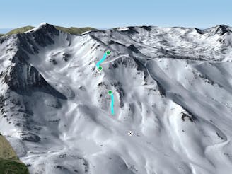
Barranc del Bullidor W

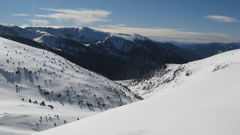
Freeride lines for resort hikers
Difficult Freeride Skiing
- Distance
- 1.3 km
- Ascent
- 0 m
- Descent
- 478 m
Backcountry route for experienced riders
Also in Canillo, Andorra
Freeride Skiing Difficult

If you are riding the resort you can get up to Costa Rodona chairlift and ride down to the mountain road pass and cross the road. On the far left side (coming down from Costa Rodona), or on the road way to Grau Roig, there is a parking. From there you can start hiking up to the top right. A hike which will take you as much as 35 min on foot and deep snow. Once there a flat section it will go west for a bit and you will see your next hiking line and the entry point of the line. 30 to 40 minutes more is the time it will take to get to Pic de Maia, but will depend, decreasing considerably the approach on the equipment used to get to the spot. There is a road going up but usually the hike takes a shortcut close to the ridge straight up. Keep going up following the ridge and spot the ridge ahead closing the bowl. We want to go just behind that ridge and our line will start just after. From the very top, if you face north you will identify two bowls separated by a ridge, we want to go to the left one. This run is dangerous because it runs all the way inside, although wide, a creek. At the end of it there is a cliff which has a narrow couloir but the exit is just above on the right. So heads up and extreme your precautions there. Al the creek is pretty fun going through a rolling terrain changing steepness which will help us with safety procedures. As reference we will have always a ridge on the right with two peaks. Once we get closer to the second one the creek turns lightly to the left and at the end there is the cliff. There are few options here. If there is enough snow you can ride to the ridge after the second peak and at the end there is few couloirs and less steep exits. If not at the very end of the ridge there is a narrow pass which will allow you to get out of the creek. The last section is steep as well head to the parking lot or the road U-turn of the road where there is a parking lot or a good spot the get the extraction spot. Another option is to ride down to the creek, cross it if there is enough snow and hike up to the roundabout. In that case you will need a shuttle as well to get back up to the village.
Difficult
Serious gradient of 30-38 degrees where a real risk of slipping exists.

As well as the slope itself, there are some obstacles (such as rock outcrops) which could aggravate injury.

Little chance of being seen or helped in case of an accident.
80 m away
Freeride lines for resort hikers
Difficult Freeride Skiing
1.2 km away

Freeride lines for resort hikers
Moderate Freeride Skiing
1.7 km away

Classic freeride lines out of the resort boundaries
Moderate Freeride Skiing
2.5 km away

Wide steep riding from Coll Blanc
Moderate Freeride Skiing
3 km away

Short, technical and steep couloirs
Severe Freeride Skiing
3.1 km away
A steep line through rocky terrain for experienced riders
Difficult Freeride Skiing
3.2 km away

Popular off piste with terrain with easy access.
Severe Freeride Skiing
3.2 km away

An open terrain freeride area
Moderate Freeride Skiing
3.5 km away

Steep couloirs for experienced riders
Difficult Freeride Skiing
3.5 km away

Technical and challenging lines on the Pic Blanc North-west face.
Severe Freeride Skiing
22 routes · Freeride Skiing