266 m away
Antenna

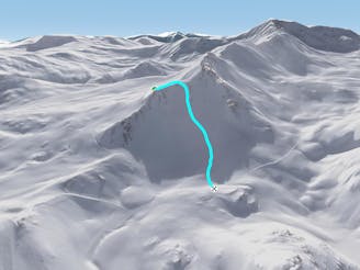
A hike along the ridge leads to some adventurous skiing down some steep couloirs.
Severe Freeride Skiing
- Distance
- 1.9 km
- Ascent
- 367 m
- Descent
- 687 m
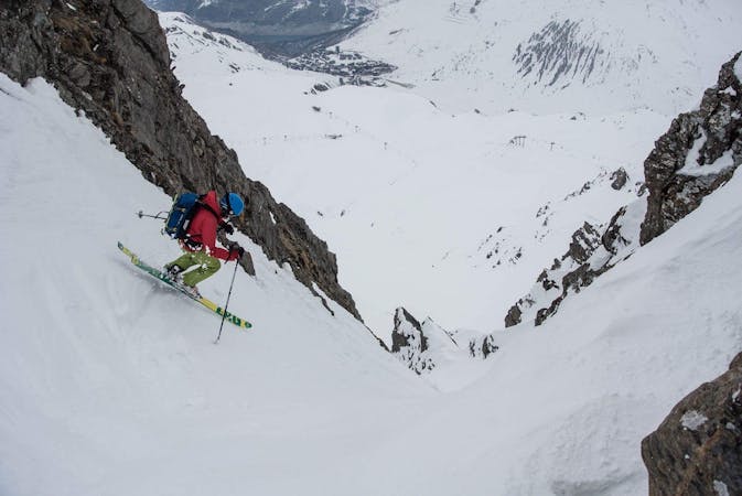
A long and varied run often on good snow.
Freeride Skiing Difficult

This is a popular freeride skiing route which is generally considered to be difficult. It's remote, it features medium exposure (e2) and is typically done between December and April. From a low point of 2.2 km to the maximum altitude of 2.6 km, the route covers 1.4 km, 0 vertical metres of ascent and 476 vertical metres of descent. It's graded 2.2 and Labande grade 3.
A long and varied run often on good snow. Start down the OK piste and after about 100 meters go off the piste to the right and traverse high under the rock band. Once on the north aspect ski the fall line before rejoining the piste.
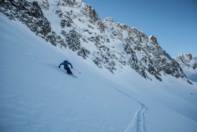
Difficult
Serious gradient of 30-38 degrees where a real risk of slipping exists.

As well as the slope itself, there are some obstacles (such as rock outcrops) which could aggravate injury.
Away from help but easily accessed.
266 m away
A hike along the ridge leads to some adventurous skiing down some steep couloirs.
Severe Freeride Skiing
328 m away

Beautiful couloir skiing from the summit of the Bellevarde
Severe Freeride Skiing
693 m away

A super variant to Spatule.
Difficult Freeride Skiing
740 m away

The classic, very popular Val d'Isere off-piste. Quickly tracked!
Difficult Freeride Skiing
886 m away

A steeper alternative to the classic Banana line
Severe Freeride Skiing
1.7 km away

Steep skiing and great snow hiding in plain sight
Severe Freeride Skiing
2.2 km away
A wide open face - the perfect gradient for freeriding
Difficult Freeride Skiing
2.3 km away

Rewarding skiing for those prepared to hike a little
Severe Freeride Skiing
2.5 km away

Ultra-classic, steep, serious skiing through the Charvet North Face
Severe Freeride Skiing
2.5 km away

A good off-piste link from Tignes to Val d'Isere although the snow suffers due to the sunny aspect of the slope.
Moderate Freeride Skiing
70 routes · Freeride Skiing
6 routes · Freeride Skiing
6 routes · Freeride Skiing