3.2 km away
Mt Seymour Hike
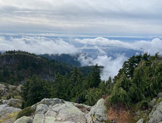
A scrambly hike to the summit of Mt. Seymour
Difficult Hiking
- Distance
- 9 km
- Ascent
- 564 m
- Descent
- 565 m
An adventure that requires route finding and bushwhacking
Hiking Difficult

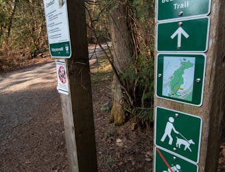
The trip to Mount Underhill requires non motorized access via private roads including Sasmat Lane. Please make sure to respect locals. The trail follows the powerline trail, the Old Elsay Lake Trail, as well as the Holmden escape trail. There are creek crossings that require car and hiking poles, and very slippery logs. Cell service 99% of the time. You must park on Indiam Arm Crescent at the Baden Powell Trail and bike or walk the 3 km to the trailhead.
Difficult
Hiking trails where obstacles such as rocks or roots are prevalent. Some obstacles can require care to step over or around. At times, the trail can be worn and eroded. The grade of the trail is generally quite steep, and can often lead to strenuous hiking.

The path is on completely flat land and potential injury is limited to falling over.

Little chance of being seen or helped in case of an accident.
3.2 km away
A scrambly hike to the summit of Mt. Seymour
Difficult Hiking
4.9 km away
Short distance, low elevation, great views
Easy Hiking
8.5 km away
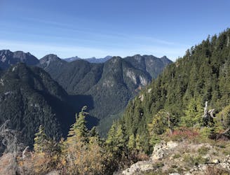
Follow a heavily forested ridge to one of Vancouver's lesser known peaks
Moderate Hiking

7 routes · Hiking · Trail Running

6 routes · Hiking

3 routes · Hiking