1.2 km away
Youla, Skiers Right

Keep it simple and easy - a great way to start off piste.
Easy Freeride Skiing
- Distance
- 780 m
- Ascent
- 3 m
- Descent
- 198 m
An excellent offpiste when Youla cable car is closed
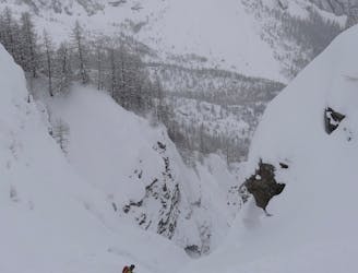
Freeride Skiing Difficult

Head up to the same start point at the top of the Checruit Cable Car (take the immediate left hand exit of the cable car) and then pass the LeGreye skilift/slope. Reach a small pass that take you inside a small couloir. Begin to descend always going a bit right. There are a few fun and playful rocks to pop off and the odd drop to play around with. After around 500 metres or so of a fairly undisturbed section of downhill, you will approach trees and a stream. Take care always of avalnche after important snowfall. The Dolonne couloir can be swept away by avalcnhe from the upper part.
The trees should act as a notifier to slow your speed right down and begin the rather arduous and annoying section of forest. You will spend the next 10 to 15 minutes winding through the rocks, trees and stream- over ice and mud until you reach the side of red run 25 or the "Dolonne" run. This path next to the stream will naturally take you bearing left which allows you to pop back onto the piste and descend down to the Dolonne cable car station.
Difficult
Serious gradient of 30-38 degrees where a real risk of slipping exists.

As well as the slope itself, there are some obstacles (such as rock outcrops) which could aggravate injury.
Away from help but easily accessed.
1.2 km away
Keep it simple and easy - a great way to start off piste.
Easy Freeride Skiing
1.4 km away

A tricky entry followed by a steep couloir and an open field.
Severe Freeride Skiing
1.4 km away

The Old Freeride World Tour Official Competition Area. Test your abilities against the athletes.
Difficult Freeride Skiing
1.5 km away
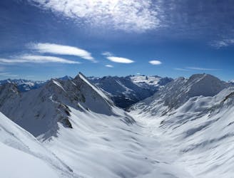
A great run from an amazing summit. There's potential for plenty of powder on varied terrain but snowboarders should be prepared for a walk at the end.
Difficult Freeride Skiing
1.5 km away
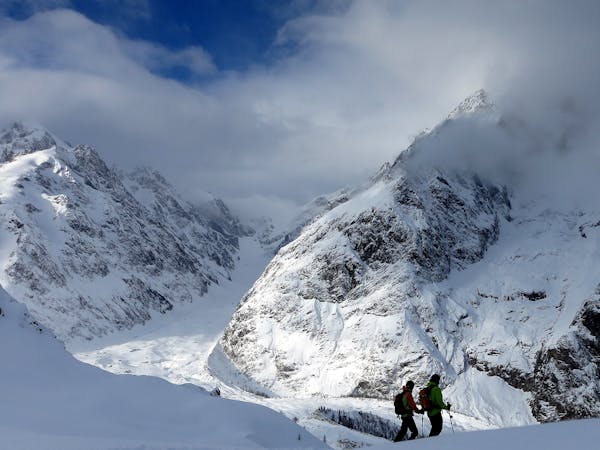
A classic skier/boarder route; long, remote and starting from a stunning viewpoint.
Difficult Freeride Skiing
1.5 km away

A good offpiste run from the Youla when conditions lower on the mountain are bad.
Difficult Freeride Skiing
1.8 km away

Short and sweet but certainly the most fun 100 metre section you will do for a while.
Moderate Freeride Skiing
2.5 km away

A chilled way to end the day, or just a pleasant ride down back to the Val Veny cable station.
Easy Freeride Skiing
2.8 km away

Another secret hidden route with an awesome Lion King theme. With lumps and bumps through the forest and the potential for some gnarly drops.
Difficult Freeride Skiing
5.6 km away

Great, varied but serious skiing offering steep to very steep options in a mostly forested area; this route is great in bad weather but not always in condition and often threatened by avalanches.
Severe Freeride Skiing
10 routes · Freeride Skiing

50 routes · Freeride Skiing · Ski Touring