742 m away
Pumba Run

Another secret hidden route with an awesome Lion King theme. With lumps and bumps through the forest and the potential for some gnarly drops.
Difficult Freeride Skiing
- Distance
- 791 m
- Ascent
- 0 m
- Descent
- 221 m
A chilled way to end the day, or just a pleasant ride down back to the Val Veny cable station.
Freeride Skiing Easy

This run is easy and there are no major shocks on the way, just a simple and easy-to-follow path that winds gently down the mountain to Val Veny. However this path is there because there was a massive land slide over a decade ago that cleared this area. The land is fairly stable now but as you descend you will ride past the boulder field that still remains. It's very impressive to see but also a stark reminder of the unstable mountain environment.
The route isn't steep and is perfectly possible for all abilities. It can be a little bumpy and rather icey towards the bottom but the path is consistently around 5 to 6m wide so there is room for turns. You can expect the odd snowmobile coming up towards you so don't go too fast! I recommend stopping when you reach the landslide debris as it is a great photo opportunity. At the end there is a small stream that you have to cross and in later season the very end of the path can be muddy. Other than that this run is a nice and relaxed option.
Easy
Wide gentle slopes at around 20 degrees or less.

Exposure is limited to that of the slope itself. Getting hurt is still likely if the slope is steep and/or the snow is hard.
Close to help in case of emergency.
742 m away
Another secret hidden route with an awesome Lion King theme. With lumps and bumps through the forest and the potential for some gnarly drops.
Difficult Freeride Skiing
804 m away

Short and sweet but certainly the most fun 100 metre section you will do for a while.
Moderate Freeride Skiing
2.5 km away

An excellent offpiste when Youla cable car is closed
Difficult Freeride Skiing
3.1 km away

Great, varied but serious skiing offering steep to very steep options in a mostly forested area; this route is great in bad weather but not always in condition and often threatened by avalanches.
Severe Freeride Skiing
3.6 km away

Keep it simple and easy - a great way to start off piste.
Easy Freeride Skiing
3.8 km away

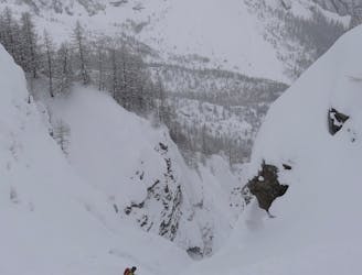
A tricky entry followed by a steep couloir and an open field.
Severe Freeride Skiing
3.8 km away

The Old Freeride World Tour Official Competition Area. Test your abilities against the athletes.
Difficult Freeride Skiing
3.9 km away
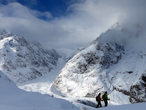
A great run from an amazing summit. There's potential for plenty of powder on varied terrain but snowboarders should be prepared for a walk at the end.
Difficult Freeride Skiing
3.9 km away

A good offpiste run from the Youla when conditions lower on the mountain are bad.
Difficult Freeride Skiing
3.9 km away
A classic skier/boarder route; long, remote and starting from a stunning viewpoint.
Difficult Freeride Skiing
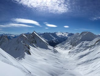
10 routes · Freeride Skiing

50 routes · Freeride Skiing · Ski Touring