4.1 km away
Tour du Mont Blanc: Lavancher to La Fouly
Day 6: The second border crossing and the highest col on the main Tour du Mont Blanc route.
Difficult Hiking
- Distance
- 18 km
- Ascent
- 871 m
- Descent
- 962 m
An exceptional, adventurous hike featuring some sections of easy via ferrata and exposed terrain.
Hiking Extreme

This is about as adventurous as hiking gets, and is only recommended for those willing to tackle steep and exposed terrain. There is a section of huge, thick ropes just below the hut and you'll need to pull on these, often above a large drop. As such, this is a hike that requires plenty of experience, a head for heights and a good level of all-round mountains fitness. If you've got all 3 of those things, you are in for a fabulous trip.
The hike can be done as a there-and-back trip and is also the approach (and descent) for the Grandes Jorasses South face - a classic alpine climb which is described in detail in FATMAP.
The trip to the Boccalatte begins in the small Italian hamlet of Plampincieux, deep in the beautiful Val Ferret. The trail is clearly marked all the way and begins with some quite steep but technically straightforward terrain up a good path.
As the trees thin out the trail steepens and becomes increasingly rocky. Cross a series of rocky, scree-filled gullies (which can be threatened by small rockfalls - don't linger in them) and keep climbing up through ever steepening ground towards the rock buttress directly below the hut.
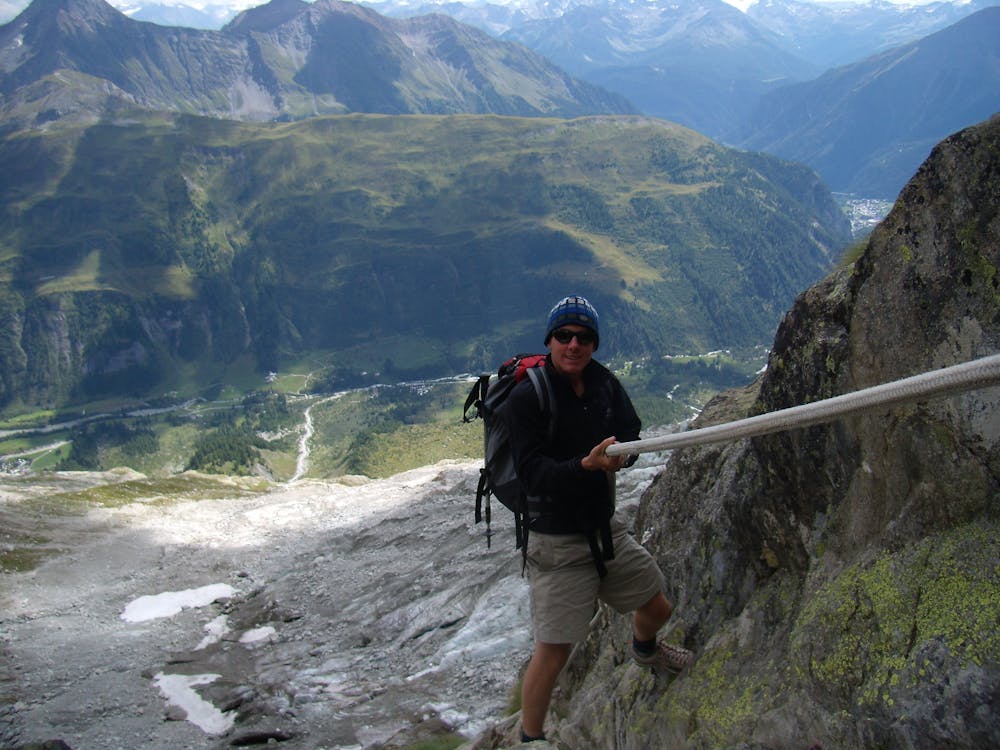
Climb up through the rock buttress via some steep walls lined with huge, thick ropes. Pull on these and pay attention all the way - there are plenty of places where a fall would be disastrous. Some hikers might be a glad of a rope and harness in places.
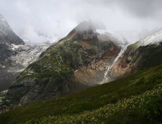
At the end of the ropes it's a short hike to the hut itself, and your efforts will feel well and truly rewarded when you sit down on the terrace and soak in the staggering view. The Glacier de Plampincieux dominates the view close to the hut, and further afield you can see much of the Grandes Jorasses South face, and all the way down and across the upper section of the Aosta Valley.
Either book in for the night or hike back down after a lunch spent admiring the view.
Extreme
Scrambling up mountains and along technical trails with moderate fall exposure. Handholds are necessary to navigate the trail in its entirety, although they are not necessary at all times. Some obstacles can be very large and difficult to navigate, and the grades can often be near-vertical. The challenge of the trail and the steepness of the grade results in very strenuous hiking. Hikes of this difficulty blur the lines between "hiking" and "climbing".

Some trail sections are extremely exposed where falling will almost certainly result in serious injury or death.

Away from help but easily accessed.
4.1 km away
Day 6: The second border crossing and the highest col on the main Tour du Mont Blanc route.
Difficult Hiking
4.5 km away
Day 5: Although this day is more of a detour than anything, it is a wonderful one in good weather. If the weather is bad or you're pushed for time, get the bus from Courmayeur to Arp Nouva to join stage 6 and skip out this stage.
Difficult Hiking

14 routes · Hiking

9 routes · Alpine Climbing · Hiking

10 routes · Alpine Climbing · Hiking