2.6 km away
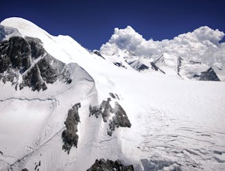
Berni Couloir

One of the most aesthetic couloirs on this side of the mountain
Severe Ski Touring
- Distance
- 2.9 km
- Ascent
- 55 m
- Descent
- 880 m
perfect 360 view on the whole Monte Rosa!
Ski Touring Difficult

This itinerary is good to gain confidence with skins and being independent in far from piste situations. The line itself is quite easy, while reaching the top requires some effort! From the Ciarcerio lift you can start putting on your skins and go up by almost flat slopes. The steepest part is the one close to the top, here it could be required a short walk. You effort will be rewarded with a breathtaking view on Monte Rosa. Keep your skins on when you reach the top and continue for few meters to reach the access to the line (many variations possible, the best is to look to the line from the piste that goes down from Bettaforca!!) The line starts with a large couloir that you can ski for 200m. Be aware of snow conditions!!! Because this first couloir ends with a massive cliff!! No chance of survival if an avalanche starts here! Remember to stay on your left because after the first 200m you have to carefully traverse left in order to bypass the cliff. Now you will find a big open face that goes into another couloir. Check the snow and have fun on this perfect slope! The run ends close to the PIsta del Colle
Difficult
Serious gradient of 30-38 degrees where a real risk of slipping exists.

As well as the slope itself, there are some obstacles (such as rock outcrops) which could aggravate injury.

Little chance of being seen or helped in case of an accident.
2.6 km away
One of the most aesthetic couloirs on this side of the mountain
Severe Ski Touring
5.1 km away
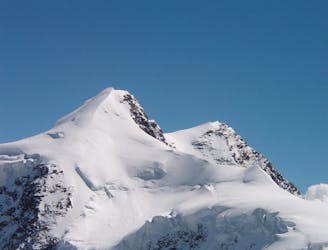
Day 3: Traverse of Passo del Naso of Lyskamm and summit of Pyramid Vincent, beginning at Rifugio Quintino Sella and ending at Capanna Gnifetti.
Severe Ski Touring
5.2 km away
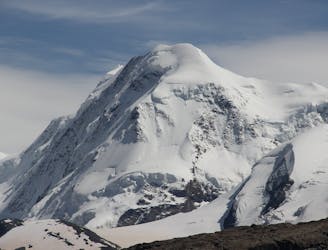
Venture up Switzerland’s famously treacherous Liskamm 4000er, affectionately nicknamed the “people eater”.
Severe Ski Touring
7 km away
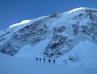
Day 2: Traverse of Castor, optional extra summit of Pollux, beginning at Rifugio Guide d'Ayas and ending at Rifugio Quintino Sella
Severe Ski Touring
7.8 km away
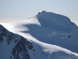
Day 4: Margherita Hut and the Grenz Glacier, beginning at Gnifettti Hut and ending at Neue Monte Rosa Hut
Difficult Ski Touring
9.4 km away
Day 1: Zermatt/Cervinia, Breithorn, Ayas Hut using the cable car to the Klein Matterhorn to start
Difficult Ski Touring

5 routes · Ski Touring

16 routes · Ski Touring