9 km away
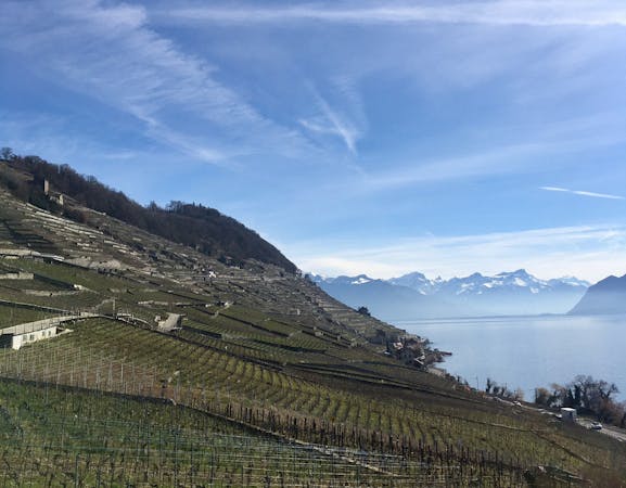
Via Francigena: Vineyards of Lavaux
Hike through the steep and stunningly-beautiful vineyards of Lavaux, a UNESCO world heritage site.
Moderate Hiking
- Distance
- 15 km
- Ascent
- 201 m
- Descent
- 201 m
Trekking over the French Alps from the Geneva Lake to Mediterrian
Also in Alpes-Maritimes, France • Haute-Savoie, France • Savoie, France • Aoste, Italy • Cuneo, Italy • Turin, Italy • Valais, Switzerland
Hiking Difficult

This is a popular hiking route which is generally considered to be difficult. It's not remote, it features low exposure and is typically done between July and August. From a low point of 12 m to the maximum altitude of 2.7 km, the route covers 571 km, 29512 vertical metres of ascent and 29874 vertical metres of descent.
This route follows the GR5 with the GR55 option and ends with the GR52 option (ending in Menton instead of Nice).
Difficult
Hiking trails where obstacles such as rocks or roots are prevalent. Some obstacles can require care to step over or around. At times, the trail can be worn and eroded. The grade of the trail is generally quite steep, and can often lead to strenuous hiking.

The path is on completely flat land and potential injury is limited to falling over.
Close to help in case of emergency.
9 km away
Hike through the steep and stunningly-beautiful vineyards of Lavaux, a UNESCO world heritage site.
Moderate Hiking
9.2 km away
You can't call yourself a local until you've climbed this peak.
Extreme Hiking
4 routes · Hiking
4 routes · Hiking