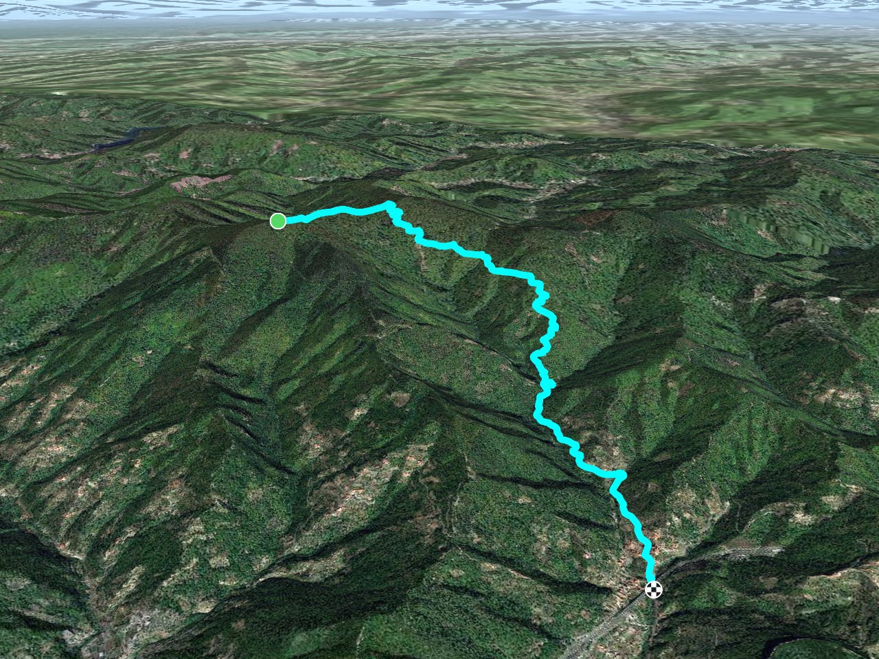
Sentiero 115 -> Ca Bianca Shuttle Run
Multi-trail top-to-bottom shuttle run combination.
Severe Mountain Biking
- Distance
- 7.4 km
- Ascent
- 24 m
- Descent
- 884 m
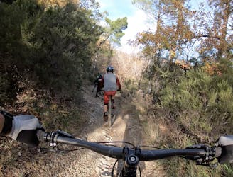
A flowy top-to-bottom trail beginning at Base Nato.
Mountain Biking Difficult
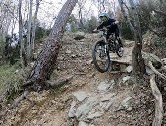
While most of the trails beginning at Base Nato only run a short way down the mountain, Ingegnere is a delightful exception to this rule, essentially forming one long, continuous top-to-bottom run. To reach Ingegnere, pedal along the ridge and then drop in to the right.
Local mountain bikers characterize Ingegnere as “flowy.” And it is a relatively flowy trail with swooping turns, mellow grades, and a few delightful berms… for the most part. By European standards, Ingegnere is definitely flowy, but you should still expect plenty of slippery root webs, high-speed rock gardens, drops, and jumps—basically, good ‘ole fashioned mountain biking!
Ingegnere splashes through a few streams on the way down and is also located on a shadowy side of the mountain, making it a little darker and wetter than some other trails in Finale Ligure.
As the trail descends, the grade gets a touch steeper, with the final plunge down to the road dropping through a steep section of trail that alternates between classic singletrack and freshly-built flow features (as of the time of this writing). The newly-built features bypass around a brutal (and not very fun) fall line chute.
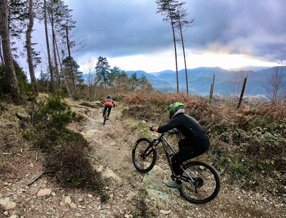
The constant metamorphosis of the trails in Finale Ligure signals the locals’ seriousness about mountain biking, both as an economic driver and a way of life. Collectively, the shuttle services fund two full-time trail builders, and the guides and shuttle drivers pitch in on trail maintenance and improvement when the weather is too wet to run shuttles.
The riders in Finale don’t just talk the talk, they walk the walk!
Difficult
Mostly stable trail tread with some variability featuring larger and more unavoidable obstacles that may include, but not be limited to: bigger stones, roots, steps, and narrow curves. Compared to lower intermediate, technical difficulty is more advanced and grades of slopes are steeper. Ideal for upper intermediate riders.

The trail contains some obstacles such as outcroppings and rock which could cause injury.
Away from help but easily accessed.
Multi-trail top-to-bottom shuttle run combination.
Severe Mountain Biking

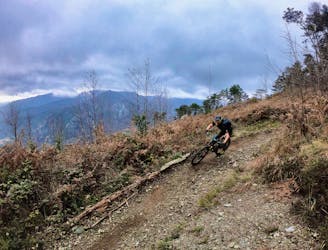
The flowiest trail in Finale Ligure!
Difficult Mountain Biking
1 m away

A two-trail top-to-bottom combination that incorporates the classic Cromagnon descent.
Severe Mountain Biking
2 m away
A flowy descent from Base Nato that's not quite as feature rich as the named Base Nato trail.
Difficult Mountain Biking
5.3 km away
Warm up on Roller Coaster then drop into some true gnar!
Severe Mountain Biking
5.3 km away
Warm up on Roller Coaster, then drop into the most technical trail in Finale Ligure.
Extreme Mountain Biking
6.1 km away
A shuttle route of massive scope, beginning at the top of Monte Settepani and ending at the mediterranean ocean.
Difficult Mountain Biking
8 routes · Mountain Biking