Piz Boë
An iconic peak followed by a long and varied descent.
Severe Ski Touring
- Distance
- 11 km
- Ascent
- 519 m
- Descent
- 1.9 km
A true Dolomites classic with a short approach and some atmospheric skiing.
Also in Bozen, Italy
Ski Touring Difficult

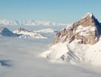
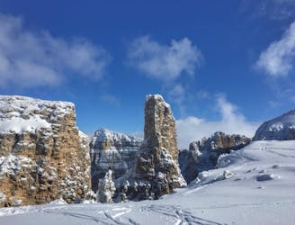
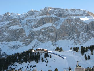
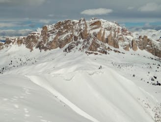
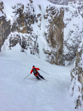
The striking Sella towers look like an impregnable fortress and the famous Sellaronda piste tour runs in both directions around the entire floor of the mountain range. As such, the gondola lift to the summit of Sass Pordoi (and the Pordoi Pass itself) is usually ignored by skiers focused on skiing the entire Sellaronda. This is good news for adventurous ski tourers because there is some amazing skiing located at the top of the gondola, including this route, the so-called "Vallée Blanche of the Dolomites".
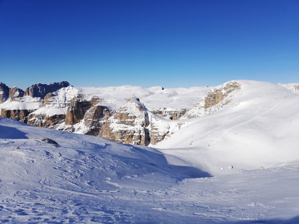
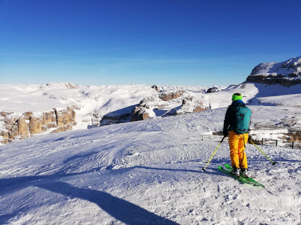
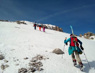
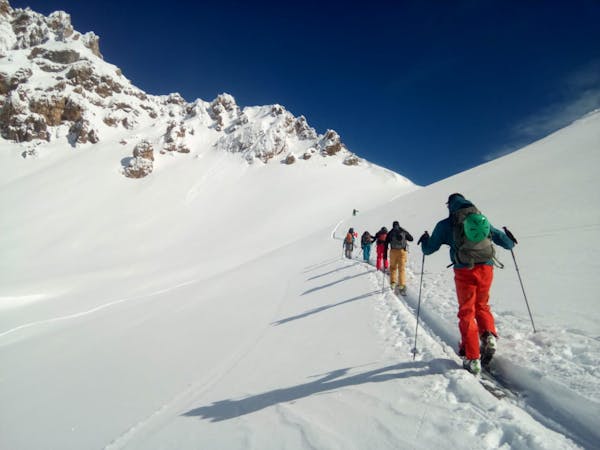
Start by riding the cable car ride to the top of the Sass Pordoi at 2,950m. If you have time grab a coffee and soak up the view before skirting around the hillside in an easterly direction. Leave the ascent to the 3,152m Piz Boé on your right and continue in the direction of the Rifuigio Boe located at the Col Turond at 2,873m. The ski descent proper starts here and getting to this point involves little over 100 metres of ascent so there is very little effort required to access this line relative to how fun it is to ski.
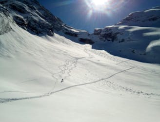
From the Refuigio drop north-northeast into the Mezdi Valley. The initial drop in is quite steep but things mellow out quickly, and most of the descent is fast and flowy. There is minimal route finding and it's impossible to exit the valley accidentally so roam around looking for the best snow and terrain. The ambience of the valley is extraordinary and for those who want to experience a typical Dolomites couloir but don't want to do any steep skiing, this line is perfect.
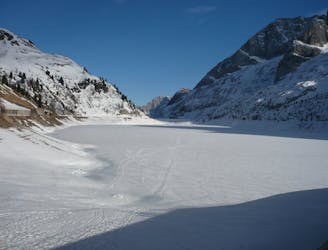
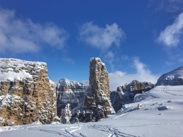
When the valley begins to widen up, drift out skier's right to locate the exit gully. The gully is wide and great to ski so the fun is not over just because you've finished the main valley.
Once out of the gully ski down through a short section of fun trees and cross an almost flat plateau to reach the foot of the Plans gondola.
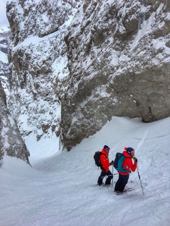
Difficult
Serious gradient of 30-38 degrees where a real risk of slipping exists.

As well as the slope itself, there are some obstacles (such as rock outcrops) which could aggravate injury.

Little chance of being seen or helped in case of an accident.
An iconic peak followed by a long and varied descent.
Severe Ski Touring
0 m away
A Stunning Journey Across the Sella Massif Followed By An Aesthetic Steep Descent
Severe Ski Touring
4 km away
A fine summit and then an abseil-accessed couloir make this a Dolomites classic.
Severe Ski Touring
6.2 km away
A quickly accessed loop through some huge terrain
Difficult Ski Touring
6.3 km away
A classic journey through some of the most famous mountains in the Dolomites.
Severe Ski Touring
6.3 km away
Climb the highest peak in the Dolomites and then ski an exciting north-facing bowl and an epic canyon.
Severe Ski Touring
8.9 km away
A staggering trip along a ridge deep in the heart of the Dolomites
Moderate Ski Touring
9.1 km away
A scenic cruise which uses lifts to maximum effect.
Easy Ski Touring

50 routes · Freeride Skiing · Ski Touring
7 routes · Freeride Skiing · Ski Touring
5 routes · Freeride Skiing · Ski Touring
7 routes · Ski Touring
3 routes · Ski Touring

6 routes · Ski Touring