569 m away
Sun Dance

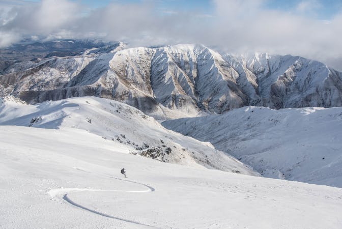
The classic Treble Cone area, perfect for freeride, plus you finish back at the base building.
Difficult Freeride Skiing
- Distance
- 1.1 km
- Ascent
- 3 m
- Descent
- 394 m
This is an area that isnt on too often as it needs good snow coverage, but when it is its one the best
Freeride Skiing Difficult

Hidden Valley, as the name suggests, is not easy to find and is more one for the locals. Take the Home Basin chair and then the cat track to the Saddle. Just as you pass a small hut on your right you will see a gate at the start of a ridgeline. This is where your hike begins. To reach Hidden Valley you need to hike around 20 mins past an area called Sundance. You will reach the boundary fence which sits just past a natural saddle, Hidden Valley is to your left.
The terrain in here is not too steep but is very undulating and really playful. There are lots of small features and hits and after a big snow it will hold the snow well. You finish on the access road to Treble Cone, so you will need to hitchhike back up, or walk for 15 mins.
The terrain is not steep, but is is a terrain trap, so be very careful and make sure your whole crew know how to use their avalanche safety equipment.
Difficult
Serious gradient of 30-38 degrees where a real risk of slipping exists.

As well as the slope itself, there are some obstacles (such as rock outcrops) which could aggravate injury.

Little chance of being seen or helped in case of an accident.
569 m away
The classic Treble Cone area, perfect for freeride, plus you finish back at the base building.
Difficult Freeride Skiing
670 m away

Hike to access Hidden Valley
Moderate Freeride Skiing
844 m away

Slightly steeper terrain than Powder Bowl
Difficult Freeride Skiing
1.2 km away

The infamous Motutapu Chutes - New Zealand sidecountry at its best
Severe Freeride Skiing
1.2 km away

Not a run, but a series of cliffs that are a freerider's idea of heaven.
Severe Freeride Skiing
1.2 km away

An unmarked area that is full of features
Difficult Freeride Skiing
1.4 km away

A wide open bowl that funnels into steep terrain
Severe Freeride Skiing
1.4 km away

Open sidecountry above the Motutapu Chutes
Easy Freeride Skiing
1.4 km away

A huge, wide open area right in the middle of the saddle
Difficult Freeride Skiing
1.4 km away

Boot pack up to the summit
Difficult Freeride Skiing
10 routes · Freeride Skiing · Ski Touring