3 m away
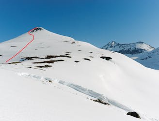
Huinnarcohkka (1788 m) Glacier NE route
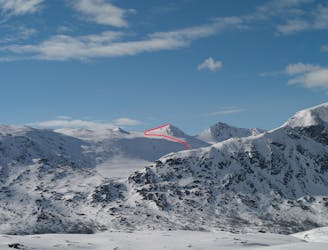
A long but rewarding glacier tour in the vicinity of Lossi Hut
Moderate Ski Touring
- Distance
- 19 km
- Ascent
- 1.2 km
- Descent
- 1.2 km
Fantastic skiing on a rarely done route
Ski Touring Moderate

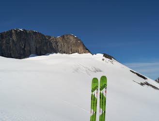
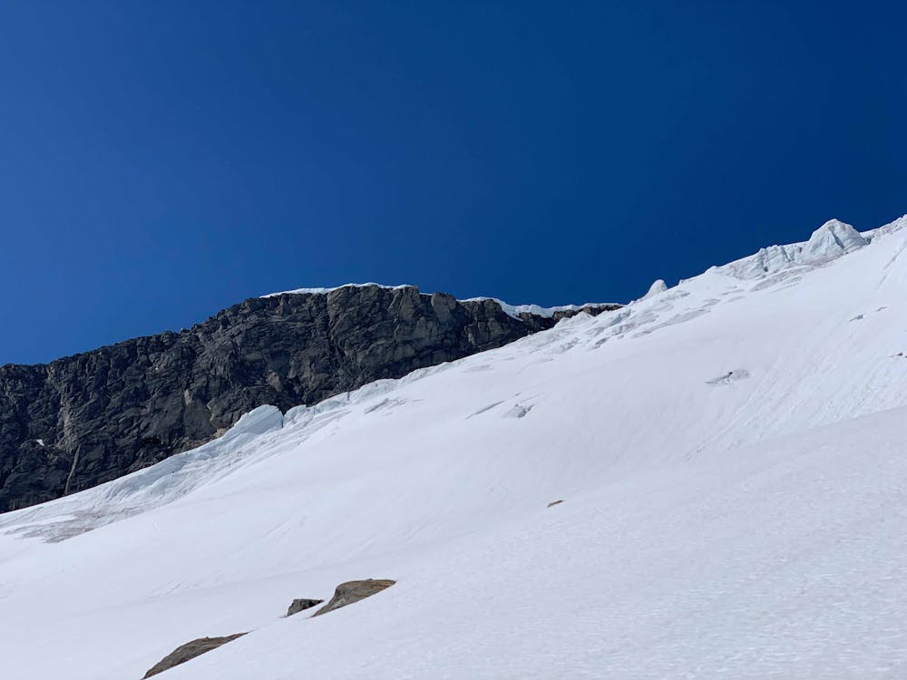
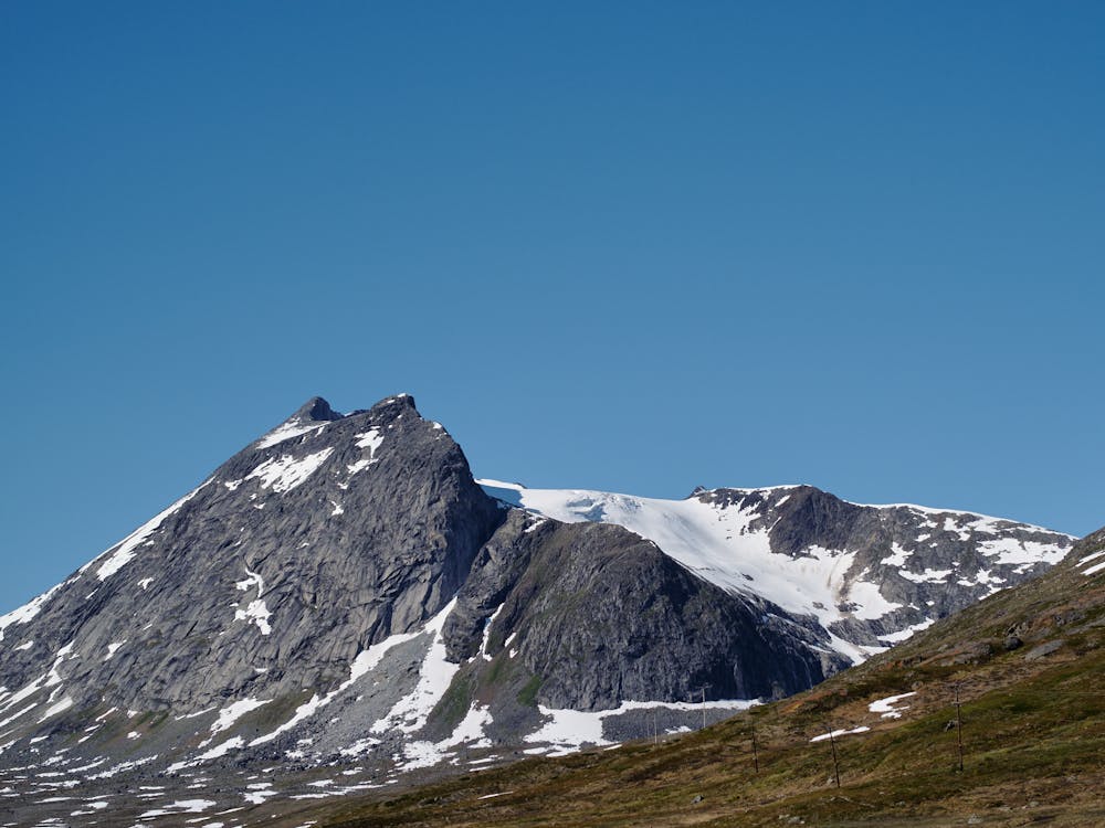
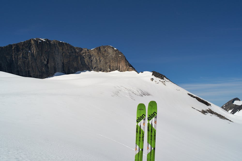
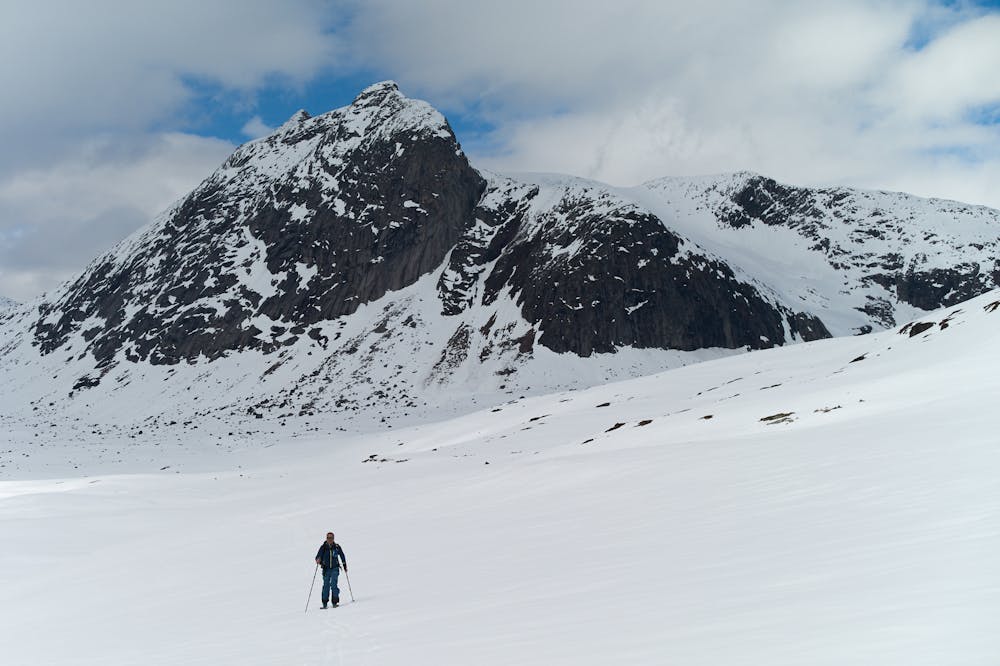
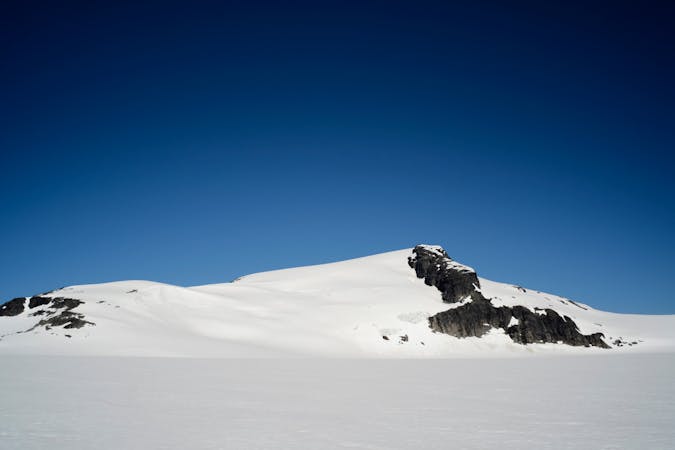
When you are at the Lossihytta (Lossi hut) you cannot fail to notice the prominent Huinnarčohkka (1788 m) and its large, crevassed glacier. From the surrounding peaks, you can also see a prominent side and end moraine below. The ski tour up the glacier does not lead to a summit (see note below), but is rewarding regardless with good fall-line skiing and good snow cover until late in the season. The tour starts at Lossihytta. Follow the shore of Lossivatnet (lake) to below the moraine, and find a place to cross the river. Depending on the time of year, you may have to head further up Rienatvaggi to find a suitable spot. Route finding up the steeper bottom of the route is challenging, and requires good route-finding skills (the line drawn may not always be the best choice - keep your eyes open!). When you enter the glacier, trend left to circumnavigate a fairly obvious crevasse area. Further up, the angles flattens considerably, and you can easily travel to the end point of the glacier. There are crevasses on this route - so take a glacier kit and consider roping up. When you get to the end of the glacier, watch the drop on the other side!
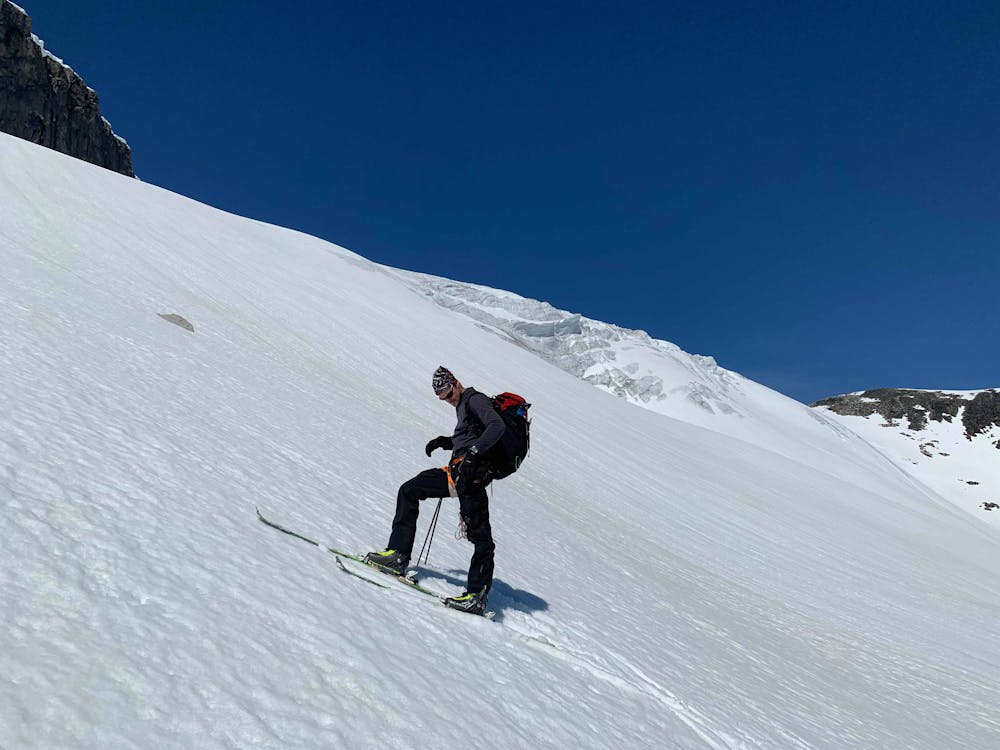
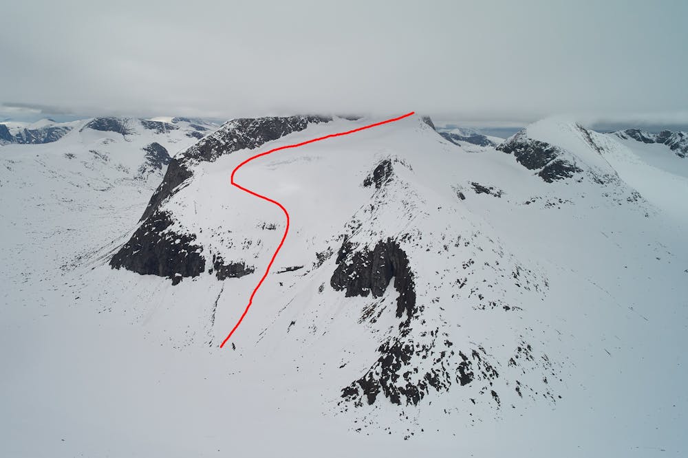
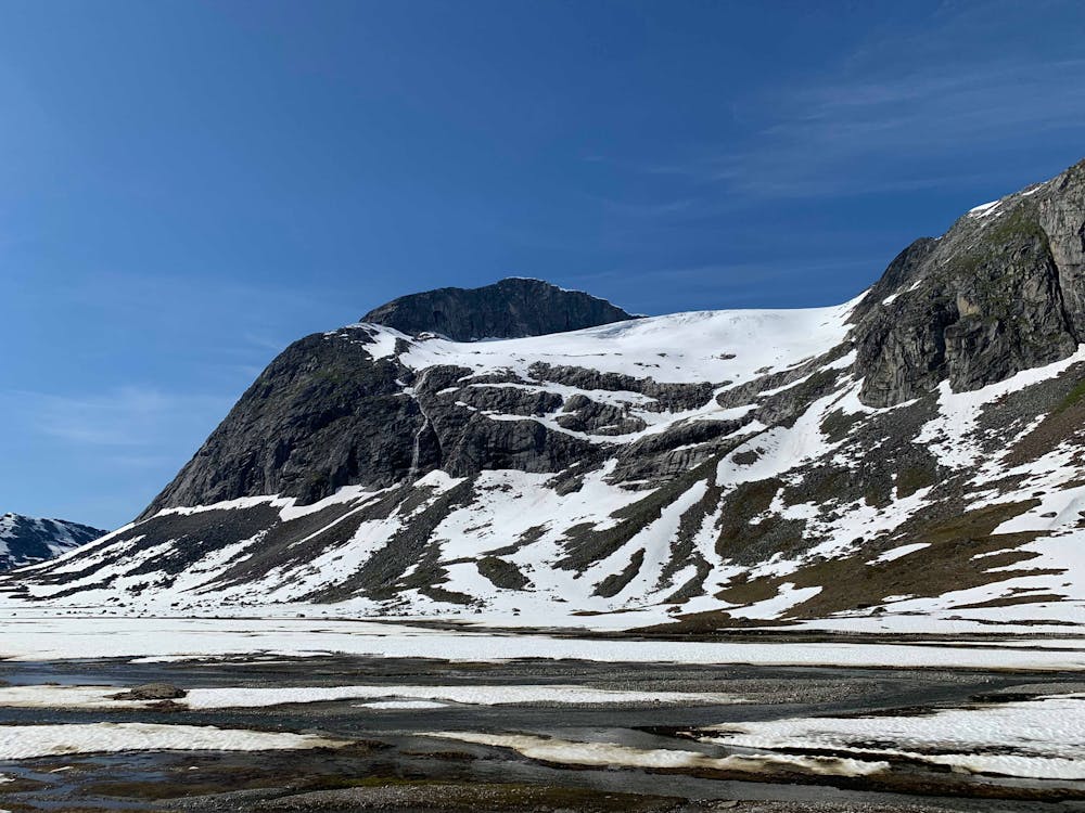
To descend, follow the same line down, or - much better, head falline (which is steeper) - keep left and descend skier`s left of the crevasse zone.
This route can be combined nicely with the NE route (https://fatmap.com/26781/Narvik/skitour/routeid/190292adventure-studio/Huinnar%C4%8Dohkka(1788m)GlacierNEroute). Late in spring or summer, when the lower section of the SE route does not hold enough snow anymore, the SE route still holds good skiing pitches accessed via the NE route.
A side note: Steep rock walls, formed by glacier retreat, are preventing easy access to the summit. Along the ridge are two notches where a skilled team with 60-70m ropes and protection (nuts, cams) could gain the SE ridge, which leads to the summit.
Moderate
Slopes become slightly steeper at around 25-30 degrees.

As well as the slope itself, there are some obstacles (such as rock outcrops) which could aggravate injury.

In the high mountains or remote conditions, all individuals must be completely autonomous in every situation.
3 m away
A long but rewarding glacier tour in the vicinity of Lossi Hut
Moderate Ski Touring
1.7 km away
An attractive ski peak in the vicinity of Lossihytta
Difficult Ski Touring
2.8 km away
A remote ski peak. Nice on its own, but best combined with Ippocohkka (1727 metres)
Moderate Ski Touring
5 km away

One of the highest peaks around Narvik, and one of the finest to ski.
Moderate Ski Touring
5.8 km away
A late-season skitour to Narvik`s highest summit
Difficult Ski Touring
9.6 km away
A great but steep ski tour, possible late into the season
Difficult Ski Touring
8 routes · Ski Touring

20 routes · Freeride Skiing · Ski Touring