413 m away
Skagastølstindtraversen
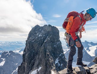
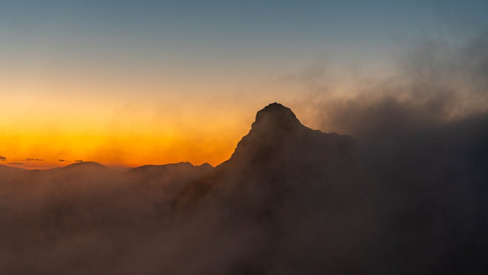
Norway's greatest alpine traverse
Difficult Alpine Climbing
- Distance
- 15 km
- Ascent
- 1.6 km
- Descent
- 1.6 km
The most remote ridge traverse in Jotunheimen offers a spectacular multi day adventure
Alpine Climbing Difficult

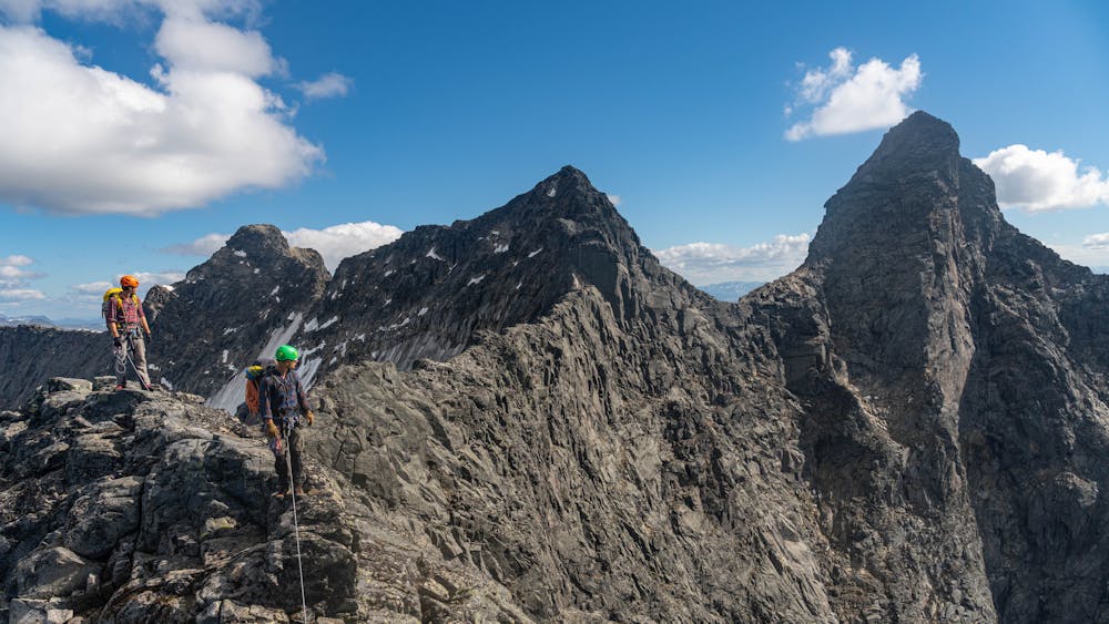
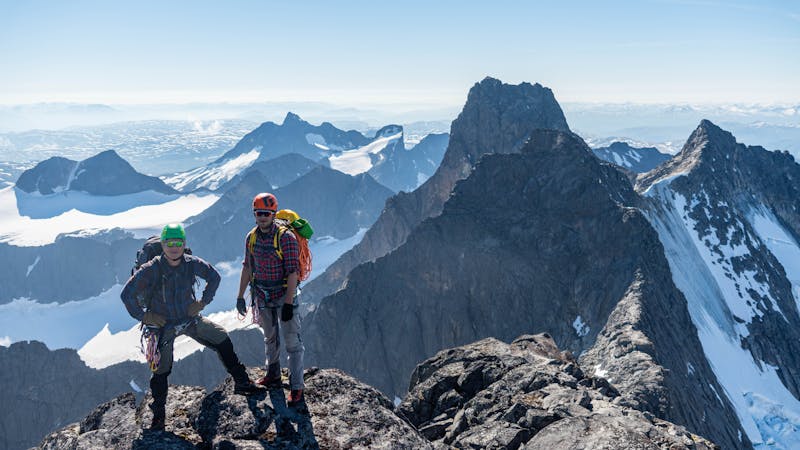
This is a spectacular and a real alpine adventure. Because of its remoteness this route is less trafficked then the Skagastølsridge, so there's a good chance you will have the mountain for yourself.

The trip starts from Turtagrø. Follow the road in Helgedalen and the climb up to the dam. From here you have two choices. You can ascend Gjertvasstind from the east ridge (1) or from the icefall(2).
(1) Follow the trail through Styggedalen, passing 3 small lakes. Pass Simlenosi on the south side and go down to Gjertvatnet. From here you have to drop some vertical meters to the south before reaching the east ridge. Follow the ridge to the summit, some scrambling is required.
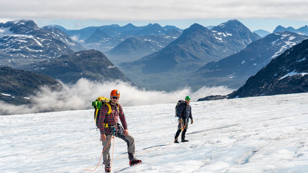
(2) At the second lake in Styggedalen, head to the south and you will soon enter the glacier. Follow the glacier via its most gentle slope up to Gjertvasskaret. Depending on the conditions, there might be crevasses and blue ice in the steep sections. If so, this is a highly demanding route, requiring additional belaying and ice-climbing equipment. As general advice, the glacier has the best conditions pre-August, but there are big annual variations. From Gjertvasskaret, you're at the base of the climb on the north side. There's one pitch, then easy scrambling up some slabs to the summit.
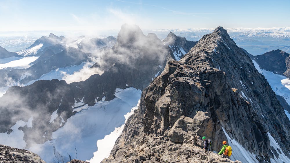
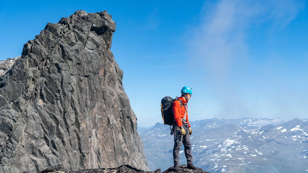
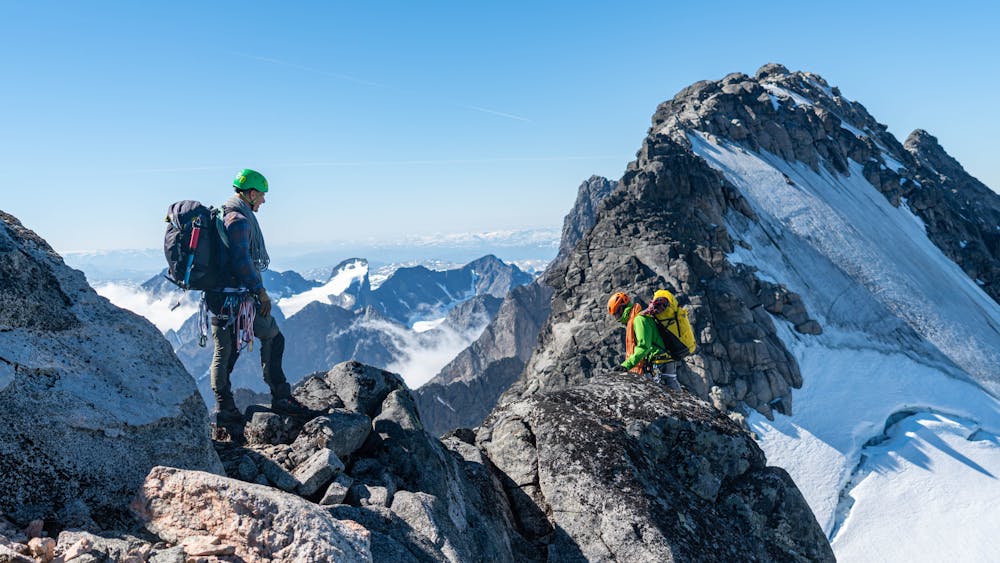
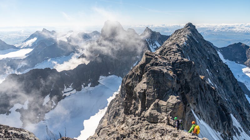
From Gjertvasstind, abseil down to Gjertvasskaret. Follow the ridge at its highest point westwards up to Styggedalstinden. There's some scrambling, but it's pretty straightforward. An easy traverse over Styggedalstindane leads to the west summit. Descend to the ridge to Centraltind by going a little bit down to the south face. Head westwards easily over the ridge until it steepens. From here 3 pitches (3+) lead to the summit of Centraltind.
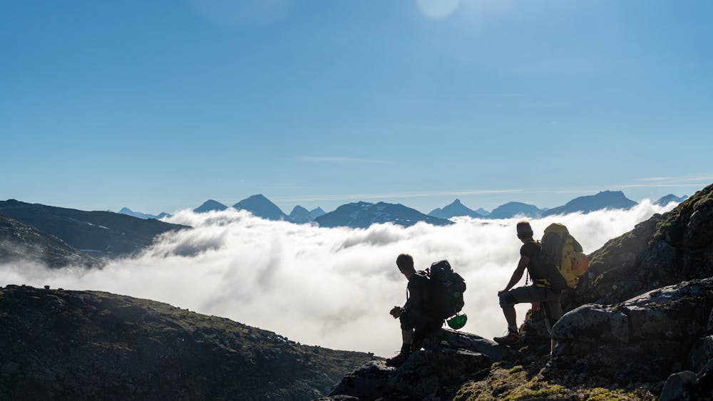
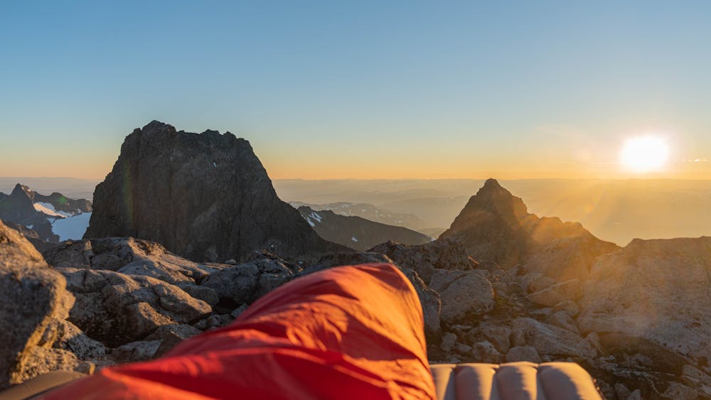
Centraltind is a very nice bivouac spot with a broad summit plateau. Alternatively you can do a bivouac at Styggedalsryggen.
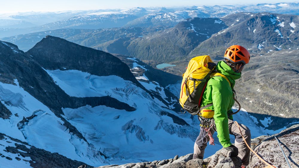
On day two, continue on the ridge towards Vetle Skagastølstind, with one abseil. From here there are two alternatives.
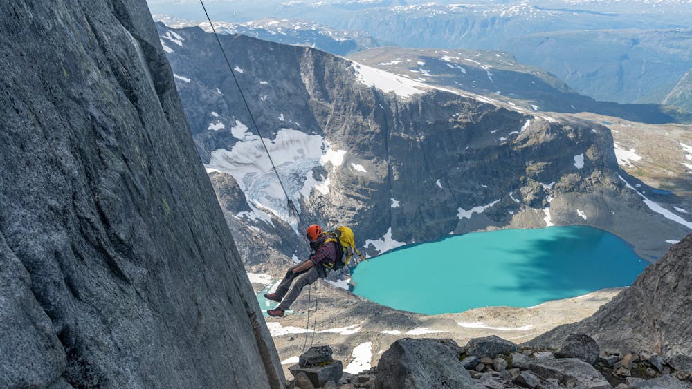
(1) Ascend Vetle Skagastølstind and finish the traverse by reversing Skagastølsryggen to the north. This involves two short (30 meters) abseils and one 60 meters abseil. Exposed (but easy) terrain then leads between Vetle and Midtre Skagastølstind and involves some down climbs.
At V-skar comes the 60 meter abseil, before you can walk the rest of the ridge to Nordre Skagastølstind. From here follow the track back to Turtagrø. The GPX-track of this description follows this alternative.
(2) Finish the traverse by ascending Store Skagastølstind via two pitches from Mohns skar, and abseil down the south face and return to Turtagrø via Hytta på bandet and north through Skagadalen.
Difficult
The beginning of truly technical terrain which might involve pitched climbing on rock and/or ice, exposed terrain and complex route finding in ascent and descent. Equivalent to AD, AD+

The majority of the route is "no fall" terrain.
In the high mountains or remote conditions, all individuals must be completely autonomous in every situation.
413 m away
Norway's greatest alpine traverse
Difficult Alpine Climbing
8.5 km away
An epic traverse of the most alpine summit in Jotunheimen
Difficult Alpine Climbing
3 routes · Alpine Climbing
5 routes · Alpine Climbing