1 m away
Breikågen (683 m) East couloir
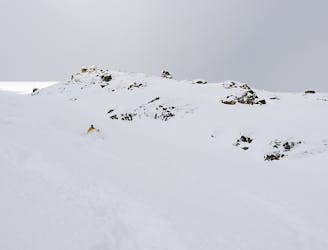
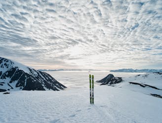
Fantastic fall-line skiing summit-to-sea on a small big peak.
Difficult Ski Touring
- Distance
- 3.9 km
- Ascent
- 669 m
- Descent
- 660 m
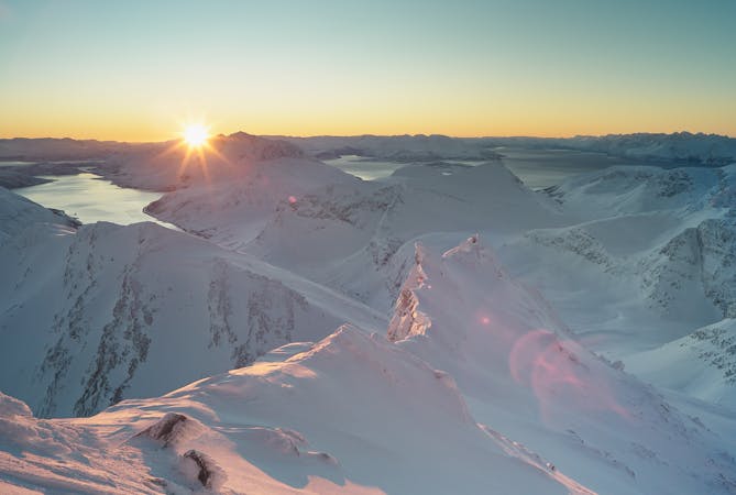
One of the great skitours in Arctic Norway
Ski Touring Difficult

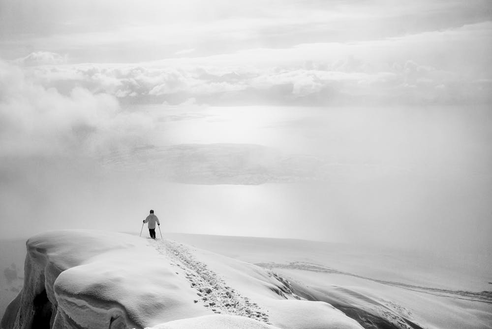
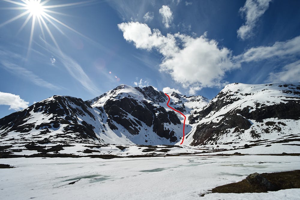
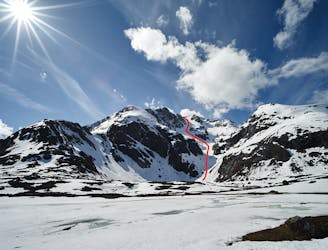
One of the most magnificient ski tours in the North of Norway. 1228 m of skiing, of which over 1100 m are pure fall-line skiing. Due to its NE-exposition, it holds snow long into early summer, and is a top summer-skiing tour as well.
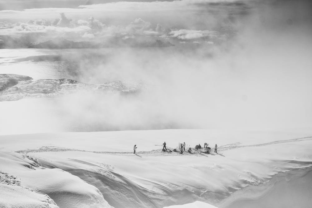
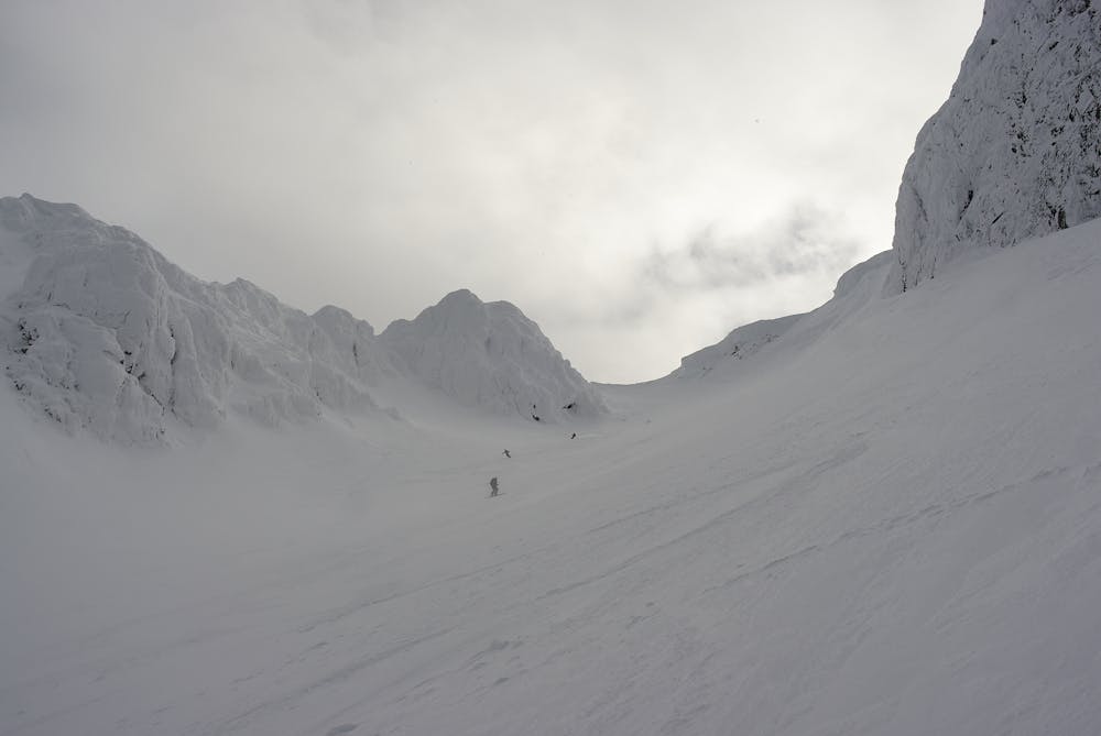
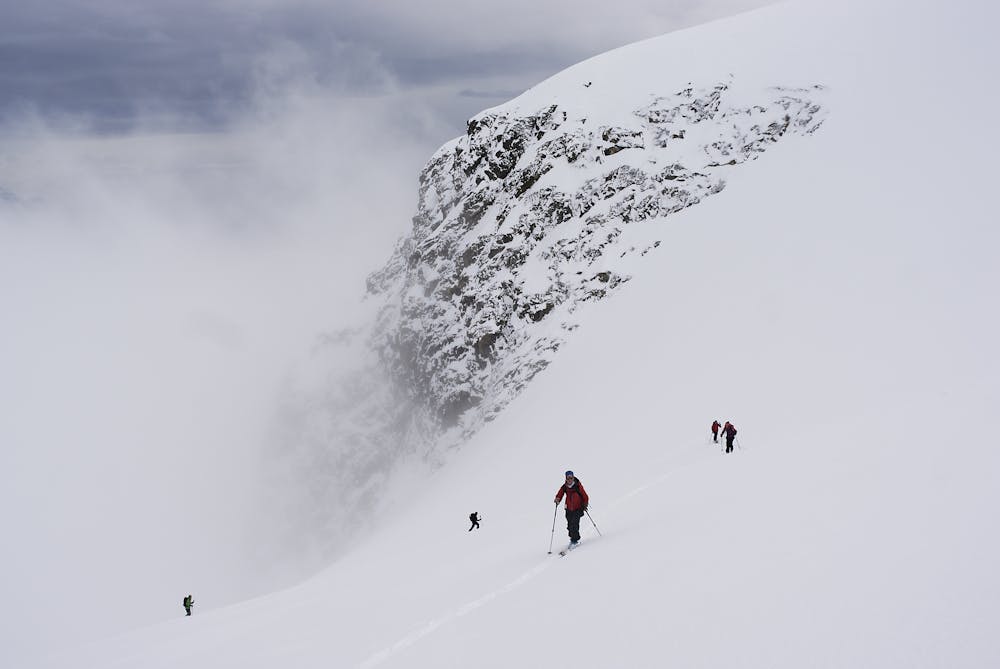

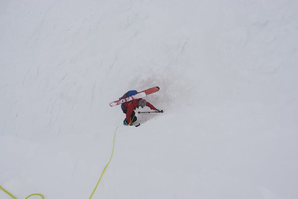
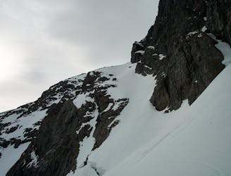
The route looks very steep from the bottom, but it rarely exceeds 35 degrees, except for the sometimes tricky exit and a short steep slop on route a). The route requires excellent snow stability, as this is complex terrain with many passages with 35 degrees on big slopes.
There are two ways to do this route, both drawn here:
a) from Storsteinnes ferry quay (way up): this route is more popular, as it avoids the large terrain trap at the bottom of the NE face. The trade-off is a rather steep traverse and short steep slope (over 35 degrees), which under certain conditions can be tricky. You can ski down this way as well, but it takes away quite a bit of fall-line skiing.
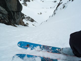
b) Direct: From the road you head up to a lake. Crossing the lake Isbuktvatnet is usually OK into May...but that varies from year to year. You can skirt around the lake on the lookers right site.
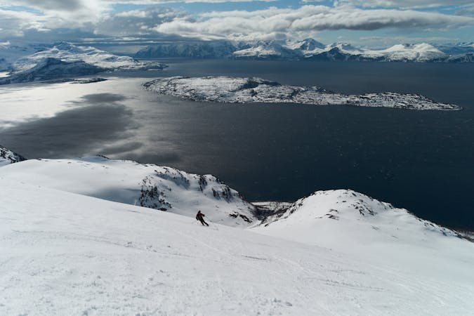
Generelly I prefer to take route a). The route is more direct. It feels exposed from above, but the bottom section is easy to travel through and quickly behind you.
As a ski descent, this is the way better option. Both routes share the upper section; continous 35 degree-ish slopes, that steepens towards the exit. There is a large cornice above you - again, remember this is complex terrain, requiring good hazard assessment.
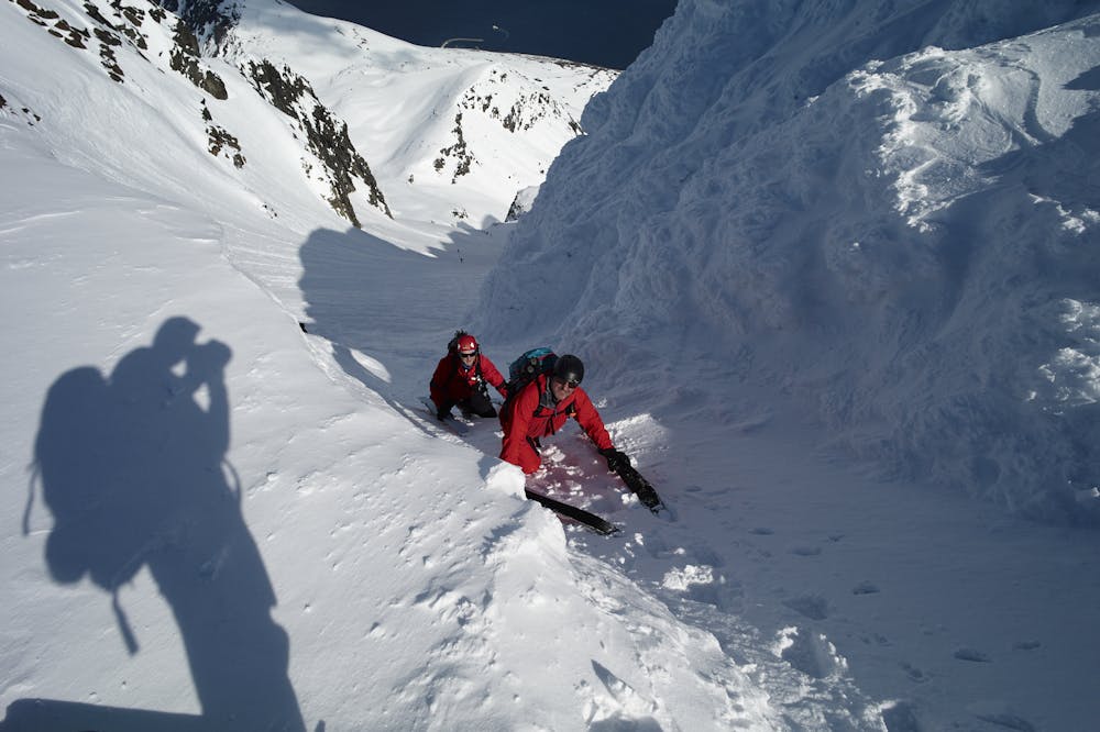
At the end of the slope there is steep (40-degrees, depending on snow built-up) funnel/ramp on the left side, which requires a boot-pack, and if icy, crampons - or a rope for the less secure.
After that you reach a small plateau, from where you can hike to the summit via an easy, but exposed ridge - watch your step!
Pick your route on the way down.
This route used to be a little secret, but it has gained popularity. Nevertheless, it sees less people that the classic lines in Lyngen.
Difficult
Serious gradient of 30-38 degrees where a real risk of slipping exists.

As well as the slope itself, there are some obstacles (such as rock outcrops) which could aggravate injury.
Away from help but easily accessed.
1 m away
Fantastic fall-line skiing summit-to-sea on a small big peak.
Difficult Ski Touring
1.7 km away
A steep skiing traverse - no summits, no tick list item, just pure steep skiing. Experts only!
Severe Ski Touring
1.7 km away
One of several amazing steep lines on Kågtinden.
Severe Ski Touring
4.1 km away
A wonderful ski traverse of one of the greatest ski peaks in Norway.
Difficult Ski Touring
6.1 km away
One of the great skitours on Kågen, with a variety of terrain
Difficult Ski Touring
8.1 km away
A long, difficult, but rewarding traverse of three summits on Kågen island in Arctic Norway
Severe Ski Touring
5 routes · Ski Touring

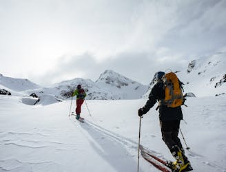
20 routes · Freeride Skiing · Ski Touring
4 routes · Ski Touring