161 m away
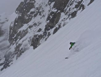
Banana couloir of Holmbukktinden
A fun, steep couloir to ski in perfect spring corn and to progress in ski mountaineering
Severe Ski Touring
- Distance
- 14 km
- Ascent
- 1.5 km
- Descent
- 1.5 km
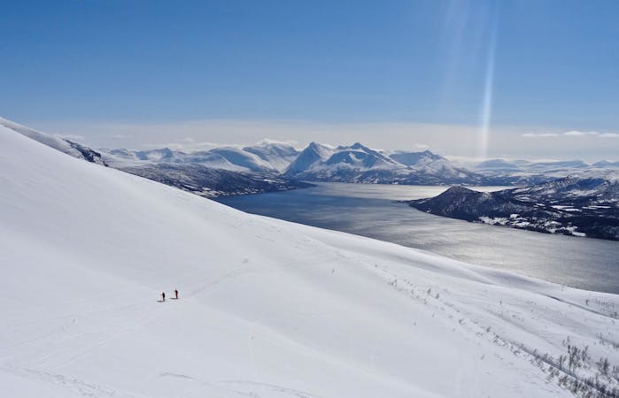
The most beautiful one-day high mountain traverse in Norway
Ski Touring Difficult

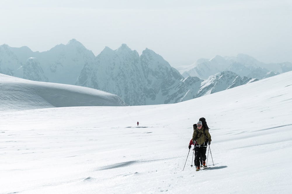
A crossing of the Jiehkkevarri Massiv is the most beautiful one-day high mountain traverse in Norway. The length is about 30 km and the number of altitude meters is around 2700.

There are several routes to choose from. The most common one goes up Holmbukttind. The second route (which is described) goes more south and follows Goverdalen until it turn east, and up the Southwest Glacier. This route is faster even though it is longer than the others. The third and direct route goes over "Blåisen" and can be demanding. It's recommended to take either route 1 or 2 because over the last couple of years there have bee bigger crevasses at "Blåisen".
The "South route" - start the day at "Indre Holmbukta" on the south side of the bridge and follow the river on the south side. Follow the river up Goverdalen a couple of kilometers before turning east up towards the Southwest Glacier. On the glacier, you hold the right hand side until you have passed a critical area where the glacier tends to calve (upper section on the glacier). Hurry past!
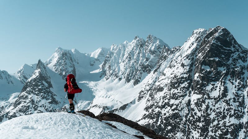
When you are up on the plateau, keep on the left side up to about 1500 meters above sea level. At this point all the mentioned routes have the same route to the summit. The last 300m you follow the visual ridge to the top. To enjoy the view from the top, one should walk around a bit, head out to the east slope or even go a bit down to the south-east.
From the top-summit it carries north and down to "Salen", preferably via "Hengende hager" located on the east side of "Salen". It's recommended to also go out to the "Balcony", a bit more east before reaching "Salen". This is the perfect place for a lunch and a cup of coffee (LOCAL TIP!).
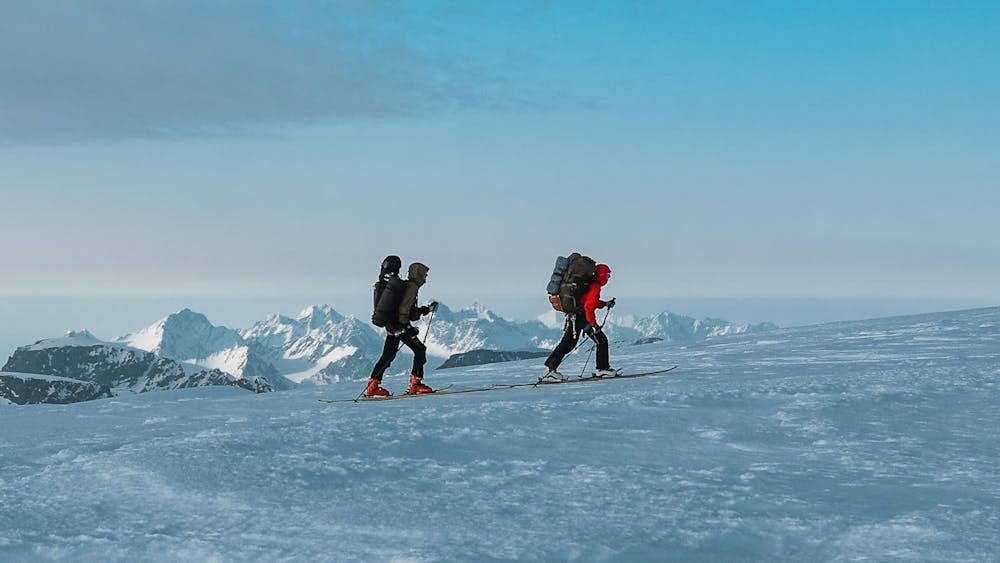
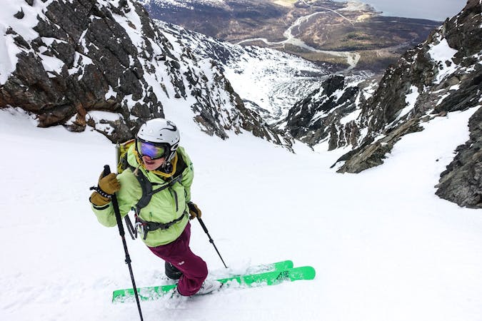
After a rest at the "Balcony", you ski down to "Salen". Here you suit up with skins again and continue north up to Kveita - about 350 vertical meters. Then you follow the clear ridge over to 1666m and then take the most northern couloir down to Fugledalsbreen. A new break is then recommended, especially to enjoy your own tracks in the 500 meter high couloir, but also to gather strength for the last part.
The pass to Fornesbreen is closed by a large semicircular formation, which looks like an open snow pit. You have to cross to the other end to get access into the pit to move on! Then it goes straight down the Fornesbreen. Keep right on the glacier and hold it until you are done with the glacier. Then you get another great slope of 500 meters. Make sure it is not icy after a hot day and temperature changes - it most likely will be evening at this point!
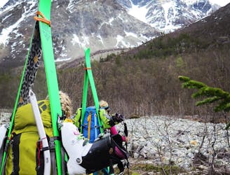
Finally it is out to Jøvika where the road ends. Call for a taxi before descending through the forest. The best option would be having two cars, one at the starting point and one in Jøvika. Pull over to the west of the river as early as possible.
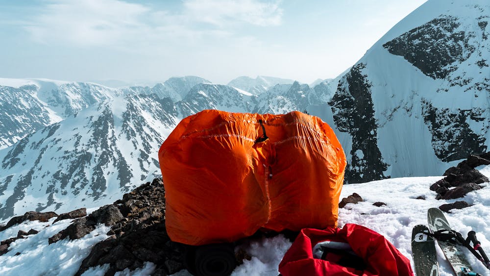
This is a tour you only take in good weather! Some have involuntarily had to spend the night up there in bad weather. It can't have been much fun! But a shortening of the trip can happen by skiing down Fugledalsbreen and into Fugledalen (keep right). Carry at least 3 liters of water, plenty of food and snacks, good clothes and bring some safety equipment, ropes, harness sling and an ice ax. Expect the trip to take 12-14 hours and enjoy some of the best landscapes Norway has to offer.
Difficult
Serious gradient of 30-38 degrees where a real risk of slipping exists.

Exposure is limited to that of the slope itself. Getting hurt is still likely if the slope is steep and/or the snow is hard.

In the high mountains or remote conditions, all individuals must be completely autonomous in every situation.
161 m away
A fun, steep couloir to ski in perfect spring corn and to progress in ski mountaineering
Severe Ski Touring
6.7 km away
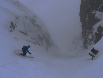
2 great steep-ish couloirs in one of Northern Norway's most scenic mountain valleys (and that's saying something!)
Severe Ski Touring
9.6 km away
A truly brilliant line with perfect pedal-to-the-metal terrain.
Severe Ski Touring
7 routes · Ski Touring
10 routes · Ski Touring

50 routes · Freeride Skiing · Ski Touring

20 routes · Freeride Skiing · Ski Touring
8 routes · Ski Touring