7 km away
La Solana's shortcut line

A short cut line between the slopes, close to a little ridge.
Difficult Freeride Skiing
- Distance
- 451 m
- Ascent
- 0 m
- Descent
- 141 m
One of the magic lines of the region...
Freeride Skiing Severe

This is a popular freeride skiing route which is generally considered to be severe. It's very remote, it features high exposure (e3) and is typically done between February and April. From a low point of 2.4 km to the maximum altitude of 2.8 km, the route covers 810 m, 1 vertical metres of ascent and 404 vertical metres of descent. You'll need skins, ice axe and crampons to complete it safely.
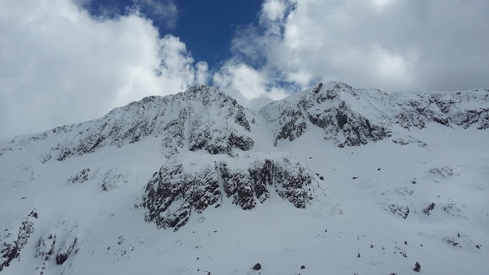
Long, narrow and steep... a real present from mother nature.
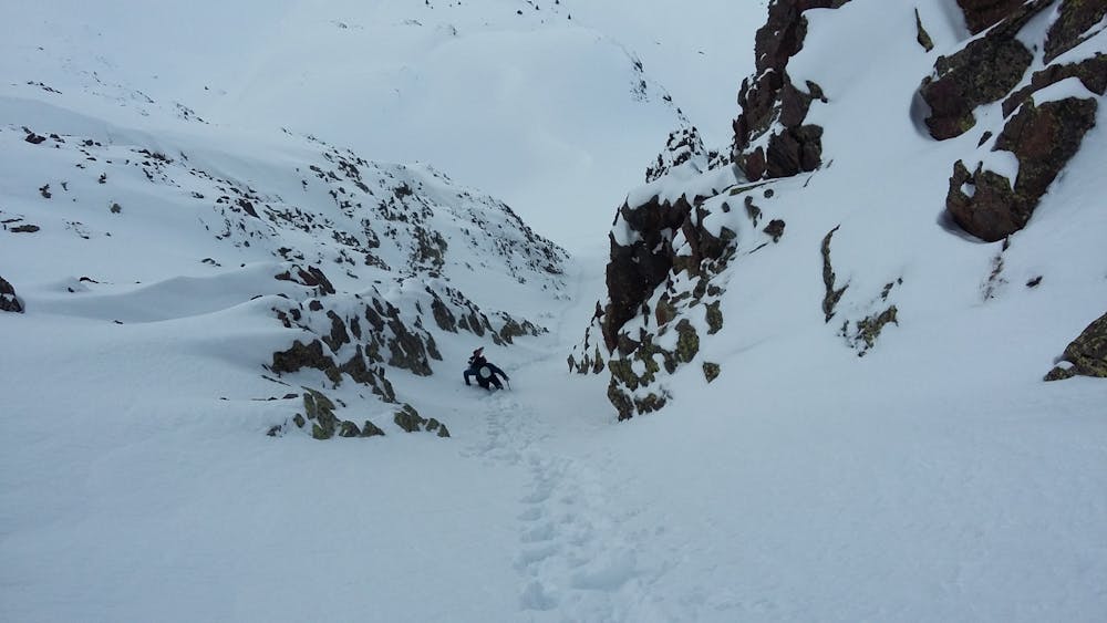
Severe
Steep skiing at 38-45 degrees. This requires very good technique and the risk of falling has serious consequences.

In case of a fall, death is highly likely.
Little chance of being seen or helped in case of an accident.
7 km away
A short cut line between the slopes, close to a little ridge.
Difficult Freeride Skiing
7 km away

An easy access, short line close to the lifts which provides a few steep turns.
Severe Freeride Skiing
7.7 km away

A short walk to a mellow line which often holds good snow and leads back to the pistes.
Severe Freeride Skiing
7.7 km away

Easy and little walk access line with a nice East face into the "Pic de la Capa's line".
Severe Freeride Skiing
8 km away

A really long expedition line into the main face of the "Pic de la Capa".
Severe Freeride Skiing
8 km away

A little walk needed to reach the top of the "Pic de la Capa", and ski the arete line.
Severe Freeride Skiing
8.3 km away

A long approach to a steep line in 2 different sections.
Severe Freeride Skiing
8.3 km away

A steep line requiring an hour long access hike.
Extreme Freeride Skiing
8.3 km away

A complex traverse and a long walk to the last part of the "Pic d'arcalis".
Extreme Freeride Skiing
8.4 km away

Another expedition line with some good gradient, where really good steep skiing skills are required.
Extreme Freeride Skiing

20 routes · Freeride Skiing