10 m away
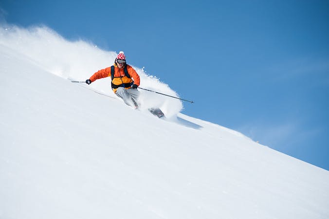
Maulerhubel

A great starting point for going off piste
Easy Freeride Skiing
- Distance
- 493 m
- Ascent
- 0 m
- Descent
- 131 m
A descent with a number of potential drop offs before heading into the trees
Freeride Skiing Moderate

Instead of turning hard right onto the Winteregg blue piste or going straight onto the red piste, turn left and head off piste down the line of the Winteregg chairlift pylons. There is undulating but not particularly steep terrain with the opportunity for jumps and drop offs. It isn't particularly steep and gets tracked quickly as it is popular especially with people going off piste for the first time. There is then a steep slope by a lift pylon which you need to pick some speed up on as there is a flat section which takes you towards the trees. You bear to the right along a narrow path that is obvious when people have already been down. The tree section is quite technical and narrow, and often very icy when it has been tracked out considerably. The tree section is more of a route back to the piste than a tree run, but the best bet is to stay high so you can return to the piste relatively easily about two thirds of the way down the Winteregg blue run. It is the top section of this run which is particularly enjoyable and gives the option for many varied descents and a good introduction to going off piste.
Moderate
Slopes become slightly steeper at around 25-30 degrees.

Exposure is limited to that of the slope itself. Getting hurt is still likely if the slope is steep and/or the snow is hard.

Away from help but easily accessed.
10 m away
A great starting point for going off piste
Easy Freeride Skiing
12 m away

An exciting descent down the line of the Winteregg chair for experienced skiers
Difficult Freeride Skiing
715 m away

A steep snow field with often very deep powder
Moderate Freeride Skiing
1.6 km away

A short, sharp, steep descent that can hold waist deep powder
Difficult Freeride Skiing
1.6 km away

Great off piste turns possible down either side of a ridge
Moderate Freeride Skiing
1.6 km away

A steep narrow couloir that is not for the faint hearted
Severe Freeride Skiing
1.7 km away

Good undulating terrain, ideal for first forays off piste
Moderate Freeride Skiing
1.9 km away

A steep and often deep run for experienced skiers
Severe Freeride Skiing
1.9 km away

A short hike accesses a large bowl for some great off piste
Difficult Freeride Skiing
2.1 km away

Short and descent that holds good snow
Moderate Freeride Skiing
13 routes · Freeride Skiing