358 m away
Kandahar off piste

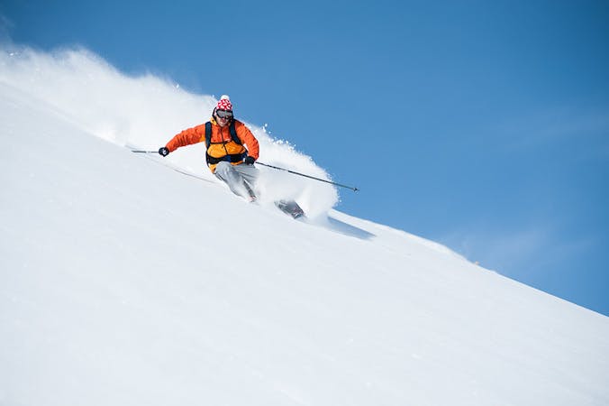
A short, sharp, steep descent that can hold waist deep powder
Difficult Freeride Skiing
- Distance
- 550 m
- Ascent
- 8 m
- Descent
- 141 m
A steep narrow couloir that is not for the faint hearted
Freeride Skiing Severe

This is probably the most difficult piece of off piste in the area, and is certainly not for the faint hearted! It is roped off by avalanche warning signs and you should be really prepared for a gnarly descent. This follows the path of the Murrenbach stream, and is a very narrow couloir approximately 100 metres long where falling is not an option. Many exposed rock bands are present so caution is required, with short turns being the order of the day. This should not be attempted until later in the season as it requires significant amount of snow, while avalanche danger can be significant after new snow. You may want to check that people have gone down beforehand as no tracks down here are generally indicative of conditions being unsuitable or dangerous. When you have exited the couloir this opens up a long descent in the Blumental valley where you get a long series of great turns before joining the Hindenburg piste, although continue to be aware of avalanches coming down from above all the way to the piste. Also watch out for landing planes as a section of the Blumental is used for small planes to practise landing on snow! As this is for expert skiers it often doesn't have many tracks down there is real scope for some great powder turns after the challenge of the couloir.
Severe
Steep skiing at 38-45 degrees. This requires very good technique and the risk of falling has serious consequences.

In case of a fall, death is highly likely.
Little chance of being seen or helped in case of an accident.
358 m away
A short, sharp, steep descent that can hold waist deep powder
Difficult Freeride Skiing
469 m away

Short and descent that holds good snow
Moderate Freeride Skiing
561 m away

Great off piste turns possible down either side of a ridge
Moderate Freeride Skiing
1.1 km away

A steep snow field with often very deep powder
Moderate Freeride Skiing
1.2 km away

Some of the best off piste turns in the area
Moderate Freeride Skiing
1.2 km away

A short hike accesses a large bowl for some great off piste
Difficult Freeride Skiing
1.2 km away

A steep and often deep run for experienced skiers
Severe Freeride Skiing
1.5 km away

Good undulating terrain, ideal for first forays off piste
Moderate Freeride Skiing
1.6 km away

An exciting descent down the line of the Winteregg chair for experienced skiers
Difficult Freeride Skiing
1.6 km away

A great starting point for going off piste
Easy Freeride Skiing
13 routes · Freeride Skiing