379 m away
Jakobshorn S

Rocky steep couloirs at Jakobshorn S face
Severe Freeride Skiing
- Distance
- 508 m
- Ascent
- 0 m
- Descent
- 221 m
Popular off piste in the resort boundaries
Freeride Skiing Easy

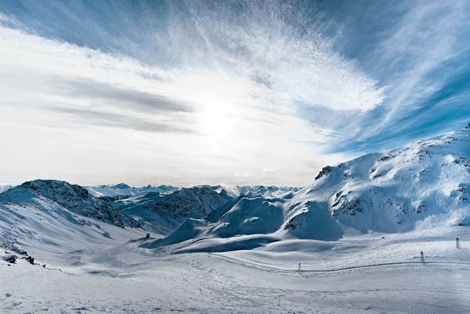
It is a mellow gentle wide slope in an alpine environment without vegetation and not to many rocks. Great for freeriding beginners because of its steepness, like a blue run, and orientation. Because of its openness in good visibility it is impossible to get lost! The run starts just after Jatzpark and runs down on a wide creek- all ridable. Eventually you will have to stay to the right and follow the chairlift line to the bottom station. It's a really popular area and usually lots of riders will draw their lines there. Not really recommended on bad weather and bad visiblity because there are no references. However, it is a really safe run and the pistes are really close, who doesn't want to get a get few easy floaty turns?
Easy
Wide gentle slopes at around 20 degrees or less.

Exposure is limited to that of the slope itself. Getting hurt is still likely if the slope is steep and/or the snow is hard.
Close to help in case of emergency.
379 m away
Rocky steep couloirs at Jakobshorn S face
Severe Freeride Skiing
442 m away

Alpine Couloirs with easy access
Severe Freeride Skiing
477 m away

Gentle wide freeride with stunning views.
Moderate Freeride Skiing
1.1 km away

Extreme freeride area for experienced riders
Severe Freeride Skiing
1.3 km away

Accessible easy off piste zone
Difficult Freeride Skiing
1.3 km away

Popular off piste for intermediate riders
Severe Freeride Skiing
1.5 km away

Easy and safe slope through the forest
Difficult Freeride Skiing
2 km away

Backcountry route for experienced riders
Severe Freeride Skiing
2.9 km away

Techy pillow line through the forest
Difficult Freeride Skiing
3.4 km away

Classic backcountry into Sertig valley
Difficult Freeride Skiing
14 routes · Freeride Skiing