196 m away
Seetäli to Obersäss

Wide freeride slope from Seetäli to Obersäas valley
Difficult Freeride Skiing
- Distance
- 1.4 km
- Ascent
- 0 m
- Descent
- 522 m
Steep lines for experienced and extreme riders
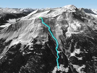
Freeride Skiing Extreme

From the top of Seetälli T bar turn right and go straight to the first mountain pass on your left. Usually there is a out of boundaries sign there and you will start a little traverse of around 50 m, this will take you 5 minutes to hike up. There is a clear little pass to your left, usually a flat area, where you can drop to the left you can see slope number 21 below. It's a steep area with a little couloir at the beginning which opens up. The upper part is rocky usually covered with snow under good conditions. Take precautions when you drop in but enjoy the ride. perfect run for turns full of speed. There are some more extreme lines if you drop in a little bit further up from the peak.
Extreme
Extreme skiing terrain above 45 degrees. These routes are reserved for experienced experts.

As well as the slope itself, there are some obstacles (such as rock outcrops) which could aggravate injury.
Away from help but easily accessed.
196 m away
Wide freeride slope from Seetäli to Obersäas valley
Difficult Freeride Skiing
365 m away

Easy acces freeride area for intermediate riders
Moderate Freeride Skiing
454 m away

Great steep SE slope from the top of Parsennfurgga with easy access
Severe Freeride Skiing
716 m away

Freeride below Parsennfurgga (2443m) with easy acces
Moderate Freeride Skiing
1.9 km away

From Totalphorn (2532m) to Gruobenalp ski out (slope nº16)
Difficult Freeride Skiing
2 km away

Fun rocky slope on the Totalphorn north face
Severe Freeride Skiing
2 km away

Ridge riding for experienced skiers
Difficult Freeride Skiing
2.4 km away

Alpine rocky terrain for experienced riders
Severe Freeride Skiing
2.4 km away
Long freeride line from alpine to forest terrain for advanced skiers
Severe Freeride Skiing
2.5 km away

Extreme freeride area for experienced riders
Extreme Freeride Skiing
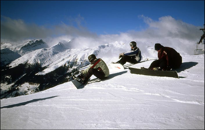
18 routes · Freeride Skiing