997 m away
Furcletta - Welschtobel Tour
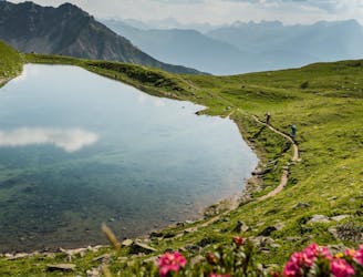
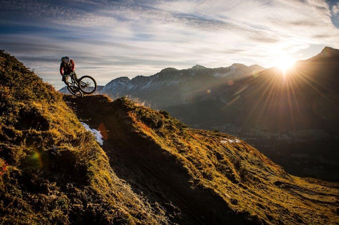
Possibly one of the most beautiful mountain bike trails in the world—the Welschtobel Valley is unbelievably beautiful!
Severe Mountain Biking
- Distance
- 37 km
- Ascent
- 3 km
- Descent
- 3 km
STYLEline is the bigger gnarlier brother of the SHOREline. Both run parellel but STYLEline is where you want to be seen.
Mountain Biking Severe

Like all tracks in the Lenzerheide bike park, STYLEline starts of at the middle station Schamoin with a few quick berms followed by some jumps, more berms and a little wall ride. After taking the right option and following the red sign, ride the first few berms of PRIMEline before drifting of to the left when the option comes. You have now reached the start of STYLEline. Keeping to the left to stay on the black options tthis first wooden section will keep you on your toes. After several small drops and jumps keep your eyes out for the black sign to the right as it leads you over a step down. You will find yourself back on the dirt with a few flowy corners and rollers to keep you happy before the next big decisions. Back on some board walk for a bit then either a big drop or a wave kicker brings you on to some of the best jumps in the bike park. Keep to the right tfor the bigger jumps. Back on some board walk with a few bank corners for fun but keep look out for the log drop on your left which can catch you by suprise. This wooden section will keep you interested for hours as it well built with lots of features. A step on step on brings you back under the cable car whre you re-join the main trails. If you havent had engough airtime for on run then keep on the red run for more fun in the trees.
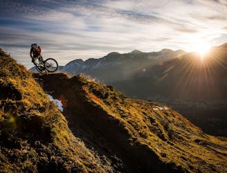
Severe
Widely variable, narrow trail tread with steeper grades and unavoidable obstacles of 15in/38cm tall or less. Obstacles may include unavoidable bridges 24in/61cm wide or less, large rocks, gravel, difficult root sections, and more. Ideal for advanced-level riders.
997 m away
Possibly one of the most beautiful mountain bike trails in the world—the Welschtobel Valley is unbelievably beautiful!
Severe Mountain Biking
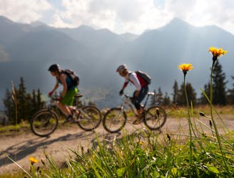
1 km away
20,000 feet of descending in one day in the beautiful Swiss Alps.
Severe Mountain Biking
1.8 km away
The easiest Biketicket 2 Ride tour climbs 630m and descends 2400m over the course of 42.9km.
Difficult Mountain Biking
1.8 km away
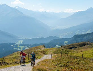
The red version of the Biketicket 2 Ride tour access superb singletrack with 950m of climbing and 3,250m of descending over 42km.
Severe Mountain Biking
3 routes · Mountain Biking

25 routes · Mountain Biking