64 m away
Gentianes - Mont-Fort Couloir

A steep and enjoyable South facing couloir
Severe Freeride Skiing
- Distance
- 1.1 km
- Ascent
- 68 m
- Descent
- 502 m

This is a popular freeride skiing route which is generally considered to be extreme. It's very remote, it features high exposure (e3) and is typically done between December and March. From a low point of 2.5 km to the maximum altitude of 3 km, the route covers 922 m, 74 vertical metres of ascent and 497 vertical metres of descent. It's graded 5.2 and Labande grade 5. You'll need rope, skins and crampons to complete it safely.
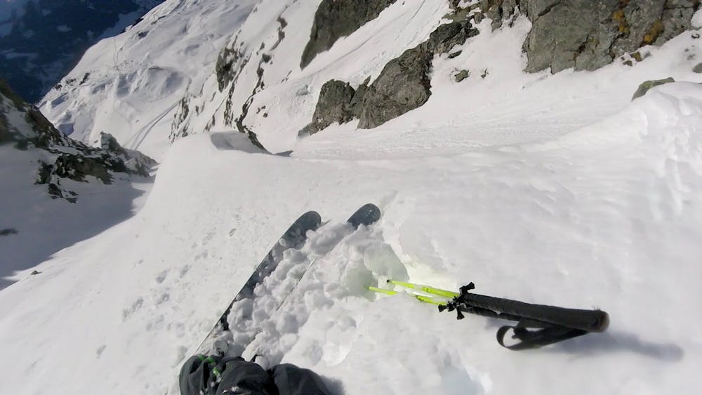
If you're looking for the least frequented and steepest couloir in Verbier, this is probably the one
Extreme
Extreme skiing terrain above 45 degrees. These routes are reserved for experienced experts.

In case of a fall, death is highly likely.
Little chance of being seen or helped in case of an accident.
64 m away
A steep and enjoyable South facing couloir
Severe Freeride Skiing
360 m away

A bit like Stairway without the bootpack
Severe Freeride Skiing
570 m away

A Verbier Mega-Classic that rewards those prepared to do a little boot packing
Difficult Freeride Skiing
571 m away

Easy access to a nice pitch of skiing
Difficult Freeride Skiing
1 km away

A classic bowl easily accessible from the Gentianes - La Chaux red piste.
Difficult Freeride Skiing
1.3 km away

The winning combination of a short ski skin up to a long run down a secluded open bowl
Difficult Freeride Skiing
1.4 km away

Excellent steep couloir skiing above the Lac de Cleuson
Extreme Freeride Skiing
1.4 km away

A narrow isolated couloir that gradually widens out in to the main Tortin valley
Severe Freeride Skiing
1.4 km away

A short skin gives access to the Col Ferret and various routes which start here
Moderate Freeride Skiing
1.5 km away

A direct line down the south face of Mont Gele
Difficult Freeride Skiing
50 routes · Freeride Skiing