4.9 km away
Approach to the Cabane de Moiry
A short and scenic trip up to a beautiful and unique mountain hut.
Moderate Hiking
- Distance
- 3 km
- Ascent
- 490 m
- Descent
- 7 m
A long, tough and incredibly scenic hike which is popular as a day tour, not just as an approach.
Hiking Difficult

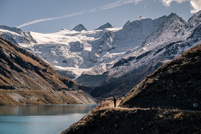
This is a great hike through some stunning Valais valleys up to an amazingly situated hut. It starts in the little village of Zinal which is something of a freeriding paradise in winter, and a popular spot for hikers in summer.
Start at the southern end of Zinal village and head south-east on a path signposted for the Roc de la Vache. Initially the trail passes through forests but these gradually thin out and you soon find yourself on a long traverse path, heading directly for the Roc de la Vache peak itself. Upon reaching the river due north of the peak, turn left and climb briefly up to a chalet called Combautanna.
From the chalet there is still a long way to go so don't pause too long looking at the view! Get hiking up a steep path that goes north-east, heading straight towards the Col de Tracuit (which is right next to its namesake hut).
The latter part of the walk in to the hut is scree covered and feels pretty tough but with the prospect of a good meal and a soft bed awaiting you, you'll find the energy to keep going!
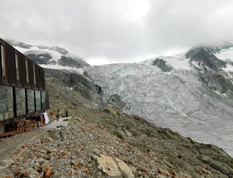
When you make it to the hut it is quite a sight, being made of shiny metal sheets and huge panes of glass. When the hut was rebuilt it was apparently designed by Savioz Fabrizzi a celebrated architect. Whether you like it or not is a question of taste but it is certainly striking.
If you're staying over, get an early night and prepare for an alpine start the following morning. If you're heading back down to the valley, allow around 3 hours for the descent.
Difficult
Hiking trails where obstacles such as rocks or roots are prevalent. Some obstacles can require care to step over or around. At times, the trail can be worn and eroded. The grade of the trail is generally quite steep, and can often lead to strenuous hiking.

The trail contains some obstacles such as outcroppings and rock which could cause injury.

Little chance of being seen or helped in case of an accident.
4.9 km away
A short and scenic trip up to a beautiful and unique mountain hut.
Moderate Hiking

11 routes · Alpine Climbing · Hiking
4 routes · Alpine Climbing · Hiking
9 routes · Alpine Climbing · Hiking