816 m away
Hallin Fell
With a high start and a low summit this likeable mini fell must be one of the easiest ascents in the Lake District, by its standard route.
Moderate Hiking
- Distance
- 2.7 km
- Ascent
- 220 m
- Descent
- 220 m
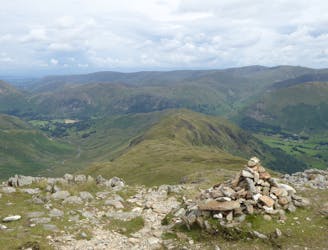
Winter Crag (St Martin's Church) - The Nab - Rest Dodd - Brock Crags - Angletarn Pikes - Place Fell - Beda Head - Winter Crag (St Martin's Church)
Hiking Moderate

This is a popular hiking route which is generally considered to be moderate. It's remote, it features medium exposure and is typically done all year round. From a low point of 190 m to the maximum altitude of 691 m, the route covers 19 km, 1127 vertical metres of ascent and 1127 vertical metres of descent.
Winter Crag (St Martin's Church) - The Nab - Rest Dodd - Brock Crags - Angletarn Pikes - Place Fell - Beda Head - Winter Crag (St Martin's Church)
Moderate
Hiking along trails with some uneven terrain and small hills. Small rocks and roots may be present.

The trail contains some obstacles such as outcroppings and rock which could cause injury.
Away from help but easily accessed.
816 m away
With a high start and a low summit this likeable mini fell must be one of the easiest ascents in the Lake District, by its standard route.
Moderate Hiking
1.8 km away
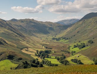
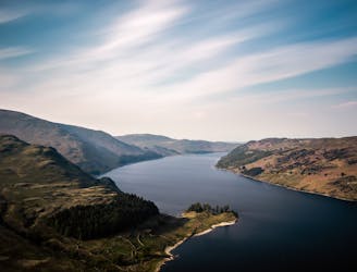
Place Fell rises alone, a hub-like point at the centre of a great arc of mountains running from Helvellyn and the Dodds to the High Street range.
Difficult Hiking
7 km away
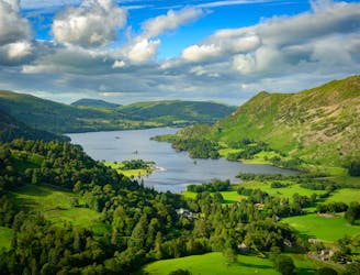
The Ullswater Way connects shoreline paths, woodland trails, fast land and popular lakeside villages to loop around Ullswater lake in the Lake District.
Moderate Hiking
8 km away
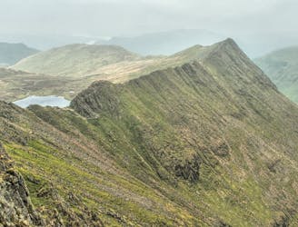
Overwhelming popularity cannot diminish the spectacular class of England’s finest ridge walking horseshoe, a circuit of the chiseled crests cupping the Red Tarn cove.
Severe Hiking
8.4 km away
People have walked High Street for thousands of years, and they'll probably be doing so for generations to come.
Difficult Hiking

7 routes · Hiking