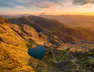
969 m away
Bowfell and Crinkle Crags
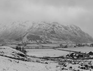
This Cumbrian crowd-pleaser is an oldie, but a goodie.
Severe Hiking
- Distance
- 14 km
- Ascent
- 956 m
- Descent
- 924 m
This classic route has it all and is justly popular but don’t let the crowds put you off; wait until later in the day and there’s a good chance you’ll have it to yourself!
Hiking Extreme

They may not be the highest peaks in the land (they’re not even the highest in the valley) but for many Lakeland habitués they are firm favourites, inspiring regular pilgrimages to their modest heights. The reasons for their popularity are manifold and this tight knit family exhibit in one compact group all that is good about the Lakeland Fells. This classic route has it all and is justly popular but don’t let the crowds put you off; wait until later in the day and there’s a good chance you’ll have it to yourself!
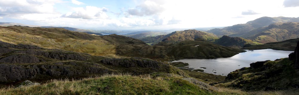
From either car park pass the toilet block on the left hand side of Stickle Barn Tavern and pick up the path following Stickle Ghyll or to give it its traditional name Mill Gill. Cross the gill via a wooden footbridge and ascend the pitched path passing a series of picturesque falls. On hot days it can be difficult to resist the cooling water so if the temptation becomes too much an entertaining gill scramble can be had at the cost of wet feet. If that doesn’t appeal then your first bit of scrambling is close at hand. An entertaining clamber up a rock step gives access to the upper section of the path which in a few minutes arrives at one of the most breathtaking sights in the district.
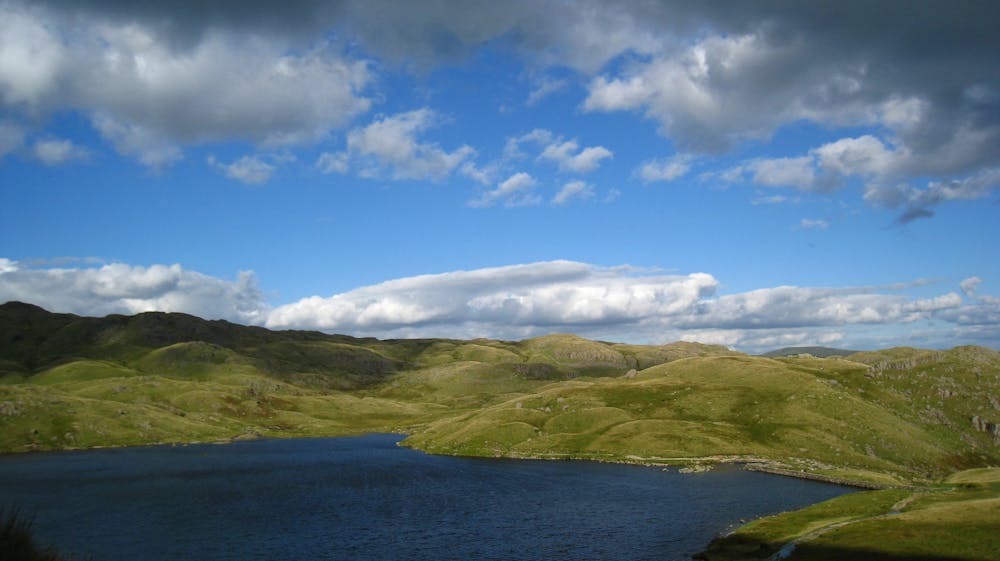
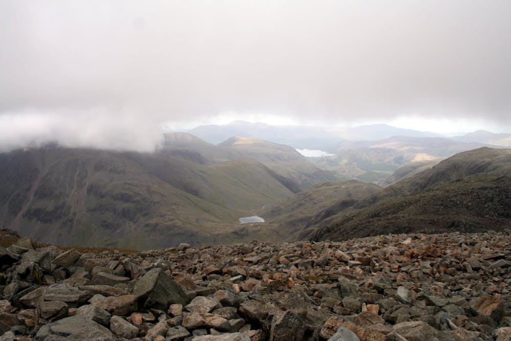
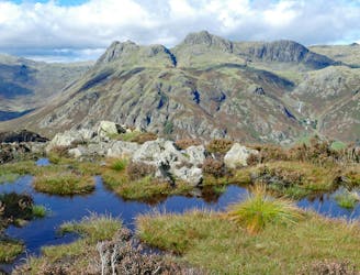
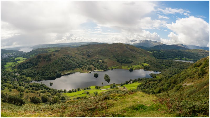
Though partially artificial, Stickle Tarn is a wonderful sheet of water and beside it you will almost certainly want to linger. To your left is Harrison Stickle which you’ll be visiting later and to your right a hummocky badlands which cries out to be explored. However, your attention will no doubt be fixed on the magnificent precipice towering over the steely waters of the tarn. Pavey Ark is palpably no place for walkers but if you take a closer look you’ll spy a fault line which rises diagonally right to left across the face...it’s called Jack’s Rake and that’s where you’re going! A pleasant walk around the tarn in either direction will bring you to a steep scree path to the start of the rake. Once at Jack's Rake, the way ahead is now plainly obvious and will either delight or intimidate depending on your particular bent. The rake starts as it means to go on with a steep groove/chimney on excellent (if extremely polished) holds though surprisingly little exposure as a comforting parapet effectively conceals the drop to the left. These steeper sections are broken up by several terraces which give exposed walking (remember that climbers may be below so take care with any loose stones on the path).Towards the top a pinnacle above comes into view and easy rock steps climb right of it until a dry stone wall is reached. Rightly exhilarated, bear right and scramble to the summit of your first Wainwright of the day from which you can enjoy a cracking view down the valley to Windermere and beyond...you’ve earned it!
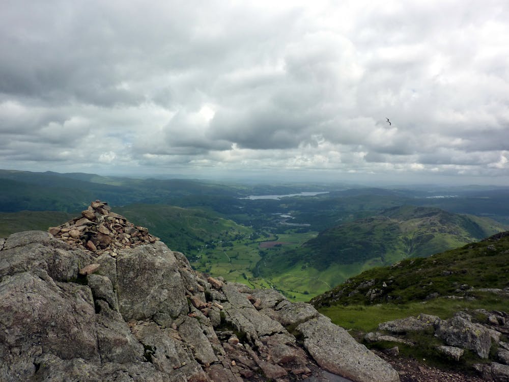
Next stop is Harrison Stickle, which at 2403ft marks the high point of the Langdale Pikes. To get there, descend SW from Pavey Ark and follow the path around the lip of the combe before a scrambly steepening puts you on the summit, a superb viewpoint and a good place to eye up your next peak, the unmistakeable rock thimble of Pike O’Stickle.
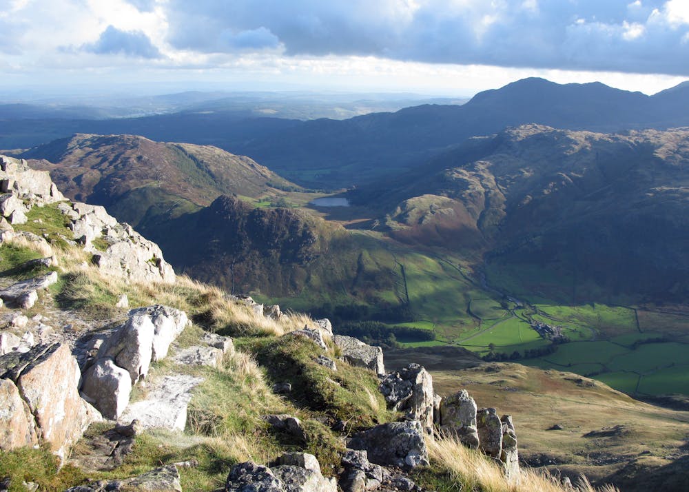
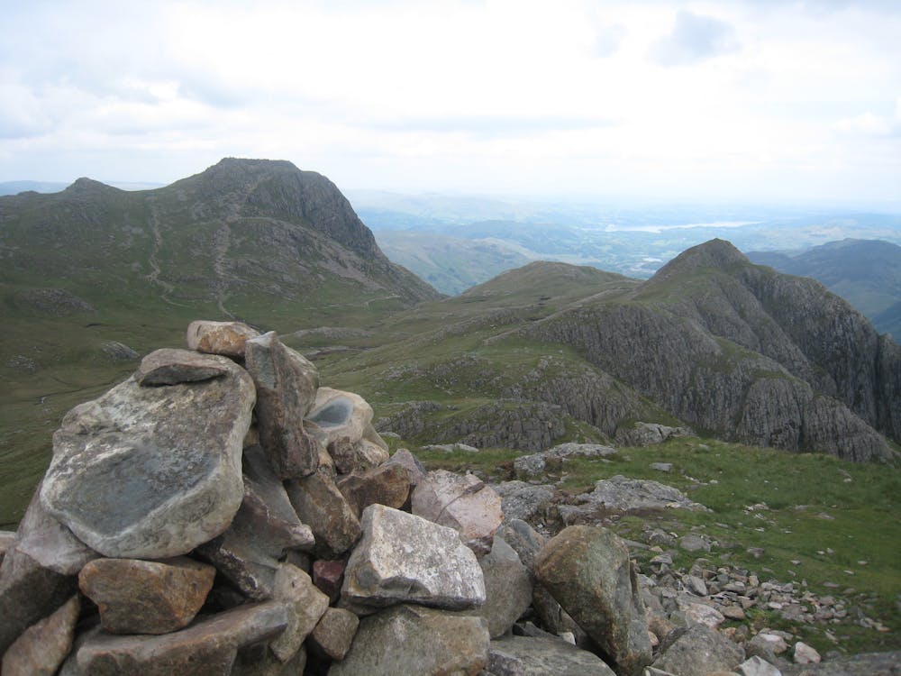
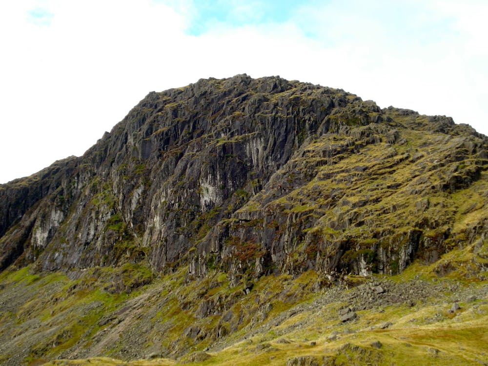
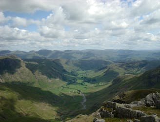
A rough, stony descent from the summit leads to the peaty combe where a pitched path takes you to the foot of the pike. A short scramble gains the top which is without a doubt one of the finest belvederes south of the border and every bit a ‘real’ summit with a grandstand view of Bowfell across the deep gulf of Mickleden.
For your last Wainwright of the day, retrace your steps from the top of Pike O’Stickle and ignoring the path down to Harrison Combe follow the ridge direct to Loft Crag, admiring as you go the steep west face of Gimmer Crag. From this final airy top head back to the combe and follow the path to the col between Harrison Stickle and Thorn Crag. This is the top of the Dungeon Ghyll ravine and your descent route.
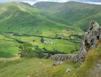
A narrow and mildly exposed path traverses above the ravine in spectacular fashion until reaching the broad grassy fellside below the SW face of Harrison Stickle. Things ease considerably now and if you’re not in a hurry I’d recommend a visit to little Pike How for an intimate view down to Stickle Ghyll before taking an easy stroll back down to the valley where good food and drink awaits.
© Nicholas Livesey - UKHillwalking.com, Oct 2011
Extreme
Scrambling up mountains and along technical trails with moderate fall exposure. Handholds are necessary to navigate the trail in its entirety, although they are not necessary at all times. Some obstacles can be very large and difficult to navigate, and the grades can often be near-vertical. The challenge of the trail and the steepness of the grade results in very strenuous hiking. Hikes of this difficulty blur the lines between "hiking" and "climbing".
969 m away
This Cumbrian crowd-pleaser is an oldie, but a goodie.
Severe Hiking
3.7 km away
The short route described here is ideal either as a half-day family adventure, or a quick blast between showers.
Easy Hiking
5.1 km away
A short family-friendly walk from Grasmere's Town Head, taking in a beautiful valley and an easy ridge to a classic Lakeland micro-summit, which feels much higher than its on-paper altitude suggests.
Moderate Hiking
5.8 km away
An excellent walk taking in an unusual combination of hills, and full of interest all the way.
Moderate Hiking
6.1 km away
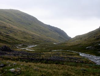
The second half of this route takes in much of the roughest ground in the Lake District and you need the fell craft of a goat to keep up a good pace.
Extreme Hiking
6.8 km away
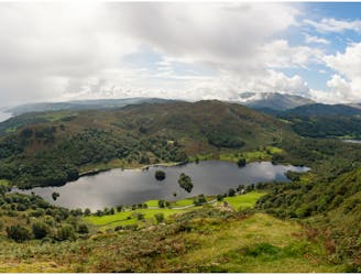
Circumnavigate a beautiful little lake and visit one of the Lake District's most famous manmade landmarks.
Moderate Hiking
7.5 km away
This stern, stony mountain sprawls over a large area, its many impressive corners offering some of the grandest mountain scenery in the Lake District.
Difficult Hiking
8 km away
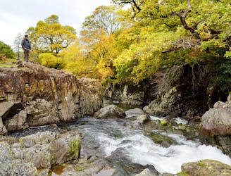
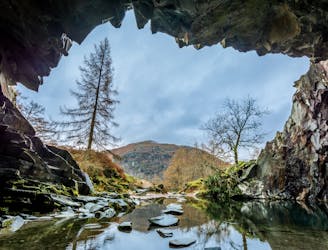
A beautiful walk to an exceptional wild swimming spot
Moderate Hiking
8.3 km away
This celebrated round packs a lot into its ten and a half miles, giving easy striding and ever-improving vistas culminating on one of the best-loved peaks in Lakeland.
Difficult Hiking
9.5 km away
Hike one of the Lake District's most iconic mountains and pass a spectacular crag en route
Difficult Hiking

9 routes · Hiking

5 routes · Hiking
5 routes · Hiking

7 routes · Hiking