2.9 km away
Fat Man's Pass via National Trail
Hike through mountaintop saguaro forest to a natural playground of boulders.
Moderate Hiking
- Distance
- 5.5 km
- Ascent
- 138 m
- Descent
- 138 m
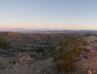
A steep climb leads to a spectacular overlook of the Phoenix metro area.
Hiking Difficult

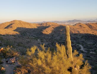
Acer Summit rises to an elevation of 2,012 feet above sea level, and even though it isn't even the highest point in South Mountain Park, this summit provides spectacular views over the Phoenix Metro Area and the Salt River Valley.
Acer Summit is a popular hike because it is easily reached via a direct climb up the Mormon Trail. This stiff climb gains almost 750 vertical feet in about 1.2 miles, making for a short, steep climb and a respectable workout that many hikers and trail runners can fit in after work.
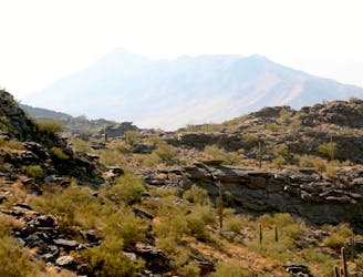
South Mountain is renowned for its rugged trails: expect a rough, rocky, steep ascent to the summit.
Difficult
Hiking trails where obstacles such as rocks or roots are prevalent. Some obstacles can require care to step over or around. At times, the trail can be worn and eroded. The grade of the trail is generally quite steep, and can often lead to strenuous hiking.

The trail contains some obstacles such as outcroppings and rock which could cause injury.

Close to help in case of emergency.
2.9 km away
Hike through mountaintop saguaro forest to a natural playground of boulders.
Moderate Hiking
4.2 km away
A demanding, short hike with incredible views of Ahwatukee.
Difficult Hiking
4.3 km away
A short hike originating from the Pima Canyon Trailhead.
Moderate Hiking
4.6 km away

An easy, scenic hike in the South Mountain trail system.
Moderate Hiking

16 routes · Hiking

6 routes · Hiking