3 km away
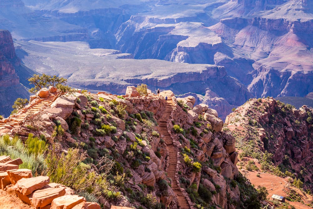
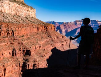
Plateau Point
Must-do side trip to one of the finest spots in the Grand Canyon.
Easy Hiking
- Distance
- 4.5 km
- Ascent
- 69 m
- Descent
- 69 m
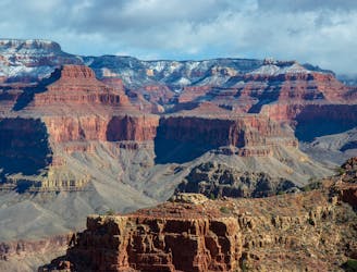
Iconic trail from rim to river in the Grand Canyon.
Hiking Difficult

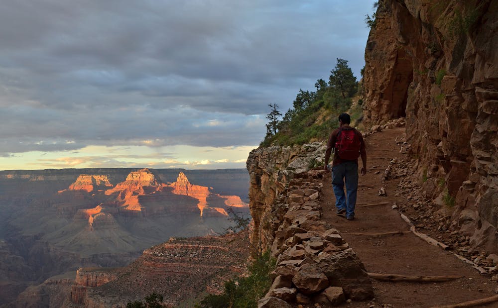
The Bright Angel Trail is the most popular trail below the rim in Grand Canyon National Park. It is the only trail from the South Rim that has water stops and a campground along the way. South Kaibab Trail, the other major route into the canyon, has water only at the beginning and end. Bright Angel Trail is also shadier and generally less exposed to the elements—thus it is the rim-to-river route favored by most, especially during the warmer months.
It is 9.5 miles from the trailhead on the rim to Bright Angel Campground in the bottom of the canyon. The Colorado River is first reached in 8 miles, however, and followed by a traverse just above river level before crossing the bridge to the campground. The Park Service does not recommend trying to get to the river and back in one day because of the length and elevation change of the roundtrip—more than 4,000 feet down and back up.
Day hikers can travel any distance down the Bright Angel Trail and return, and any amount of scenery here is rewarding. The farthest recommended turnaround point for day hikes is Indian Garden, about halfway from rim to river. Backpackers can camp at Indian Garden or at Bright Angel Campground to break up the journey.
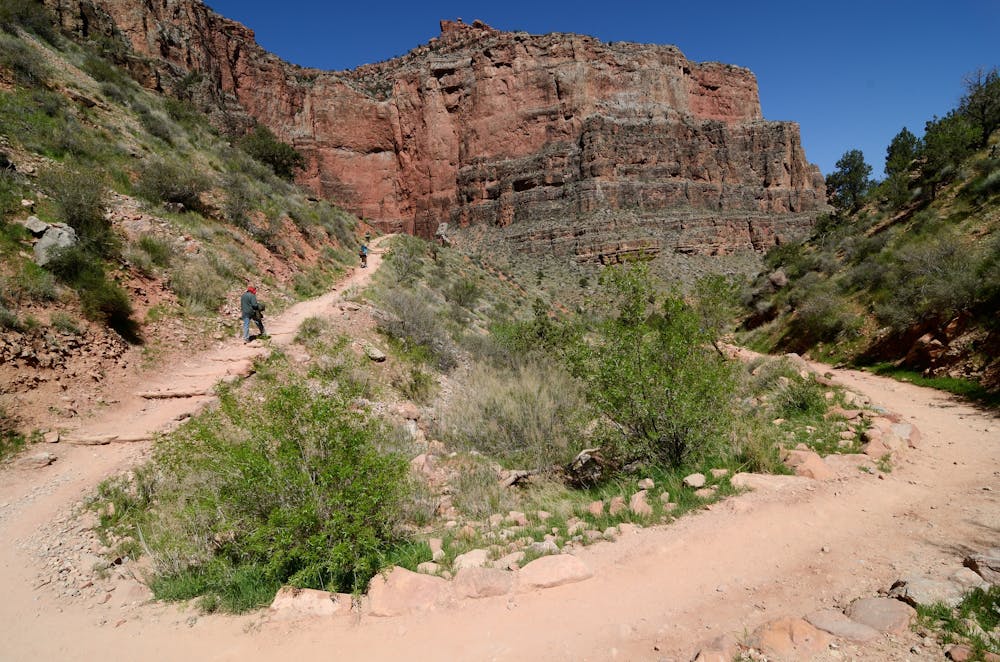
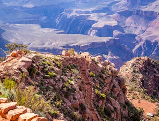
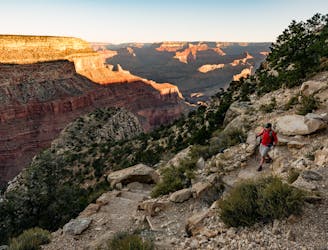
Bright Angel Trailhead is in Grand Canyon Village in between Hermit Road and Bright Angel Lodge. It does not have a dedicated parking lot, but hikers can find a spot in the village or take the free shuttle Blue Route from elsewhere in the park. It begins with a relatively gradual descent, and many casual hikers congregate here to simply dip below the rim and come back up. A tunnel blasted through a cliff wall is a popular highlight not far from the trailhead
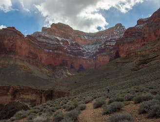
For those intent on going farther, another tunnel, as well as steeper and tighter switchbacks, await not far below. The knee-grinding descent stays pretty much constant for nearly 4 miles as the trail winds downward in an arm of the greater canyon. Along the way, you'll find a covered resthouse, toilet, and potable water at mile 1.5. The trail gets sunnier, dustier, and hotter as you go down, but the views get better and better as the walls grow taller above and the canyon grows wider ahead. You'll find another resthouse and water spigot at mile 3.0. Both this and the water supply at mile 1.5 are seasonal. They may be turned off in the colder months.
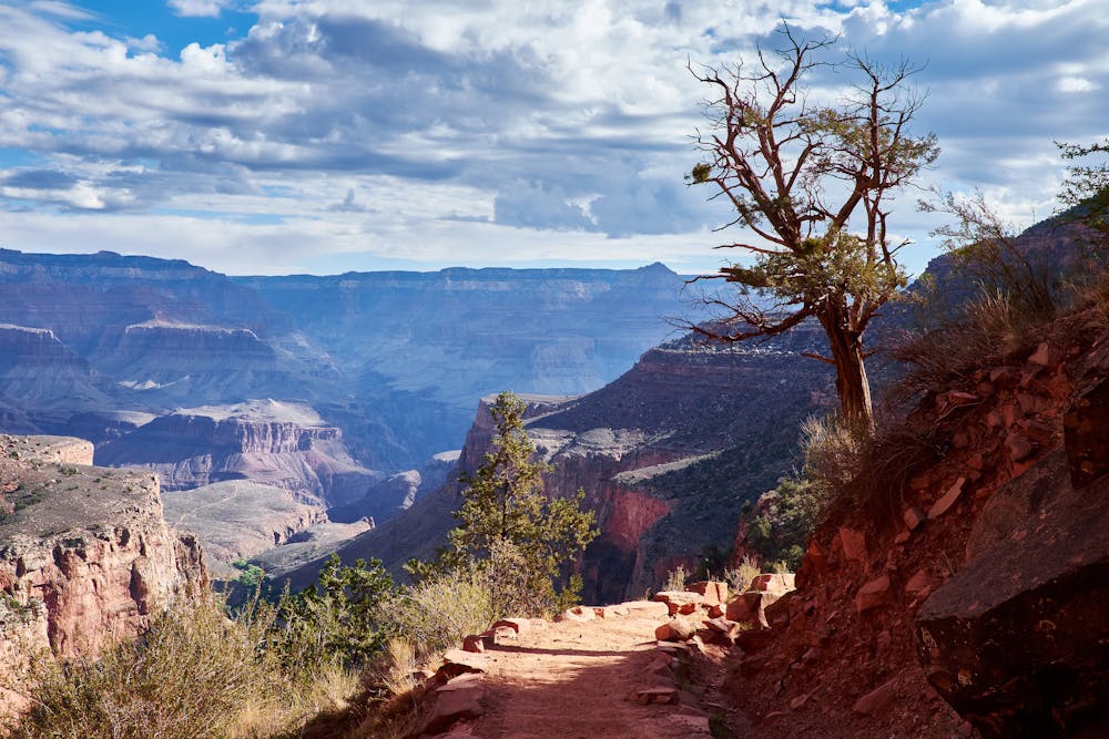
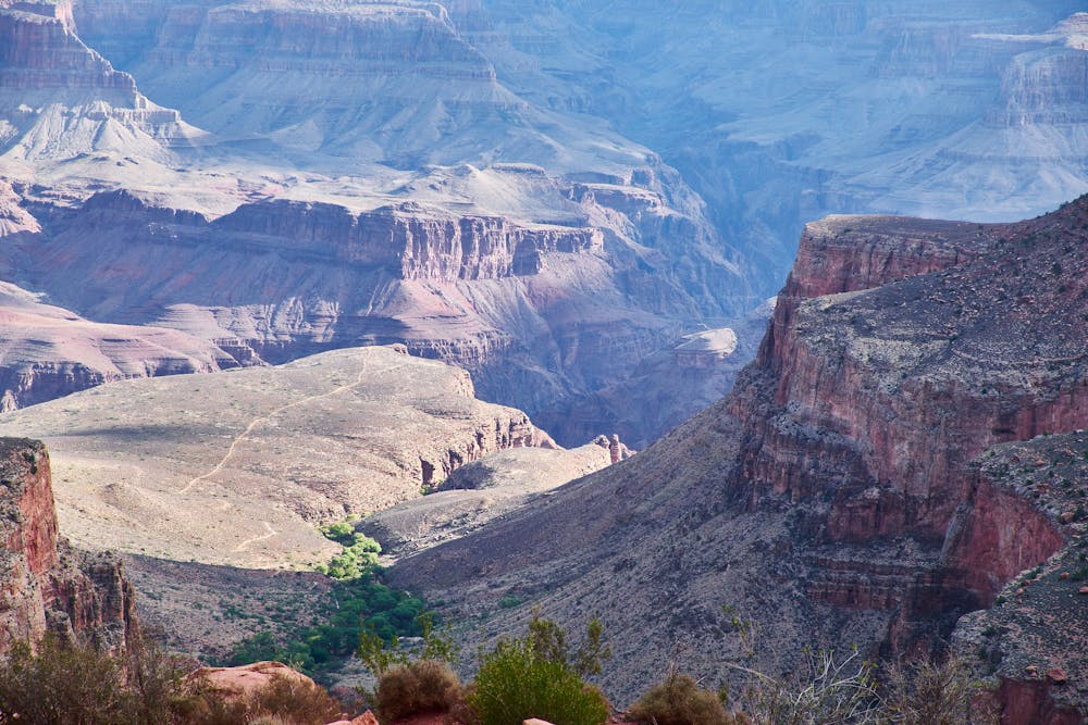
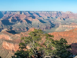
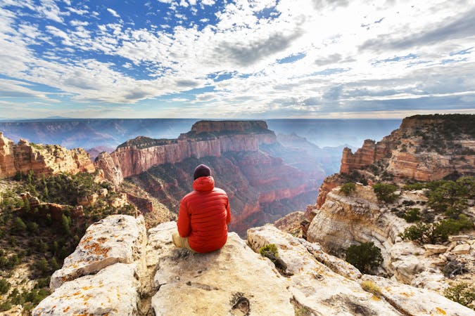
Eventually, the gradient lessens as the trail nears Indian Garden. Here at mile 4.5, huge cottonwoods and other vegetation thrive on water from natural springs. It’s an oasis of green and shade with a ranger station, campground, resthouses, picnic area, and year-round potable water. This is the turnaround point recommended during summer. When the sun is less intense, fit hikers may want to continue on Bright Angel Trail or take the side trip to a mid-canyon panorama at Plateau Point.
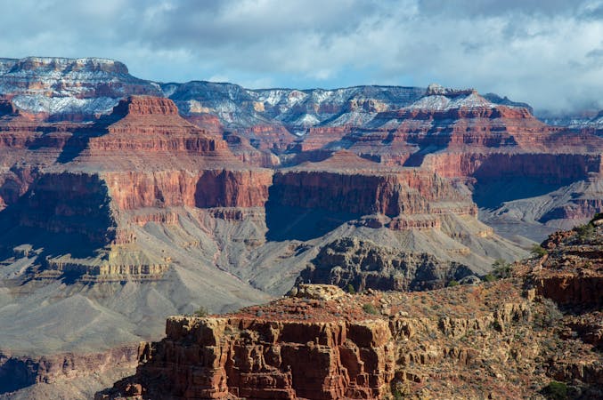
Beyond Indian Garden, Bright Angel Trail follows the spring-fed creek into a mini gorge. Hemmed by multi-hued sandstone, brimming with cottonwoods and cane plants, and teeming with birds and deer, this flowing stream would itself be a highlight hike of any other national park. Remind yourself, however, that it’s but one fascinating microcosm of the massive Grand Canyon.
Soon the creek disappears into a tight slot canyon, and the trail is left to find a way through the canyon’s final, formidable rock layers. The path is an arc of steep trail that corkscrews into a deep side canyon of dark stone. Crossing both muddy seeps and dusty sections on the way down, the trail finally meets a dry wash at the bottom and meanders toward the river.
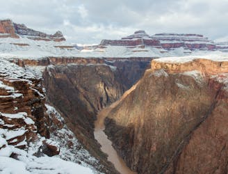
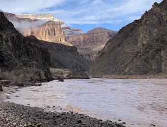
The creek from before rejoins the trail shortly, and both continue together, around one bend and then the next. The echo of water from the stream builds as the canyon grows deeper, and the Colorado River seems tantalizingly close. Eventually, you’ll reach it. Dip your feet and wet your hat in the gloriously cold water and pause to take it all in. There is a resthouse here but no water.
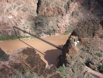
The final 1.5 miles of trail makes a short climb past the resthouse and cuts across the cliff walls above the river. The perspective from here, in the bottom of the Grand Canyon, is mind-boggling. You can see thousands of feet above to towers of yellow sandstone near the North Rim, but the rim itself remains hidden from view. This trail is sandy and has constant small ups and downs. Stick with it and you’ll soon reach the Silver Bridge, which spans a rapid on the Colorado River and reaches Bright Angel Campground on the other side.
In the campground you’ll find running water, flush toilets, bountiful shade beside a flowing stream, and good company among other hikers. Continue a bit farther to see Phantom Ranch, and go inside to buy a drink or even a hot meal, and to send a postcard delivered by mule. Take time to rest up, refuel, and make the return journey to the rim.
Note: Bright Angel Trail is used by mules that carry people and supplies up and down the canyon. Mules have right of way for safety reasons. Always stop when mules pass and follow the driver’s instructions.
Sources: https://www.nps.gov/grca/planyourvisit/upload/brightangeltrail.pdf
Difficult
Hiking trails where obstacles such as rocks or roots are prevalent. Some obstacles can require care to step over or around. At times, the trail can be worn and eroded. The grade of the trail is generally quite steep, and can often lead to strenuous hiking.

Some trail sections are extremely exposed where falling will almost certainly result in serious injury or death.

Away from help but easily accessed.
3 km away
Must-do side trip to one of the finest spots in the Grand Canyon.
Easy Hiking
3 km away

Day three traverses the famed Colorado River and heads up the North Kaibab Trail
Moderate Hiking
5.1 km away
Day two traverses the magnificent Tonto Platform as you make your way across the Canyon.
Moderate Hiking
5.1 km away
Side trip to one of the largest rapids in the Colorado River.
Easy Hiking
5.5 km away
A truly epic hike across the Grand Canyon.
Severe Hiking
5.5 km away
Family and dog-friendly trail linking major overlooks on the South Rim.
Easy Hiking
5.5 km away
A jaw-dropping journey into the Grand Canyon, and the most direct route from rim to river.
Difficult Hiking
6 km away
Experience living history on this challenging trek.
Difficult Hiking
6 km away
Edgy exposure makes this an adventurous trek.
Difficult Hiking
6.1 km away
Day one of a spectacular route through the Grand Canyon.
Moderate Hiking

23 routes · Mountain Biking · Hiking
14 routes · Hiking
8 routes · Hiking

25 routes · Alpine Climbing · Hiking

10 routes · Hiking

63 routes · Alpine Climbing · Hiking