3.2 km away
Starr Pass Tour
A cactus-filled hike through eastern Tuscon Mountain Park.
Difficult Hiking
- Distance
- 13 km
- Ascent
- 231 m
- Descent
- 230 m
Short, steep hike to gain incredible views!
Hiking Severe
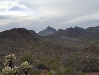
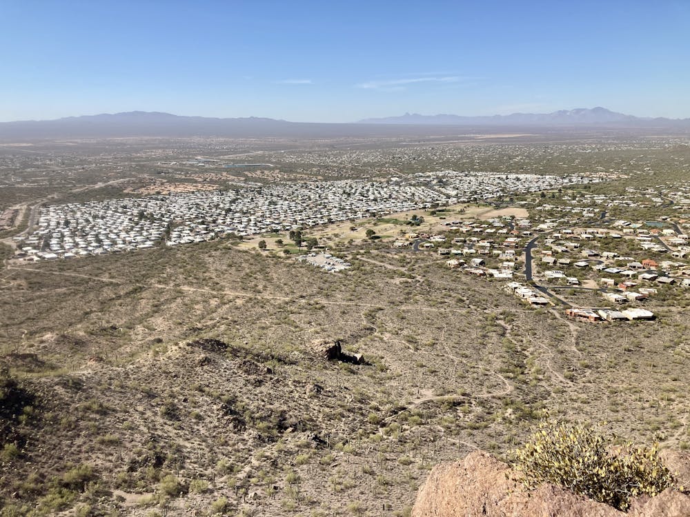
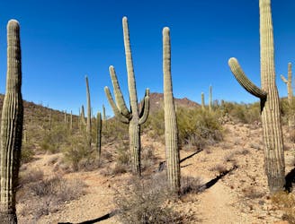
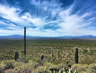
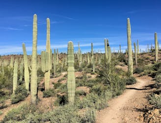
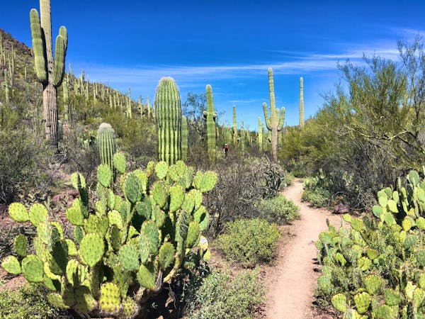
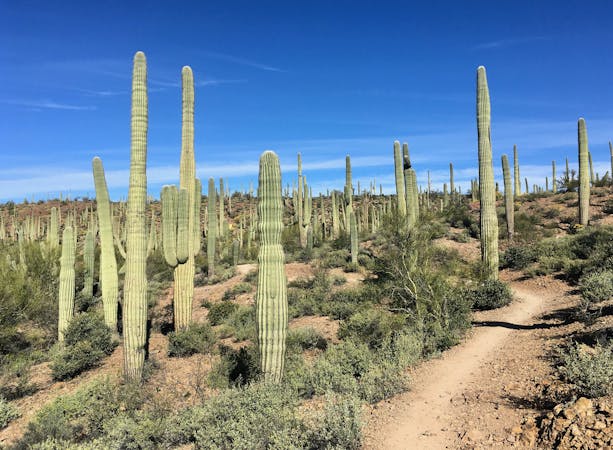
The arid Tucson Mountains form a ragged skyline just to the west of the eponymous million-person metropolis. This rocky mountain range doesn't rise nearly as high as the Catalinas to the northeast of the city, but the trails riddling the mountain range are downright rugged. This short, steep loop hike gains the top of a rocky ridge, affording stunning views of the spine of the mountain range as it trots both north and south from this vantage point.
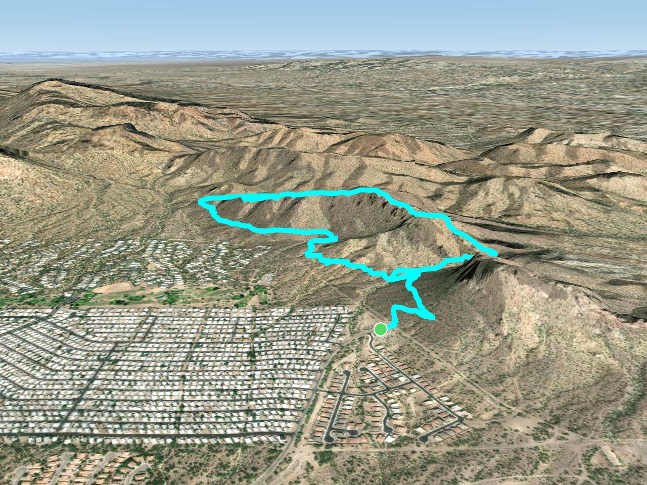
While you can reach the John Crane trail from either side of the mountain range, the route mapped here is the shortest way to reach the top. For a longer hike but with less driving from Tucson, you could also begin from the Starr Pass Trailhead, creating a more challenging variant of the Starr Pass Tour.
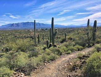
After departing the trailhead, you'll slowly climb and traverse along mellow singletrack, before turning and heading up the Starr Pass Cutoff trail. Keep an eye out for the left turn onto the John Crane trail—it's unmarked but is well-trod. Be sure to download this map for offline navigation so you don't miss the turn!
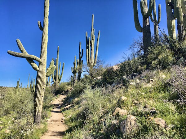
Once you've made the turn onto John Crane, the climbing begins in earnest, heading straight up the mountainside on an extremely rough, eroded trail. Rolling rocks, loose dirt, and steep ledges will have you looking at your feet to avoid rolling an ankle. At times, you may even need to use a hand or two to ascend extremely steep sections of rocky ledges.
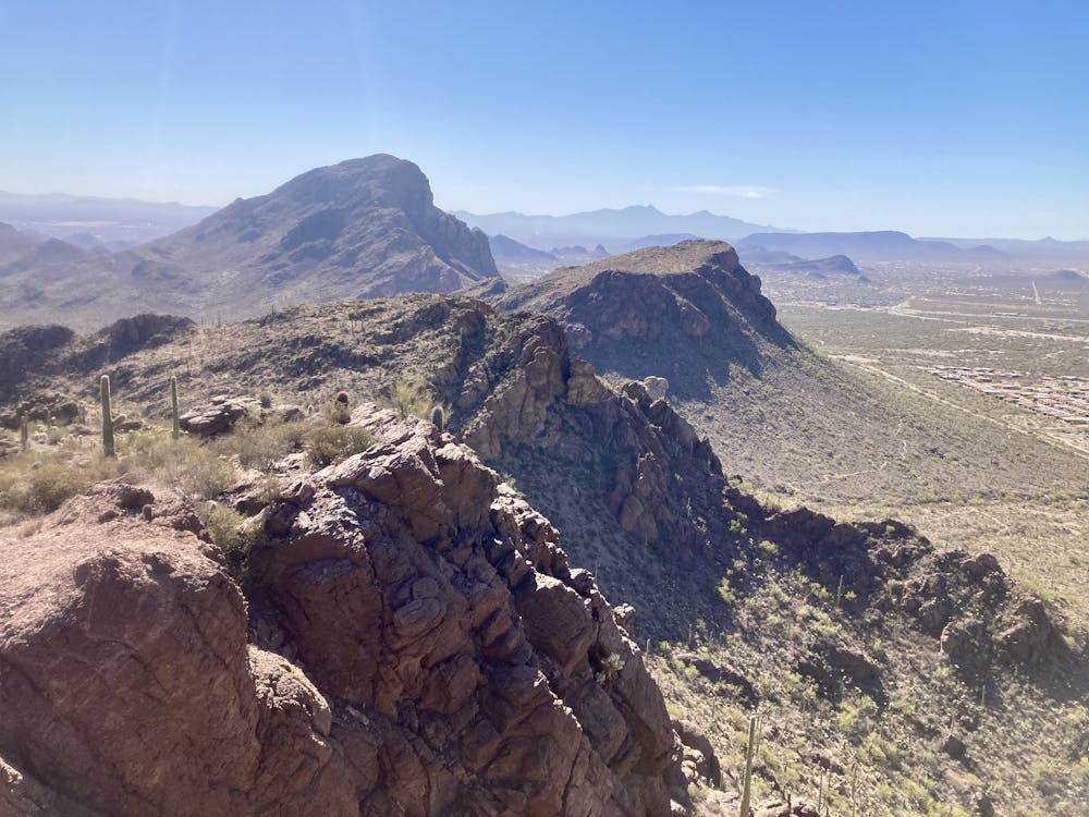
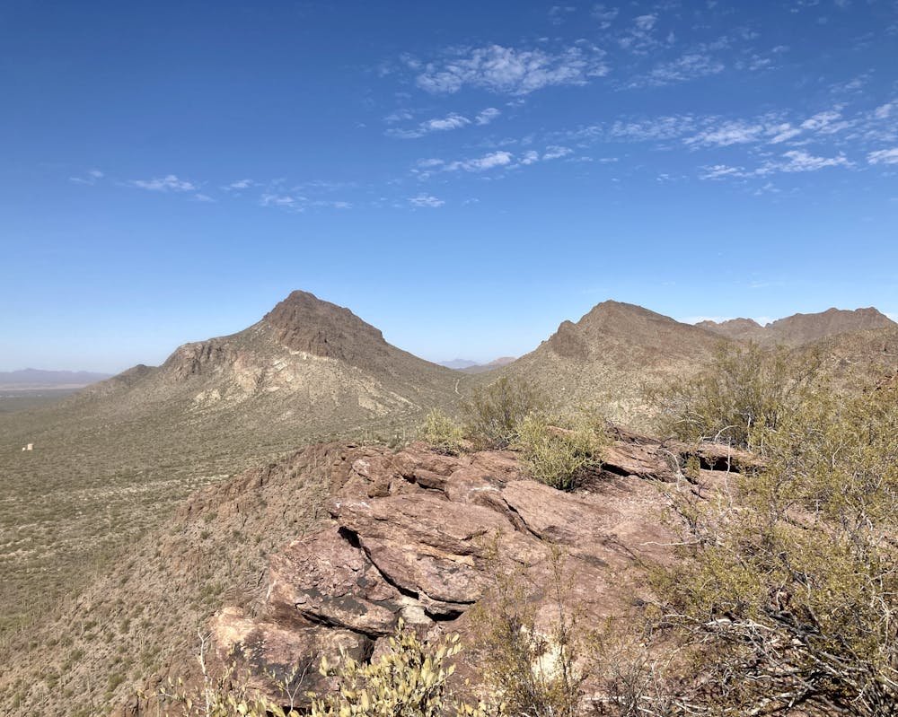
Even though you may be looking at your feet, be sure to stop periodically to look up and soak in the views around you. As you ascend the ridge, the vistas get better and better until you finally gain the top. The view of the spine of the mountains running in both directions is simply stunning—you could be forgiven for forgetting you're just minutes from downtown Tucson!
Once on top of the ridge, the trail undulates up and down as it traverses northward. Eventually, it begins to descend slowly down to the Yetman trail. Once on the Yetman trail, take a left, and then another left on Starr Pass to head back to the trailhead where you began.
Severe
Hiking challenging trails where simple scrambling, with the occasional use of the hands, is a distinct possibility. The trails are often filled with all manner of obstacles both small and large, and the hills are very steep. Obstacles and challenges are often unexpected and can be unpredictable.

The trail contains some obstacles such as outcroppings and rock which could cause injury.
Away from help but easily accessed.
3.2 km away
A cactus-filled hike through eastern Tuscon Mountain Park.
Difficult Hiking
5.6 km away
An easy loop hike leading to impressive views.
Moderate Hiking
7.5 km away
Hike along a gorgeous ridge with stupendous views of the Tucson Mountains and Saguaro National Park.
Difficult Hiking
9.9 km away
A delightful bite-sized hike in Sweewater Preserve
Easy Hiking
9.9 km away
An idyllic preserve filled with towering saguaro cacti.
Easy Hiking
10 routes · Hiking
4 routes · Hiking
7 routes · Hiking · Trail Running

7 routes · Hiking

32 routes · Mountain Biking · Hiking · Road Biking