3.4 km away
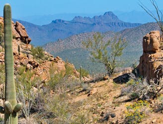
King Canyon - Gould Mine Loop
Mountainside cactus forest and an old copper mine, plus a backcountry picnic area with a view.
Moderate Hiking
- Distance
- 4.2 km
- Ascent
- 142 m
- Descent
- 142 m
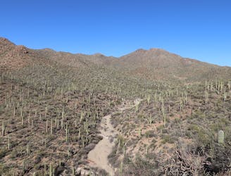
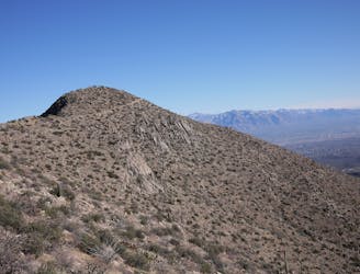
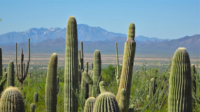
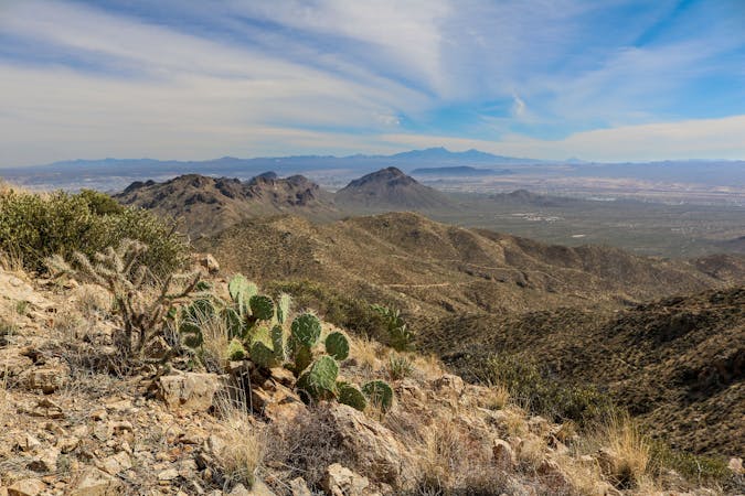
Hike along a gorgeous ridge with stupendous views of the Tucson Mountains and Saguaro National Park.
Hiking Difficult

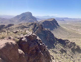
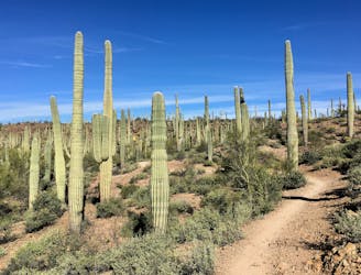
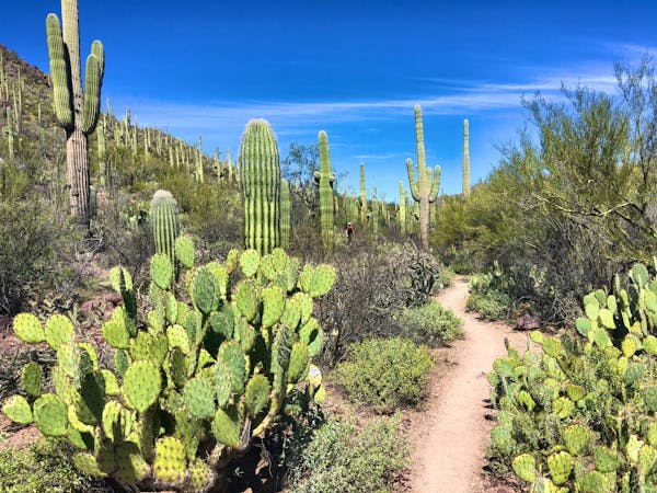
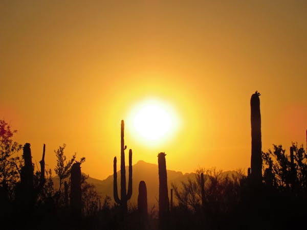
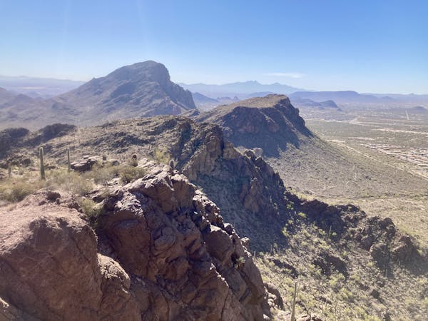
More than just a single peak, Brown Mountain consists of several small summits along a low ridge measuring 1.5 miles long. The route mapped here is a quick but beautiful 4.6-mile lollipop that traverses the entirety of the ridge on visually-stunning, exposed singletrack.
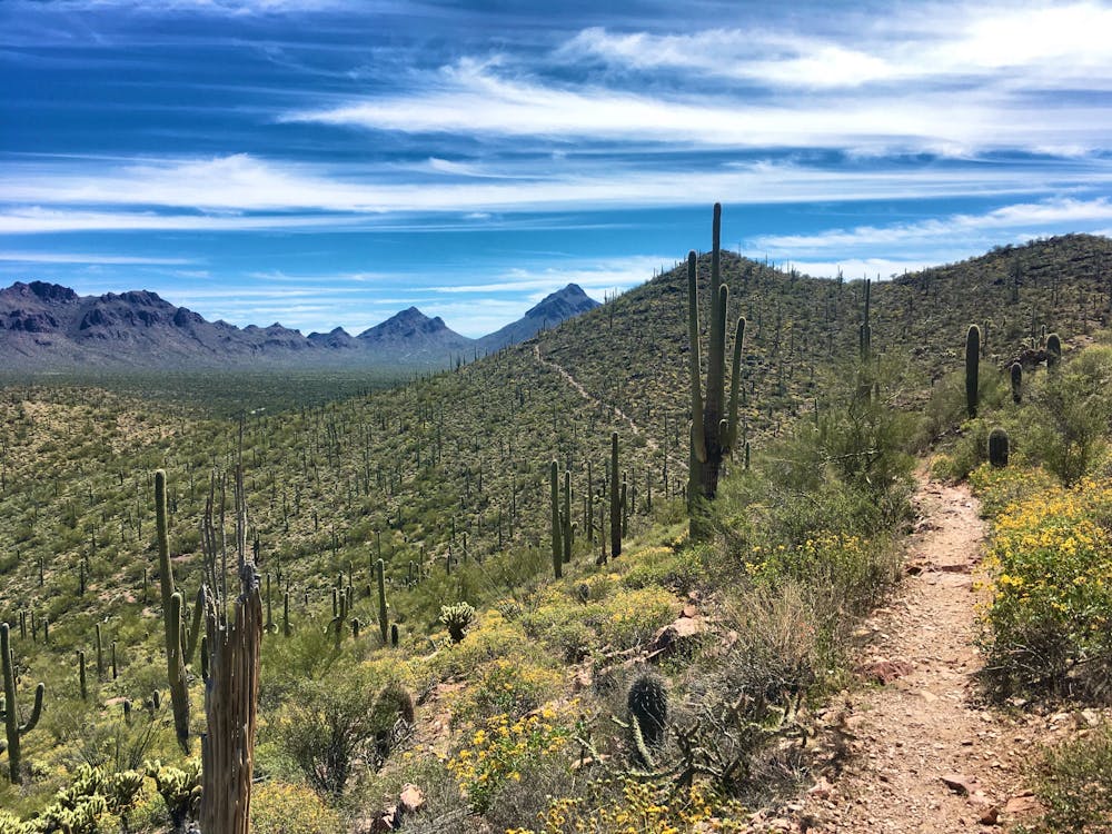
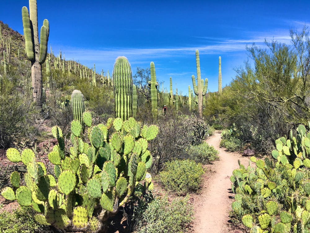
The recommended route wraps around the base of the mountain to reach the northwestern end of the ridge. You'll then climb onto the ridge and traverse up and down the several small summits on your way back to the trailhead. The singletrack along the base is narrow and twisty, ducking beneath towering saguaro cacti and through the beautiful undergrowth that has made the Sonoran Desert so famous.
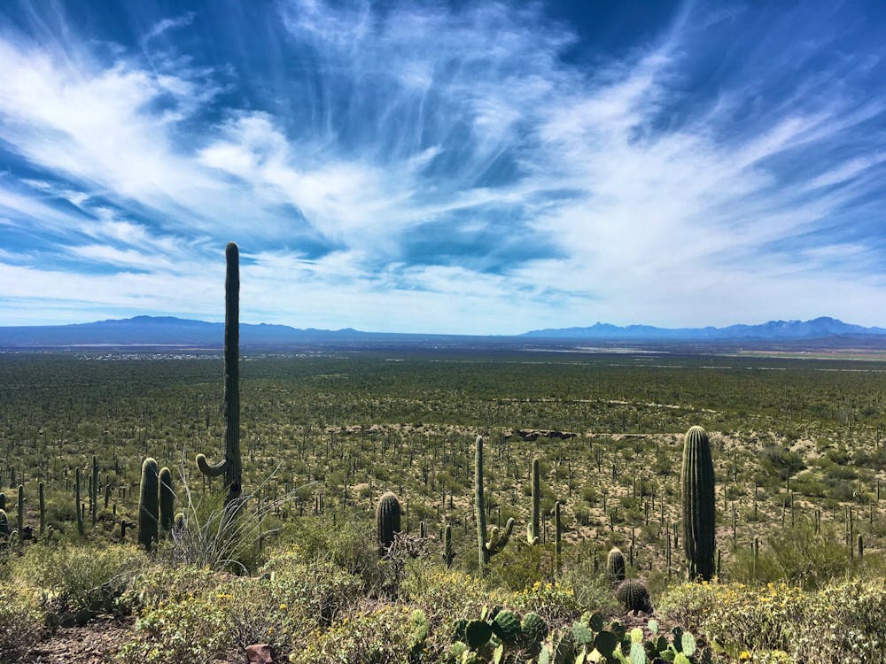
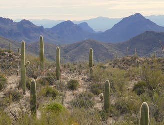
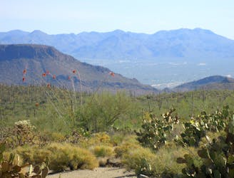
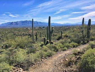
As you climb toward the top of Brown Mountain, you'll enjoy expansive views of the Tucson Mountains all around you. Despite being located right on the edge of the second-largest city in Arizona, this small mountain range is protected by Tucson Mountain Park and Saguaro National Park. While Brown Mountain isn't technically inside the national park, the western section of Saguaro National Park begins just to the north and is visible from the entire route. Take your time and savor the views as you traverse the ridgeline—you earned this reward!
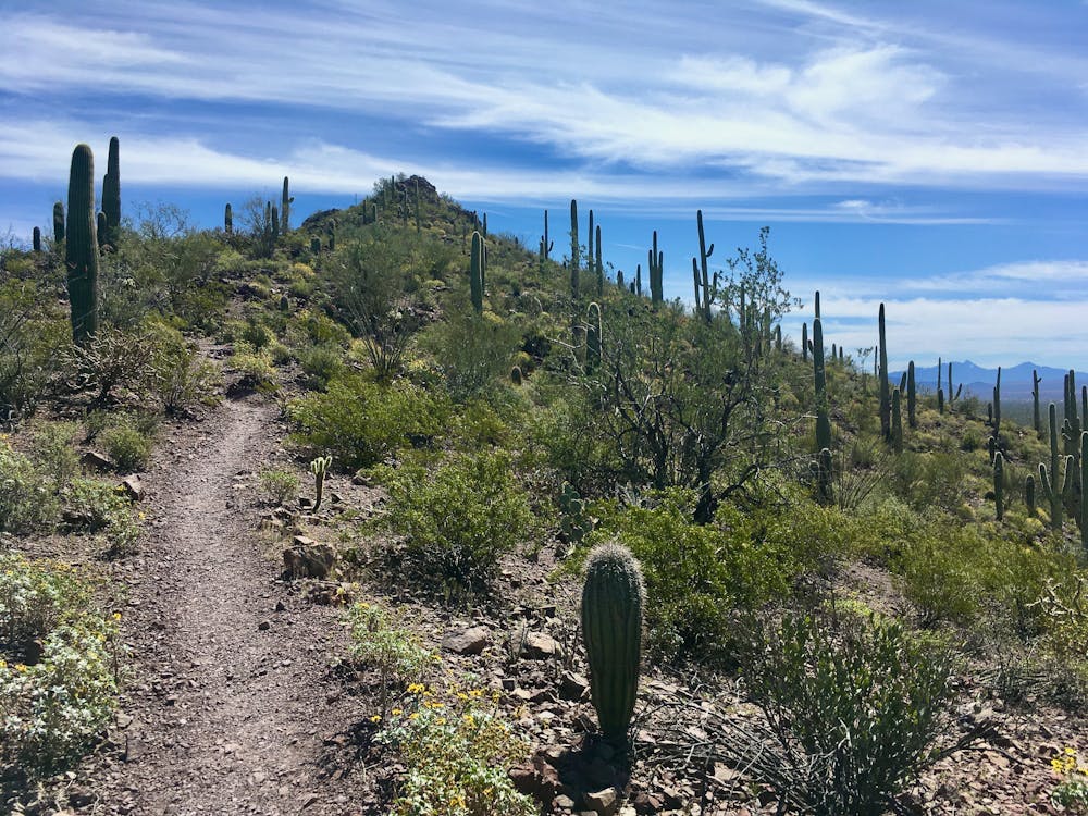
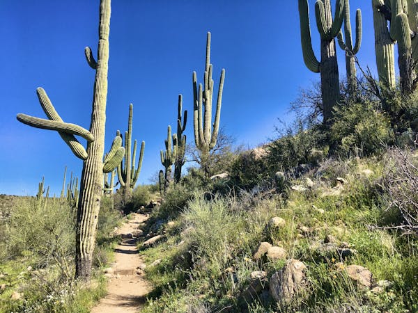
The final descent off the mountain is steep and technical, dropping through a series of tight, rocky switchbacks that could challenge some hikers. While this trail is bike-legal and you may encounter mountain bikers out here, the short, steep climbs and tight switchbacks on the descent make it most ideal as a hiking or trail running route.
Difficult
Hiking trails where obstacles such as rocks or roots are prevalent. Some obstacles can require care to step over or around. At times, the trail can be worn and eroded. The grade of the trail is generally quite steep, and can often lead to strenuous hiking.

The trail contains some obstacles such as outcroppings and rock which could cause injury.
Away from help but easily accessed.
3.4 km away
Mountainside cactus forest and an old copper mine, plus a backcountry picnic area with a view.
Moderate Hiking
3.4 km away
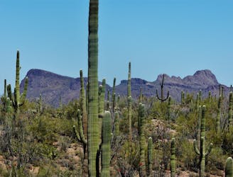
A full-value loop to the highest point in the Tucson Mountains District of Saguaro National Park.
Difficult Hiking
7.1 km away
A mellow walk through open desert, then a steep but short climb to a panoramic ridgeline.
Moderate Hiking
7.5 km away
Short, steep hike to gain incredible views!
Severe Hiking
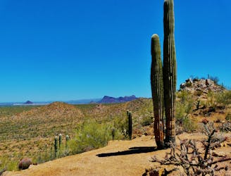
7.6 km away
Climb to the highest peak in the Tucson Mountain.
Difficult Hiking
7.6 km away
The most scenic route to the top of Wasson Peak, and perhaps in all of Saguaro West.
Difficult Hiking
7.8 km away
Mellow hike among desert flora and low hills within the Bajada Scenic Loop.
Easy Hiking
7.8 km away
A quick hike through colorful cactus forest, to a panoramic overlook on a hill.
Moderate Hiking
8.5 km away
An idyllic preserve filled with towering saguaro cacti.
Easy Hiking
8.5 km away
A delightful bite-sized hike in Sweewater Preserve
Easy Hiking
10 routes · Hiking
4 routes · Hiking
5 routes · Hiking
9 routes · Hiking
6 routes · Hiking
7 routes · Hiking

32 routes · Mountain Biking · Hiking · Road Biking

63 routes · Alpine Climbing · Hiking

10 routes · Alpine Climbing · Canyoning · Hiking