3.8 km away
Sweetwater Preserve
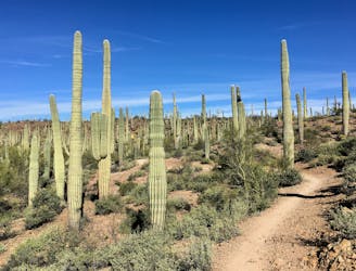
An idyllic preserve filled with towering saguaro cacti.
Easy Hiking
- Distance
- 16 km
- Ascent
- 207 m
- Descent
- 207 m
Climb to the highest peak in the Tucson Mountain.
Hiking Difficult

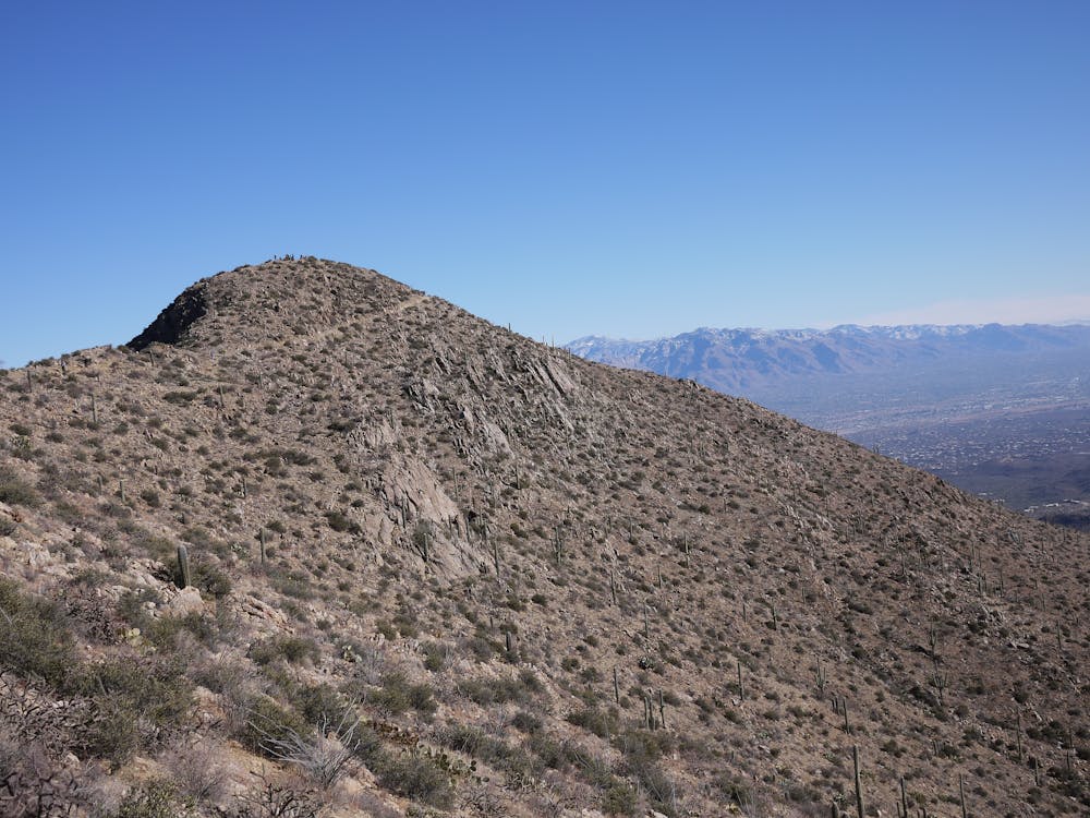
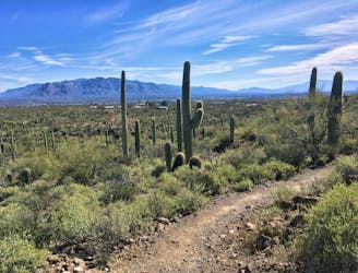
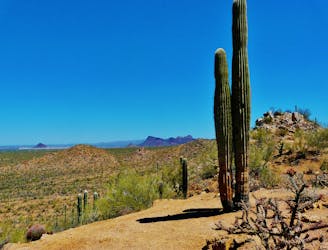
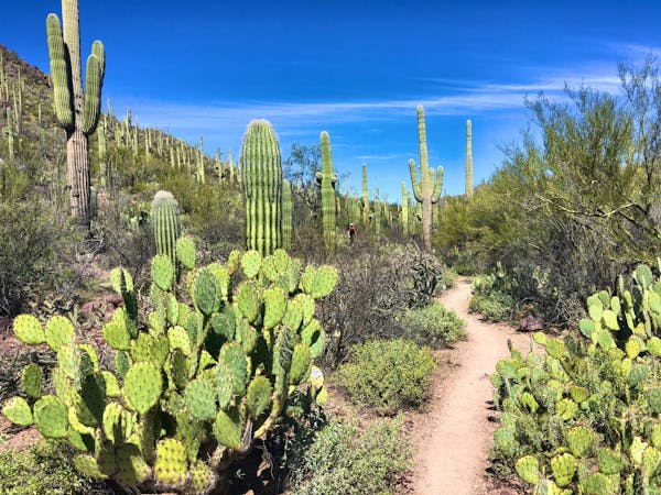
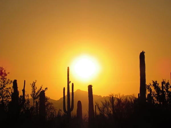
While the Tucson Mountains don't soar nearly as high as the Santa Catalinas on the opposite side of the city, the moderate elevations mean that the trails here generally stay snow-free all year long. Wasson Peak, featured here, is the tallest of the peaks in the Tucson Mountains and the highest point in Saguaro National Park, rising to an elevation of 4,687 feet above sea level.
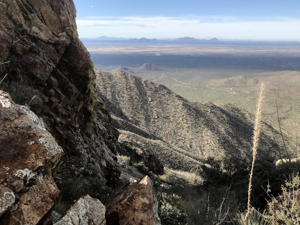
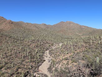
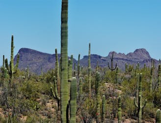
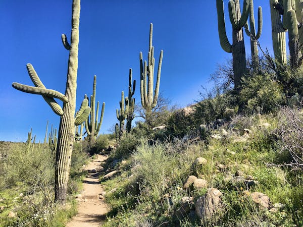
The climb to the summit begins on a wide, rocky trail that slowly climbs through the desert. After a couple miles, the grades get considerably steeper as the trail climbs up a canyon, making for the summit in earnest.
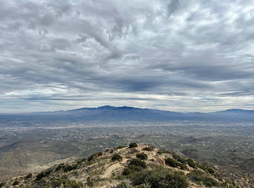
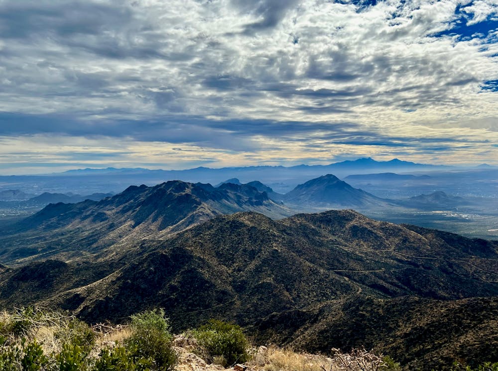
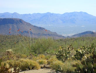
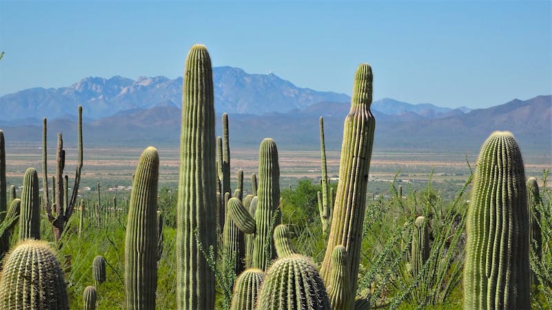
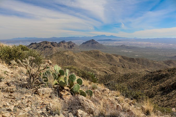
Soon you'll reach a saddle between two mountain peaks, with Wasson Peak to your right. From the saddle, you'll glimpse your first views to the west of the Tucson Mountains. The expansive vistas of Saguaro National Park spreading out below you are definitely camera-worthy!
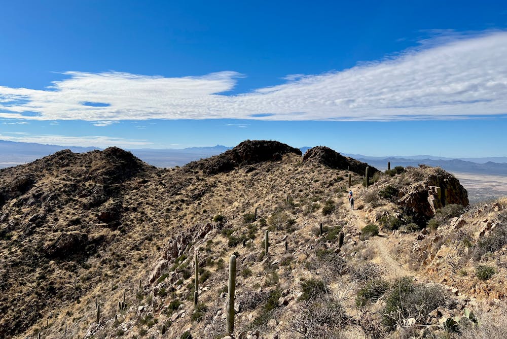
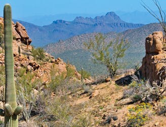
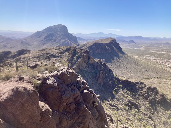
From the saddle, turn right for the final, steep ascent to the summit of Wasson Peak. You'll have to scale a few steep, rocky switchbacks along the way, but before you know it, you'll find yourself on top of the Tucson Mountain Range.
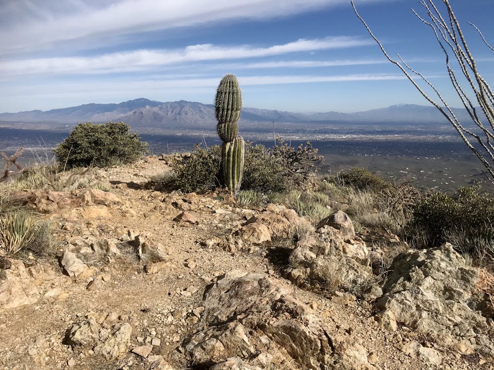
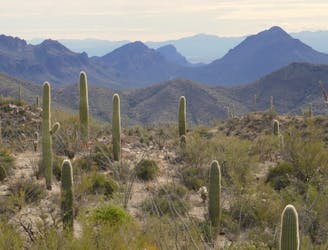
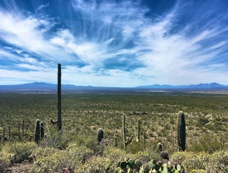
"From the top you can see all of the Tucson Mountains, the city of Tucson, the Santa Catalina Mountains, the Rincon Mountains, and if you've already hiked Picacho Peak, you should be able to pick out its distinct shape out to the northwest," writes Richard Oppelaar on SoCalHiker.net.
This version of the climb to Wasson Peak follows an out-and-back route on the Sweetwater Trail. Return the way you came to get back to your vehicle.
Sources: https://socalhiker.net/hiking-wasson-peak-in-saguaro-national-park/ https://www.theoutbound.com/arizona/hiking/summit-wasson-peak https://www.summitpost.org/wasson-peak/151398
Difficult
Hiking trails where obstacles such as rocks or roots are prevalent. Some obstacles can require care to step over or around. At times, the trail can be worn and eroded. The grade of the trail is generally quite steep, and can often lead to strenuous hiking.

The trail contains some obstacles such as outcroppings and rock which could cause injury.
Away from help but easily accessed.
3.8 km away
An idyllic preserve filled with towering saguaro cacti.
Easy Hiking
3.8 km away
A delightful bite-sized hike in Sweewater Preserve
Easy Hiking
4.4 km away
A mellow walk through open desert, then a steep but short climb to a panoramic ridgeline.
Moderate Hiking
6.3 km away
A full-value loop to the highest point in the Tucson Mountains District of Saguaro National Park.
Difficult Hiking
6.3 km away
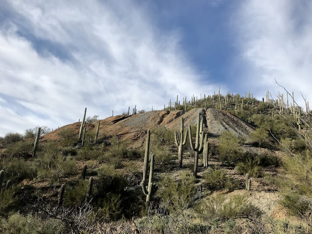
Mountainside cactus forest and an old copper mine, plus a backcountry picnic area with a view.
Moderate Hiking
7.3 km away
A quick hike through colorful cactus forest, to a panoramic overlook on a hill.
Moderate Hiking
7.3 km away
Mellow hike among desert flora and low hills within the Bajada Scenic Loop.
Easy Hiking
7.6 km away
Hike along a gorgeous ridge with stupendous views of the Tucson Mountains and Saguaro National Park.
Difficult Hiking
7.9 km away
The most scenic route to the top of Wasson Peak, and perhaps in all of Saguaro West.
Difficult Hiking
8.2 km away
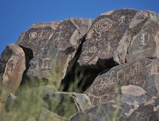
Not much of a hike, but a quick walk to the site of well-preserved Native American rock art.
Easy Hiking
10 routes · Hiking
4 routes · Hiking
5 routes · Hiking
9 routes · Hiking
6 routes · Hiking
7 routes · Hiking

32 routes · Mountain Biking · Hiking · Road Biking

63 routes · Alpine Climbing · Hiking

10 routes · Alpine Climbing · Canyoning · Hiking