3 km away
Valley View Overlook
A quick hike through colorful cactus forest, to a panoramic overlook on a hill.
Moderate Hiking
- Distance
- 1.3 km
- Ascent
- 19 m
- Descent
- 19 m
A mellow walk through open desert, then a steep but short climb to a panoramic ridgeline.
Hiking Moderate

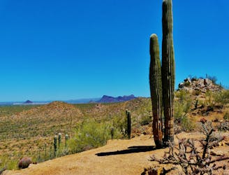
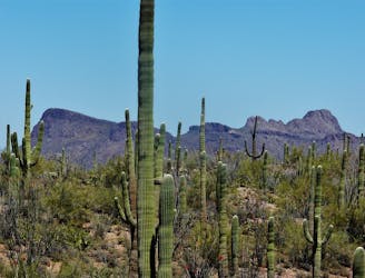
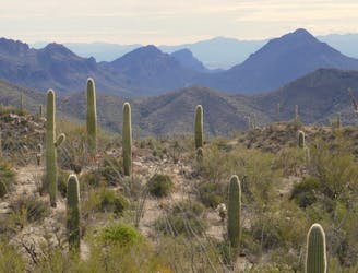
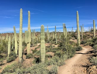
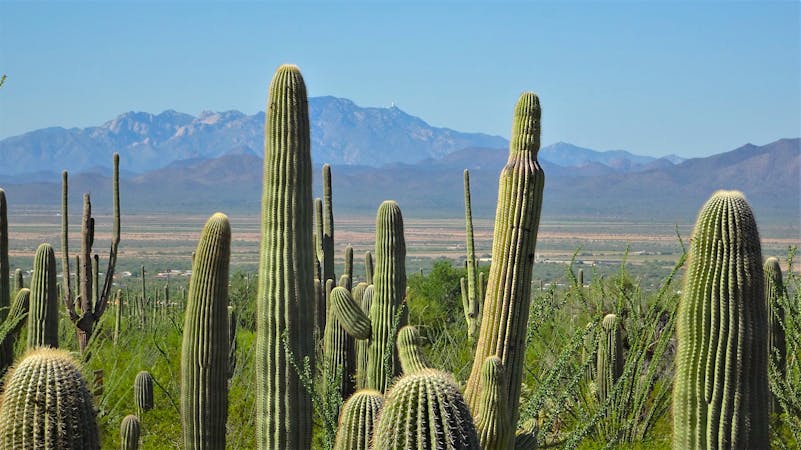
The Tucson Mountains are the collection of peaks in the western district of Saguaro National Park. They rise steeply from the flatter desert that surrounds them, so getting up in the mountains makes for incredible views. There are no roads to any mountain top in the park, however, so you’ll have to hike. Sendero Esperanza Trail is a relatively easy approach to an elevated view on a ridge leading to Wasson Peak. Wasson is the tallest mountain in the park, and though Sendero Esperanza does not reach its 4,687-foot summit, it offers impressive panoramas from a prominent ridgeline.
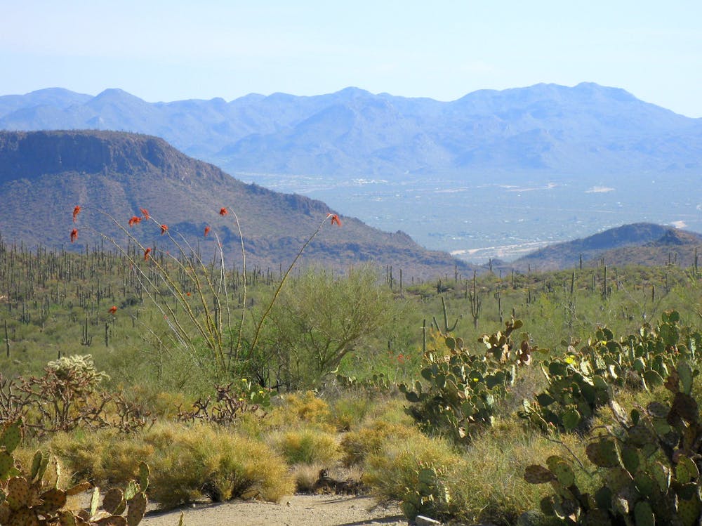
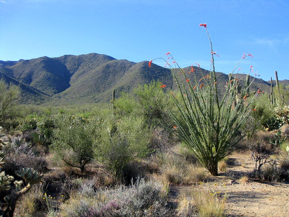
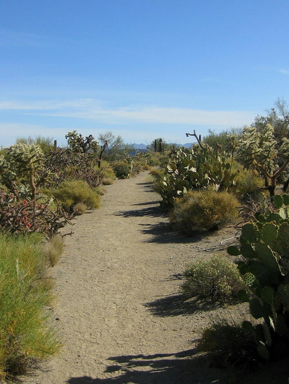
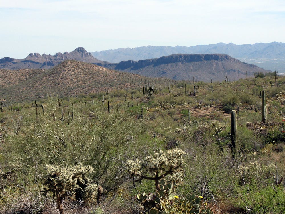
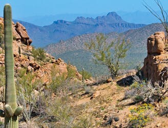
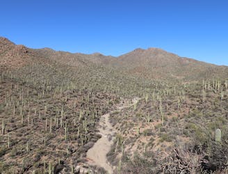
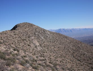
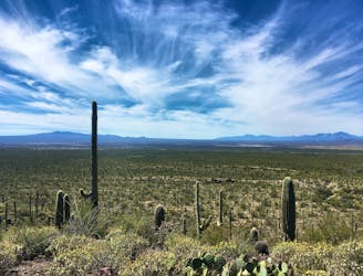
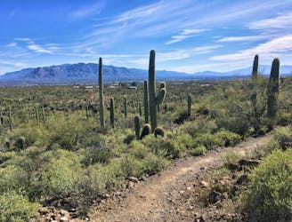
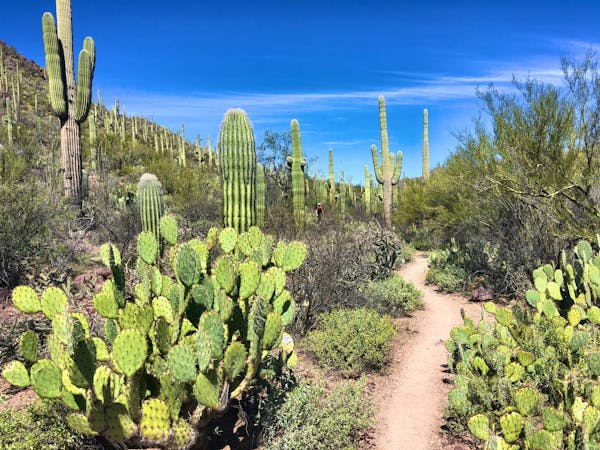
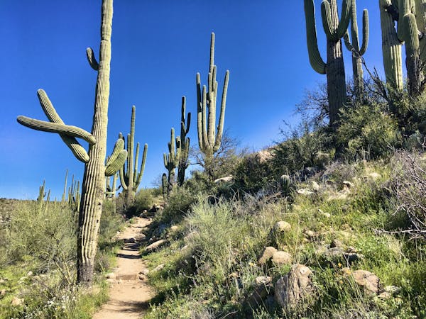
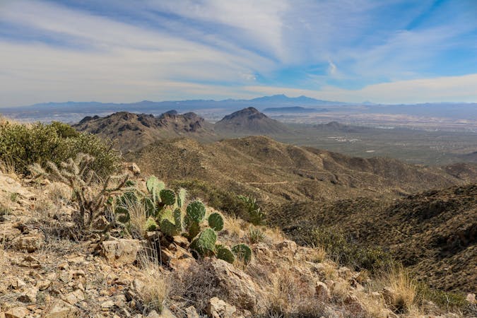
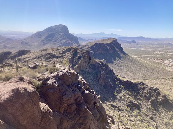
Sendero Esperanza goes at first across open desert of rich cactus forest, toward the elongate mountain in the distance. The path was once a mining road, so it’s wide and easy to walk. After the initial mile, though, the trail meets the mountainside and turns into switchbacks on rockier terrain. The strenuous climb lasts less than a mile before topping out on the ridgeline. From there, views stretch north and south to numerous other mountains and down to the desert floor, now appearing far away. The ridgeline arcs upward to the east and west, but more steeply to the east, on a trajectory for Wasson Peak.
This spot is a 4-way trail junction, where Sendero Esperanza crosses Hugh Norris Trail. Sendero Esperanza continues over the ridge and down to the south, where it later intersects other trails. Hugh Norris Trail follows the ridgeline and continues toward the peak. If you’re feeling motivated, you can turn left at this junction and take Hugh Norris Trail higher for even better views and a tougher workout.
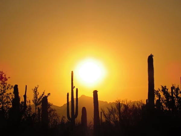
The trailhead for Sendero Esperanza has ample parking and a toilet, but no water, so bring plenty. There’s no shade on the trail, so get an early start if the day will be a hot one, or save this hike for the cooler season. Mid-spring is usually the best time because of milder temperatures and abundant desert flowers.
Sources: https://www.nps.gov/sagu/planyourvisit/saguarohiking.htm https://www.americansouthwest.net/arizona/saguaro/hiking-west.html
Moderate
Hiking along trails with some uneven terrain and small hills. Small rocks and roots may be present.

The trail contains some obstacles such as outcroppings and rock which could cause injury.
Away from help but easily accessed.
3 km away
A quick hike through colorful cactus forest, to a panoramic overlook on a hill.
Moderate Hiking
3 km away
Mellow hike among desert flora and low hills within the Bajada Scenic Loop.
Easy Hiking
3.7 km away
The most scenic route to the top of Wasson Peak, and perhaps in all of Saguaro West.
Difficult Hiking
3.9 km away
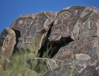
Not much of a hike, but a quick walk to the site of well-preserved Native American rock art.
Easy Hiking
4.1 km away
A full-value loop to the highest point in the Tucson Mountains District of Saguaro National Park.
Difficult Hiking
4.1 km away
Mountainside cactus forest and an old copper mine, plus a backcountry picnic area with a view.
Moderate Hiking
4.4 km away
Climb to the highest peak in the Tucson Mountain.
Difficult Hiking
7.1 km away
Hike along a gorgeous ridge with stupendous views of the Tucson Mountains and Saguaro National Park.
Difficult Hiking
8 km away
An idyllic preserve filled with towering saguaro cacti.
Easy Hiking
8 km away
A delightful bite-sized hike in Sweewater Preserve
Easy Hiking
10 routes · Hiking
4 routes · Hiking
5 routes · Hiking
9 routes · Hiking
6 routes · Hiking
7 routes · Hiking

32 routes · Mountain Biking · Hiking · Road Biking

63 routes · Alpine Climbing · Hiking

10 routes · Alpine Climbing · Canyoning · Hiking