1 m away
King Canyon - Gould Mine Loop
Mountainside cactus forest and an old copper mine, plus a backcountry picnic area with a view.
Moderate Hiking
- Distance
- 4.2 km
- Ascent
- 142 m
- Descent
- 142 m
A full-value loop to the highest point in the Tucson Mountains District of Saguaro National Park.
Hiking Difficult

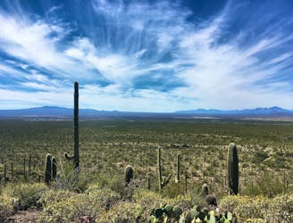
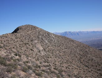
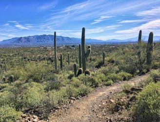
Wasson Peak, rising to 4,687 feet, is the highest point in the Tucson Mountains, and the highpoint of Saguaro National Park West. As such, it’s a popular hike, especially during the cooler months when desert temperatures are tolerable. There are multiple trails on Wasson, but King Canyon Trail is a commonly used route to the top––favored because of its moderate distance, and for its trailhead that’s located outside of the national park, not requiring the entrance fee. The trailhead, which is in Pima County’s Tucson Mountain Park, has no water or other facilities, so come prepared. It also has limited parking, so arrive early to secure a spot.
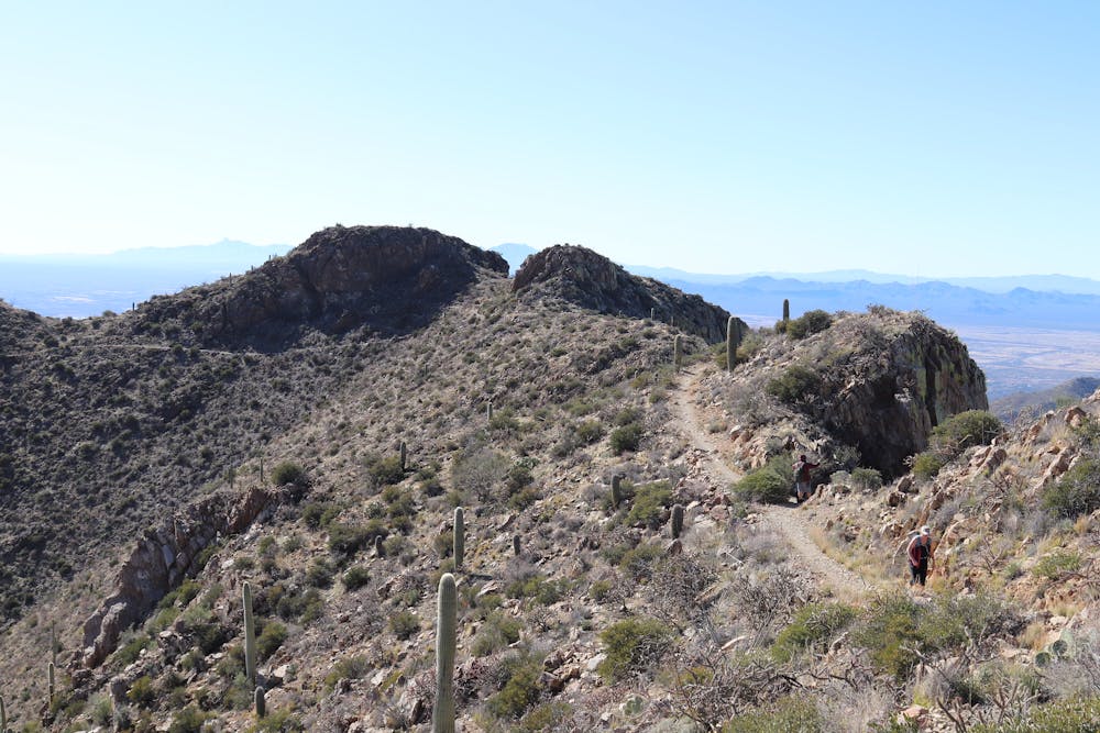
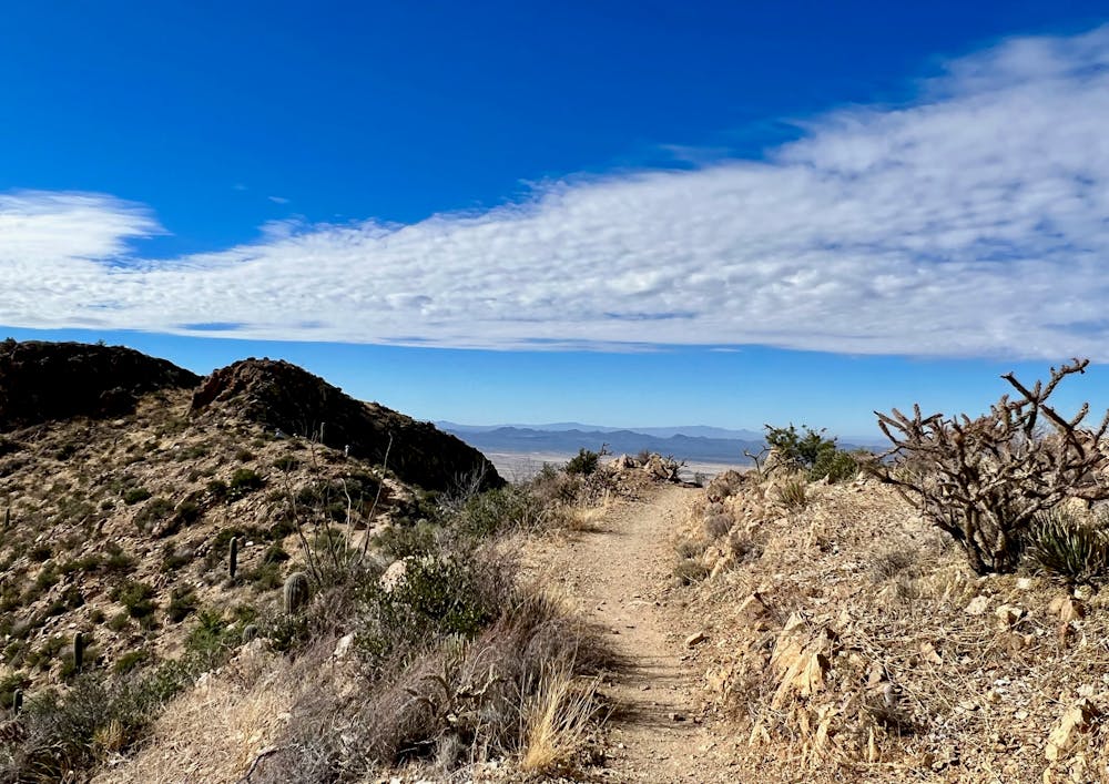
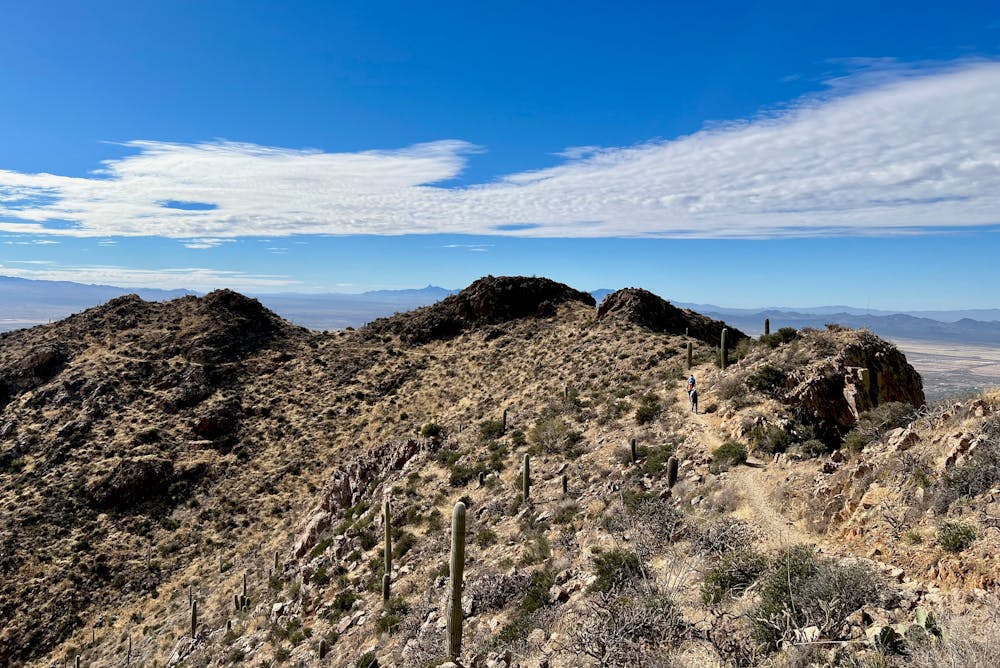

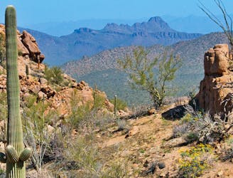
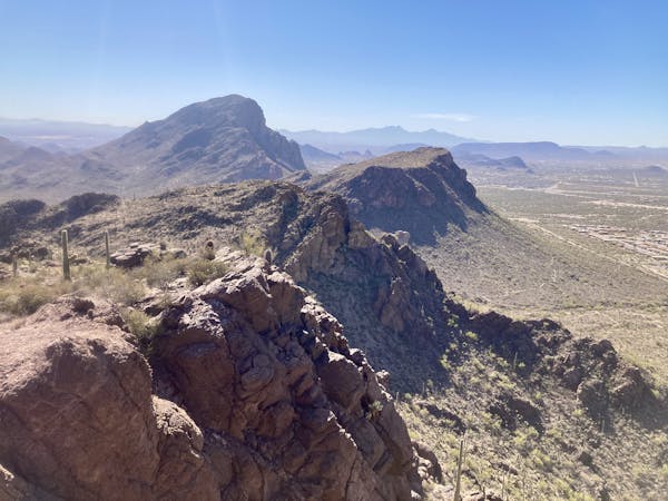
The loop described here ascends on King Canyon and Sweetwater trails to Hugh Norris Trail, then descends on Hugh Norris and Sendero Esperanza to Gould Mine Trail. Of course, you could simply retrace King Canyon Trail instead, but the loop is less than one mile farther than the out and back, and very much worth it for the extra scenery. The airy ridge section of Hugh Norris Trail, in particular, is not to be missed.
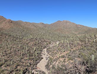
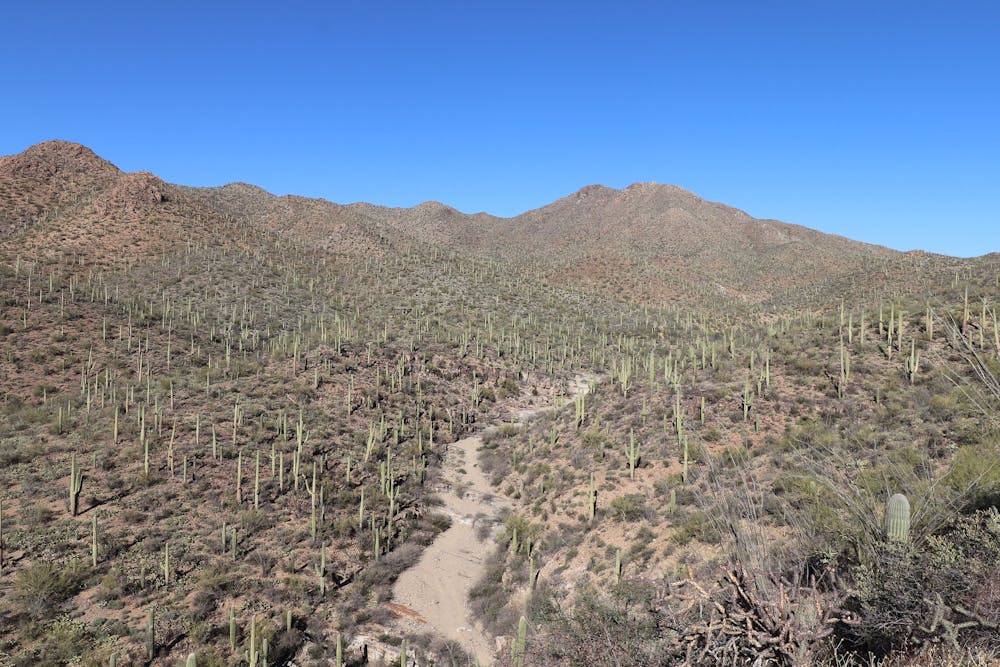
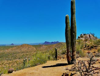
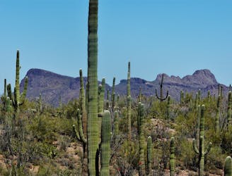
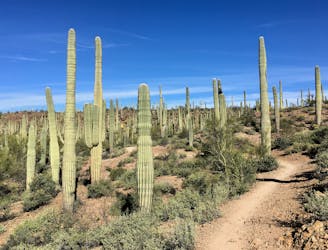
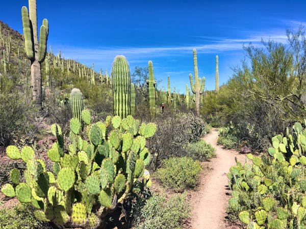
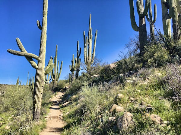
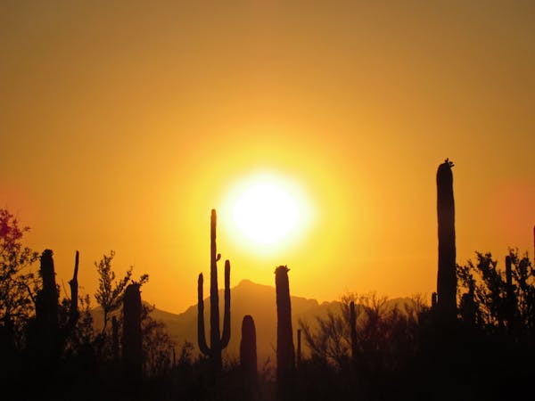
King Canyon Trail is a wide and stony path, ascending the side of a canyon with Wasson Peak in clear view ahead. The surroundings are rocky cactus forest, desert brush, and abundant wildflowers in spring. Eventually, the trail dips down to meet a wash and a trail intersection. King Canyon Trail continues directly up the sandy wash for a short distance, then finds stone steps to climb out and onto another hill.
The trail progresses steadily uphill for a while, then comes to a saddle and the first view of Tucson to the east. This is also the junction with Sweetwater Trail, and the beginning of the toughest part of the hike. Sweetwater’s switchbacks are steep, rocky, and narrow. You should watch your footing for loose rocks, and you’ll dodge encroaching cacti here and there, but the ever-expanding views are a satisfying reward.
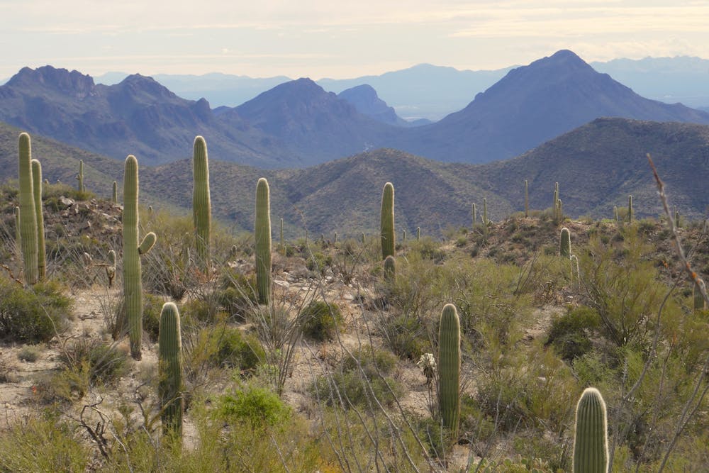
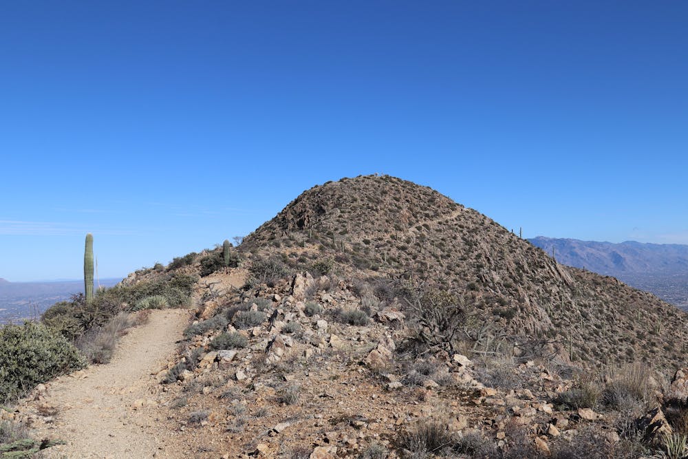
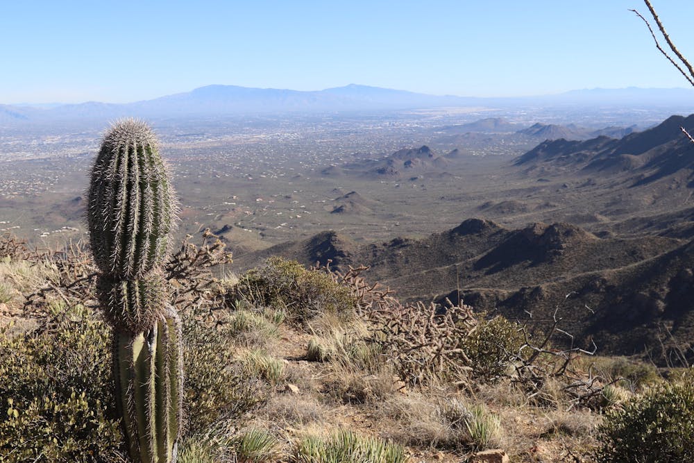
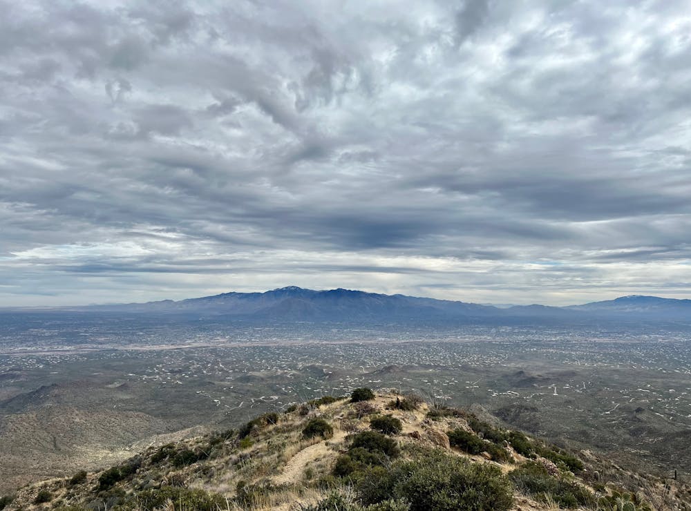
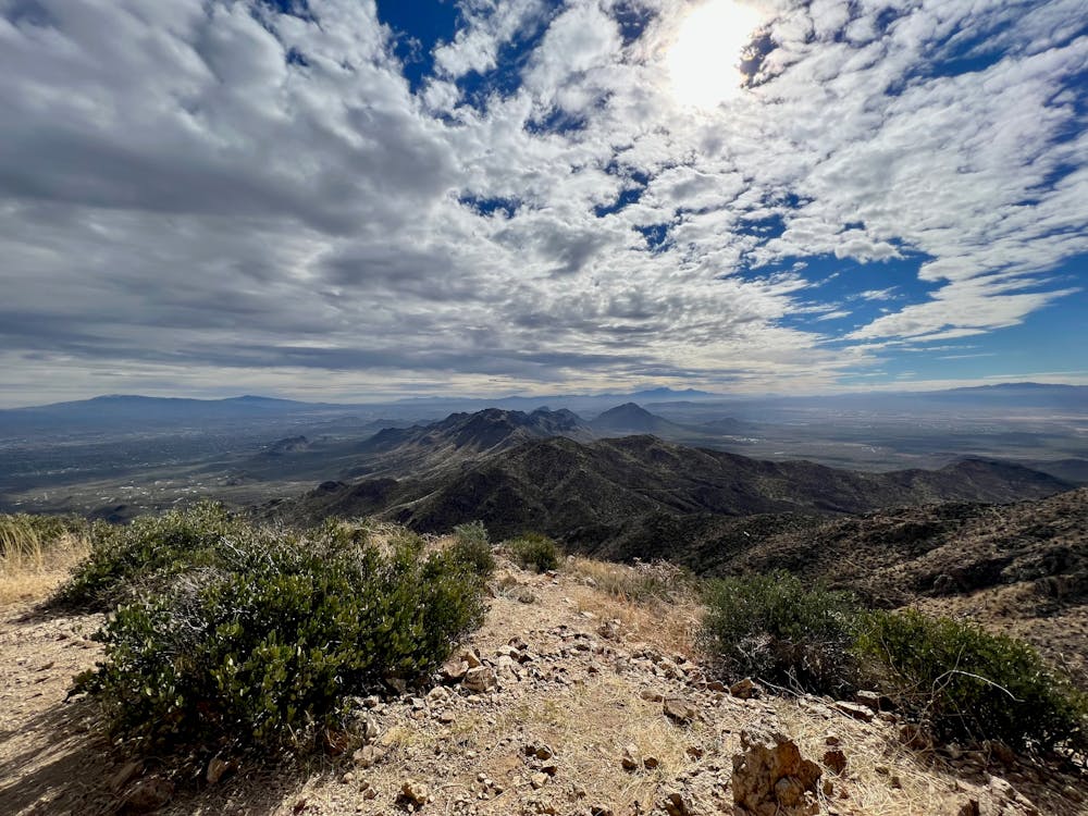
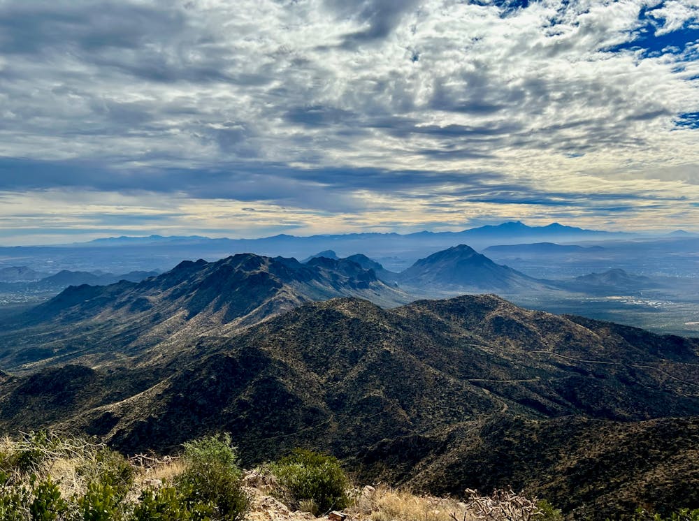
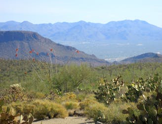
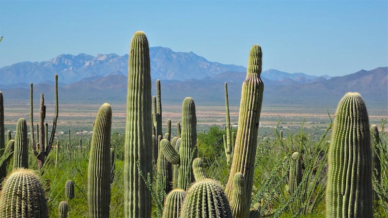
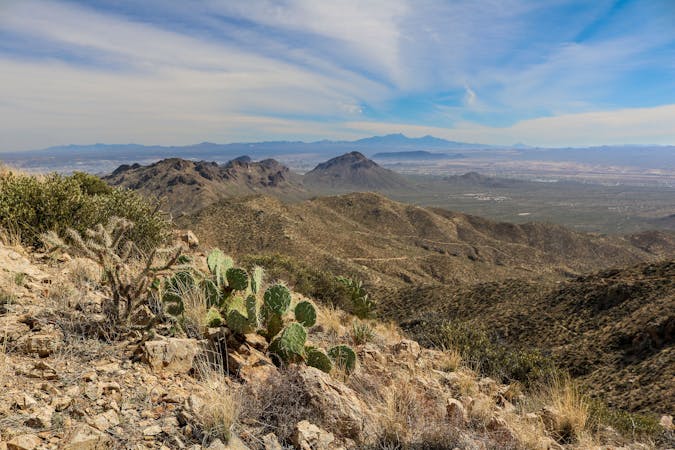
Higher on the mountain, Sweetwater meets Hugh Norris Trail on Wasson’s upper ridgeline. Hugh Norris makes the final, breathtaking traverse to the summit, on easier terrain. At the top are truly victorious views––over Tucson, the Santa Catalina and Rincon Mountains, plus farther mountains and valleys in all directions.
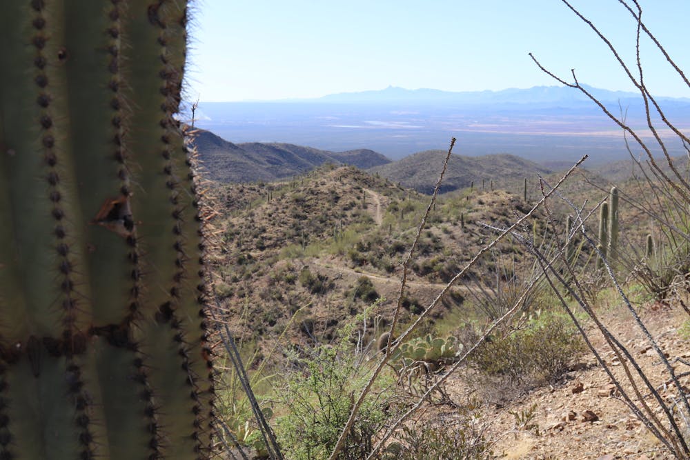
From the summit, backtrack to the intersection with Sweetwater Trail. To complete the loop, stay on Hugh Norris and continue toward Sendero Esperanza Trail. This section is another highlight of the hike, almost as scenic as the summit itself. You’ll look westward, down the snaking ridgeline, with impressive vertical relief on both sides. The junction with Sendero Esperanza comes at a broad saddle in the ridge, then that trail makes a meandering descent, in and out of surprisingly lush mountainside drainages, to meet Gould Mine Trail near a clearly visible but now defunct copper mine. Gould Mine Trail continues the descent of the mountain, following a canyon into a wash. A brief climb up and over a low hill completes the loop, rejoining King Canyon at the trailhead.
Sources: https://socalhiker.net/hiking-wasson-peak-in-saguaro-national-park/ https://www.azutopia.com/moderate-hikes/king-canyon-hiking-trail/
Difficult
Hiking trails where obstacles such as rocks or roots are prevalent. Some obstacles can require care to step over or around. At times, the trail can be worn and eroded. The grade of the trail is generally quite steep, and can often lead to strenuous hiking.

The trail contains some obstacles such as outcroppings and rock which could cause injury.
Away from help but easily accessed.
1 m away
Mountainside cactus forest and an old copper mine, plus a backcountry picnic area with a view.
Moderate Hiking
3.4 km away
Hike along a gorgeous ridge with stupendous views of the Tucson Mountains and Saguaro National Park.
Difficult Hiking
4.1 km away
A mellow walk through open desert, then a steep but short climb to a panoramic ridgeline.
Moderate Hiking
4.3 km away
The most scenic route to the top of Wasson Peak, and perhaps in all of Saguaro West.
Difficult Hiking
4.4 km away
A quick hike through colorful cactus forest, to a panoramic overlook on a hill.
Moderate Hiking
4.4 km away
Mellow hike among desert flora and low hills within the Bajada Scenic Loop.
Easy Hiking
6.1 km away
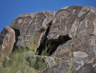
Not much of a hike, but a quick walk to the site of well-preserved Native American rock art.
Easy Hiking
6.3 km away
Climb to the highest peak in the Tucson Mountain.
Difficult Hiking
8.7 km away
An idyllic preserve filled with towering saguaro cacti.
Easy Hiking
8.7 km away
A delightful bite-sized hike in Sweewater Preserve
Easy Hiking
10 routes · Hiking
4 routes · Hiking
5 routes · Hiking
9 routes · Hiking
6 routes · Hiking
7 routes · Hiking

32 routes · Mountain Biking · Hiking · Road Biking

63 routes · Alpine Climbing · Hiking

10 routes · Alpine Climbing · Canyoning · Hiking