2 m away
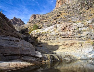
Sabino Lake Loop
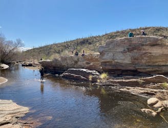
A short but scenic loop to a surprising "lake" in the desert.
Moderate Hiking
- Distance
- 3.8 km
- Ascent
- 52 m
- Descent
- 51 m
Epic backpacking route from base to summit.
Hiking Severe

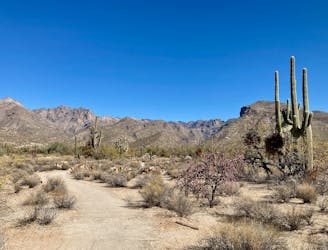
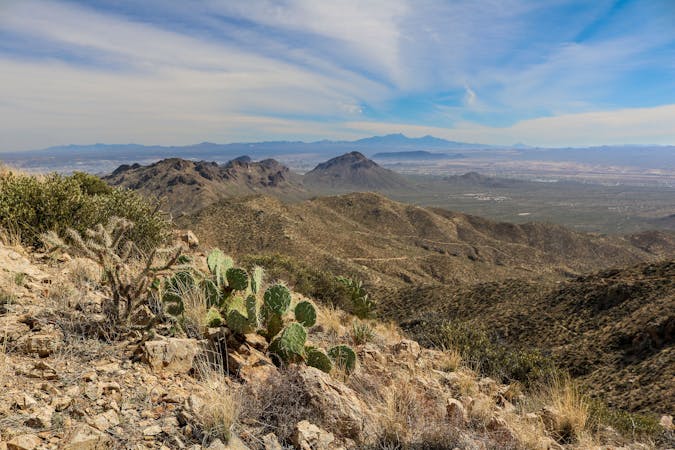
Mount Lemmon is the pinnacle of the Catalina Mountain Range. The 9,157-foot summit soars above the city of Tucson, lying in a desert valley far, far below.
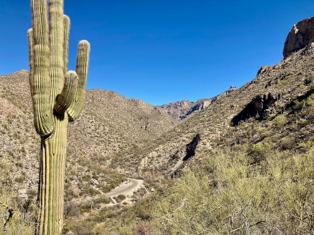
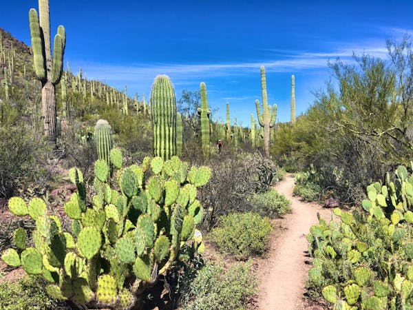
Mount Lemmon is a "sky island," which means that the top of the mountain is home to a verdant landscape filled with aspen trees, alpine meadows, and towering pines. But when you begin your hike on the lower flanks of the mountain, you'll be hiking through the land of cacti, rattlesnakes, and desert sand. Eventually you'll reach the cooler altitudes as you ascend the mountain. "While Lemmon’s heights have much of the same vegetation and wildlife as other high mountains in southern Arizona, these areas are isolated from each other by the desert in between – hence the term," explains Andinstaloco on SummitPost.org.
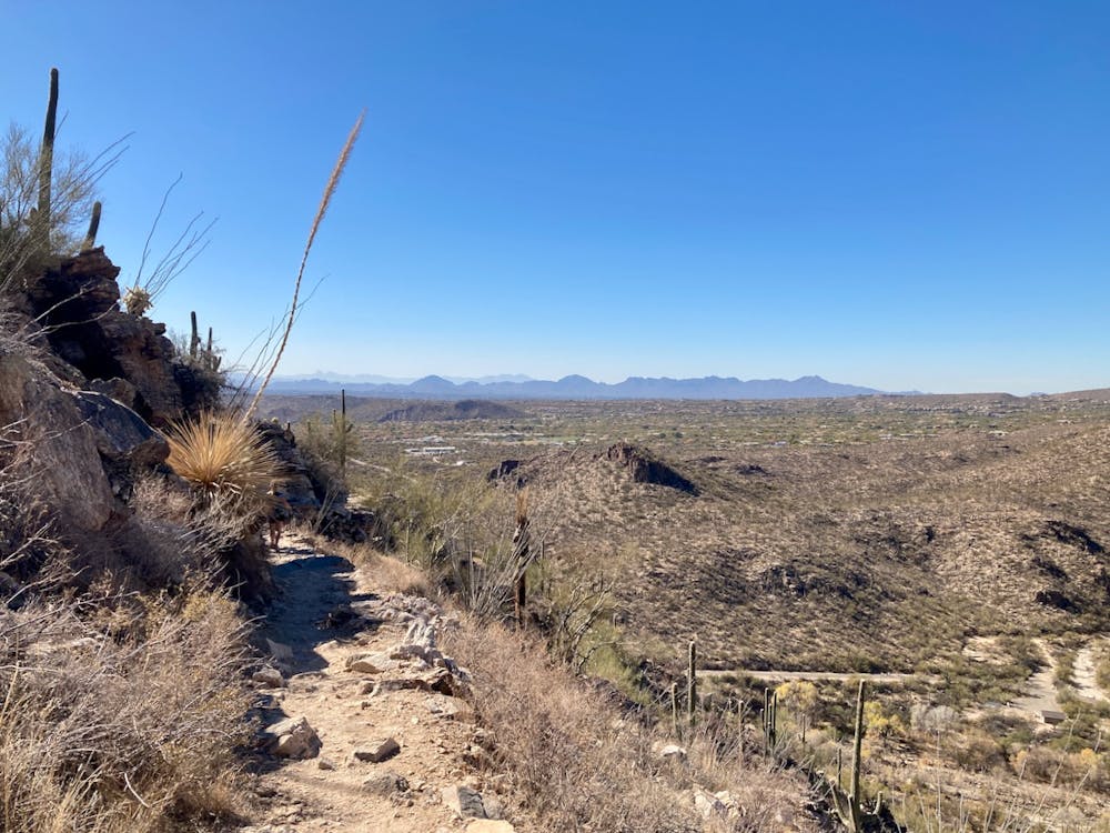
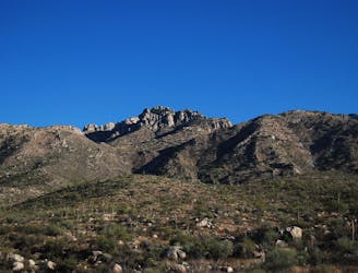
There are several different ways to reach the summit of Mount Lemmon, including driving up a highway. There's also an expansive trail system lacing the flanks of the mountain, with multiple hike options that could bring you to the peak. But if you're looking for a truly epic endeavor, consider backpacking from the base of the mountain to the summit and back down on this 41-mile round-trip hike.
Over the course of this route, you'll climb (and descend) a staggering 10,269 feet of elevation. While many potential routes to the summit exist, the one shown here traverses some of the more well-used trails and begins from the popular Sabino Canyon hiking area. This is an ambitious route that's intended for backpackers and peak climbers who are in search of a real challenge.
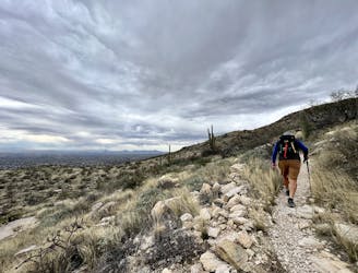
Severe
Hiking challenging trails where simple scrambling, with the occasional use of the hands, is a distinct possibility. The trails are often filled with all manner of obstacles both small and large, and the hills are very steep. Obstacles and challenges are often unexpected and can be unpredictable.

The trail contains some obstacles such as outcroppings and rock which could cause injury.

In the high mountains or remote conditions, all individuals must be completely autonomous in every situation.
2 m away
A short but scenic loop to a surprising "lake" in the desert.
Moderate Hiking
27 m away
A beautiful set of waterfalls in the Sonoran Desert.
Moderate Hiking
90 m away
An achievable loop with one steep climb.
Difficult Hiking
8.8 km away
One of the most accessible major peaks in the Catalinas.
Severe Hiking
9.5 km away
This underused trail follows a historic route to a stunning overlook in the Catalinas.
Difficult Hiking
10 routes · Hiking
6 routes · Hiking

32 routes · Mountain Biking · Hiking · Road Biking

10 routes · Alpine Climbing · Canyoning · Hiking