8.1 km away
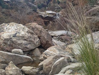
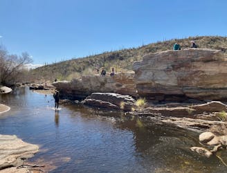
Tanque Verde Falls
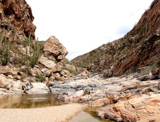
An impressive waterfall and nice swimming holes just outside of Tucson.
Difficult Hiking
- Distance
- 3.2 km
- Ascent
- 143 m
- Descent
- 143 m
This underused trail follows a historic route to a stunning overlook in the Catalinas.
Hiking Difficult

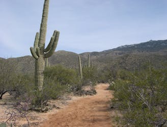
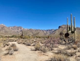
The Babad Do'ag trail is far from the most popular hike in Tucson or even in the Santa Catalina Mountains, and that lack of traffic is precisely one of its appeals. (Note: the trail name is sometimes spelled as "Babat Duag," and even local trail signs disagree on the correct name.)
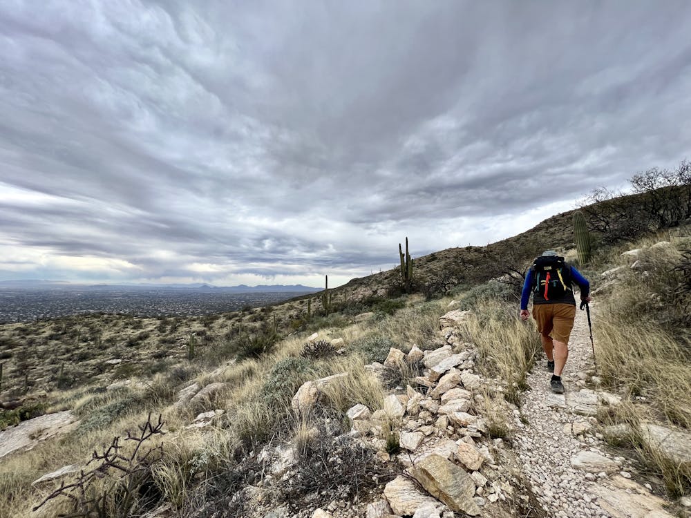
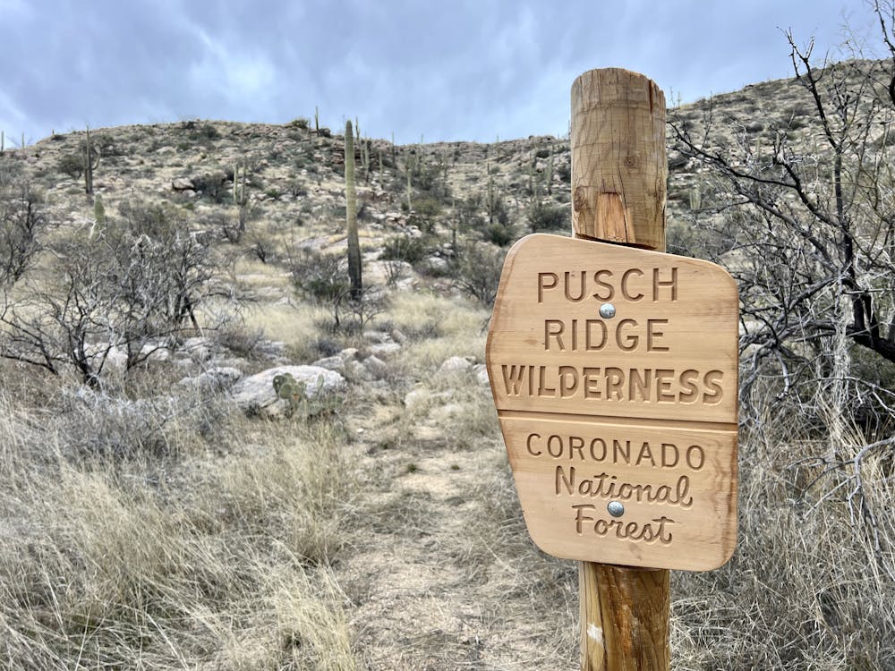
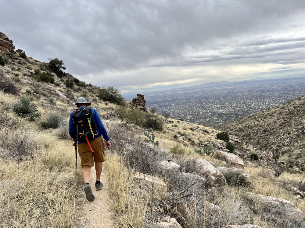
Begin this out-and-back hike at the Babad Do'ag overlook parking area off the right side of the Mount Lemmon Highway, and look for the trail a few yards up the highway on the left. Take caution on the short bit of highway walking, as the corner is quite blind, and drivers might not expect to see hikers crossing the road.
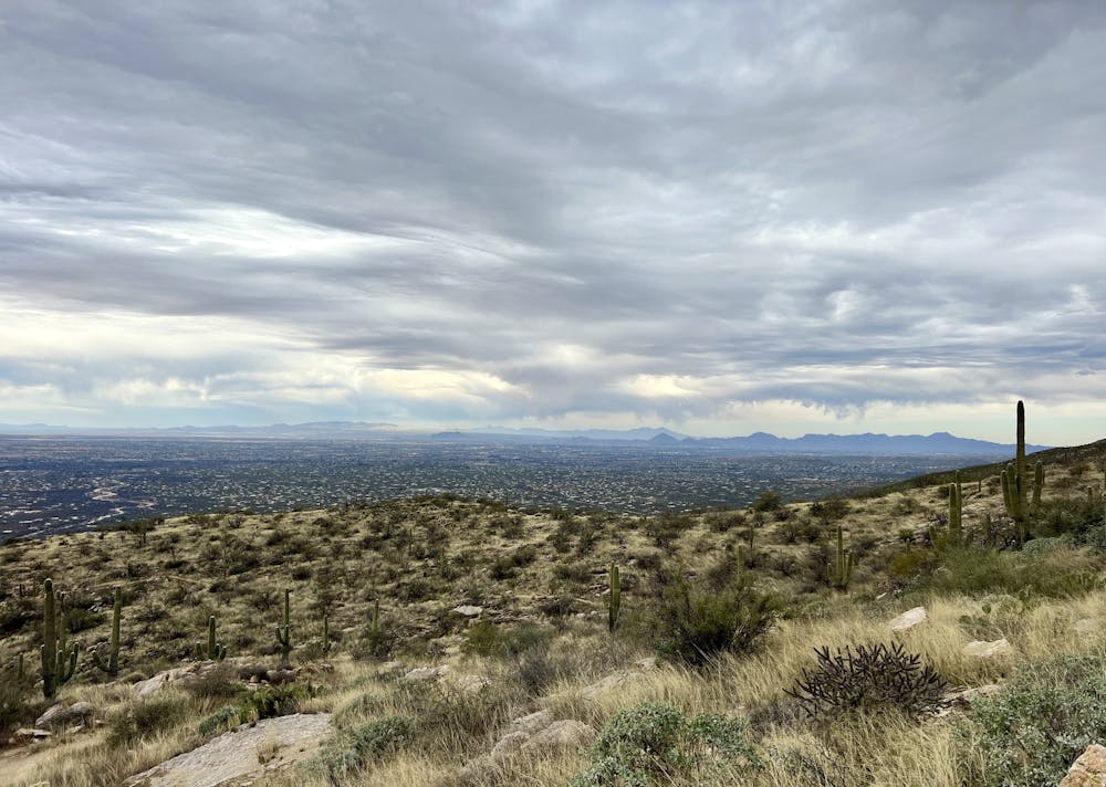
The trail begins climbing steeply up a series of rough rock faces. While none of the rock faces require true scrambling, the grade is stiff, and it can be quite rough in places. However, after a bit of steep climbing, the grade levels off, and the route turns into a well-built singletrack trail with some sections of beautiful benchcutting. Some higher sections of the trail do negotiate substantial rock gardens and have a few steepish climbs, overall earning the trail a "Difficult" FATMAP technicality rating.
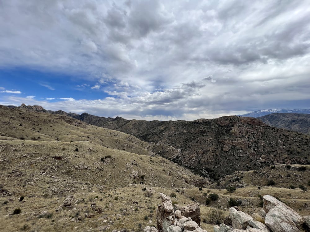
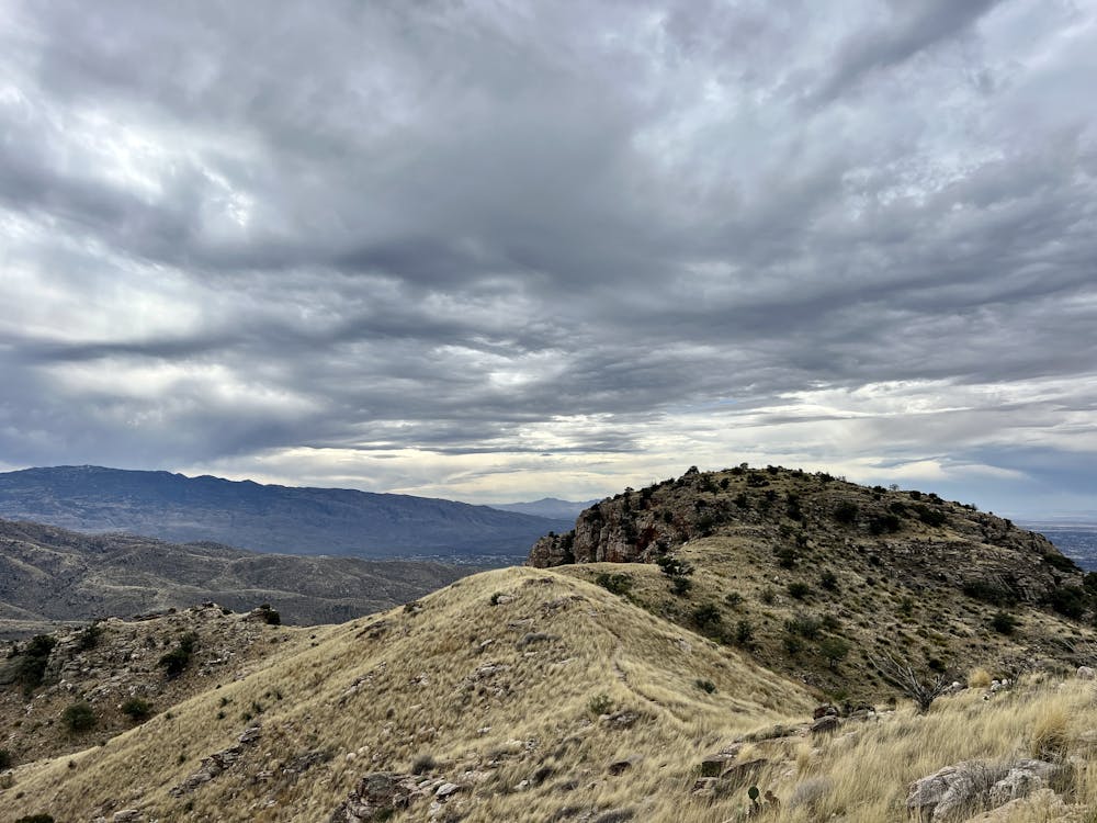
Babad Do'ag was once a historic path deep into the mountains, and the present-day trail is a revitalization of that historic route. However, the revitalization efforts appear to have ended at a random point on the mountainside, making this trail a mere out-and-back with a lackluster ending.
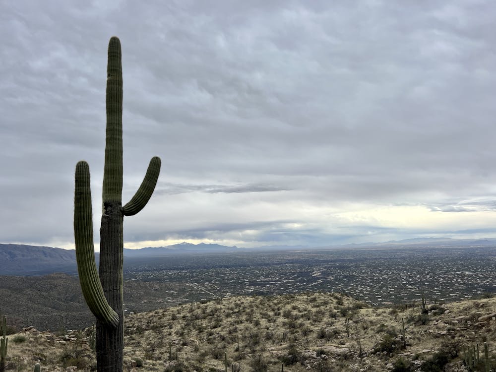
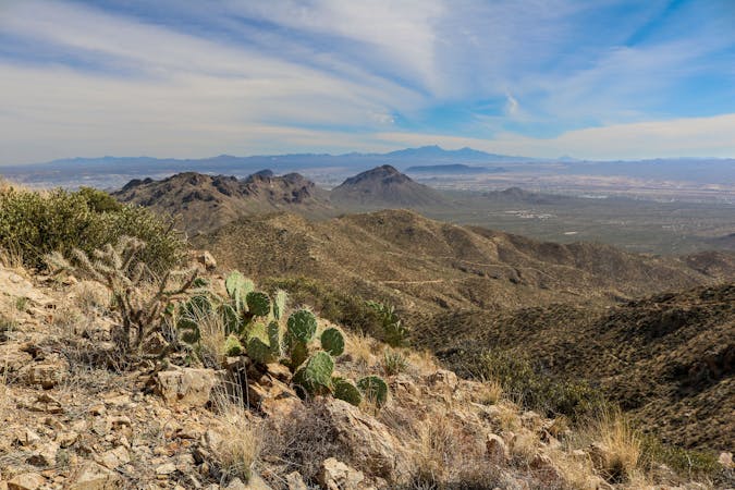
The lack of traffic on Babad Do'ag might be due in part to the lackluster ending: the current route climbs up to a beautiful overlook on top of a small knob and then descends down to a saddle and takes a lefthand turn along a benchcut before abruptly ending at an "End of Trail" sign.
While it seems plausible to keep following the overgrown bench around the mountain, connecting to the nearby Soldier Trail would take a lot of bushwhacking across rough, awkward terrain. You'd also have to drop down into a drainage, climb back out, and reach the second drainage over to connect with the Soldier Trail.
Thus, Babad Do'ag is best hiked simply as an out-and-back. And for the best bang for your buck, you can choose to turn around at the top of the overlook knob and then head back the way you came.
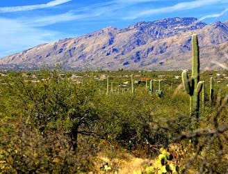
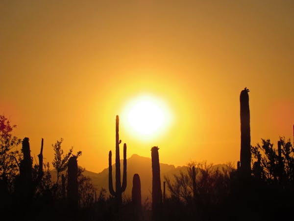
Whether you do the quick-hit version of Babad Do'ag or turn it into a much more epic off-trail adventure is up to you, but no matter which version you choose, the beauty of the Catalinas will leave a permanent impression on your memory!
Difficult
Hiking trails where obstacles such as rocks or roots are prevalent. Some obstacles can require care to step over or around. At times, the trail can be worn and eroded. The grade of the trail is generally quite steep, and can often lead to strenuous hiking.

The trail contains some obstacles such as outcroppings and rock which could cause injury.
Away from help but easily accessed.
8.1 km away
An impressive waterfall and nice swimming holes just outside of Tucson.
Difficult Hiking
8.8 km away
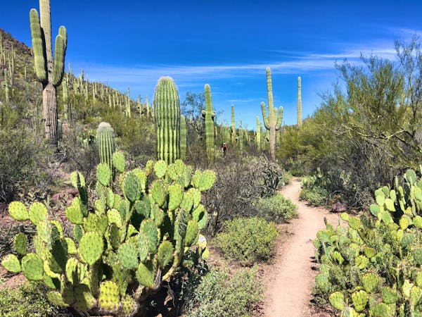
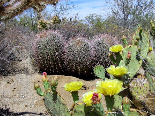
An easily accessed corner of the Cactus Forest, with especially rich desert flora and broad vistas.
Moderate Hiking
8.8 km away
Hike through the foothills beside a rocky ravine, to a waterfall that flows with seasonal rainfall.
Moderate Hiking
8.8 km away
A tour of ranching relics and diverse nature, with views over Tucson from the rocky foothills.
Difficult Hiking
9.5 km away
A beautiful set of waterfalls in the Sonoran Desert.
Moderate Hiking
9.5 km away
A short but scenic loop to a surprising "lake" in the desert.
Moderate Hiking
9.5 km away
Epic backpacking route from base to summit.
Severe Hiking
9.6 km away
An achievable loop with one steep climb.
Difficult Hiking
10 routes · Hiking
5 routes · Hiking
9 routes · Hiking
6 routes · Hiking

32 routes · Mountain Biking · Hiking · Road Biking

10 routes · Alpine Climbing · Canyoning · Hiking