114 m away
Apple Dumplin Trail
I recommend riding counterclockwise, making sure you take the high ground when given an option to catch a couple of fun features.
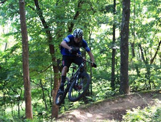
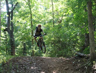
Difficult Mountain Biking
- Distance
- 1.3 km
- Ascent
- 23 m
- Descent
- 23 m
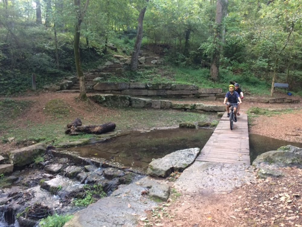
The trails here routes cyclists through scenic water garden area.
Mountain Biking Difficult

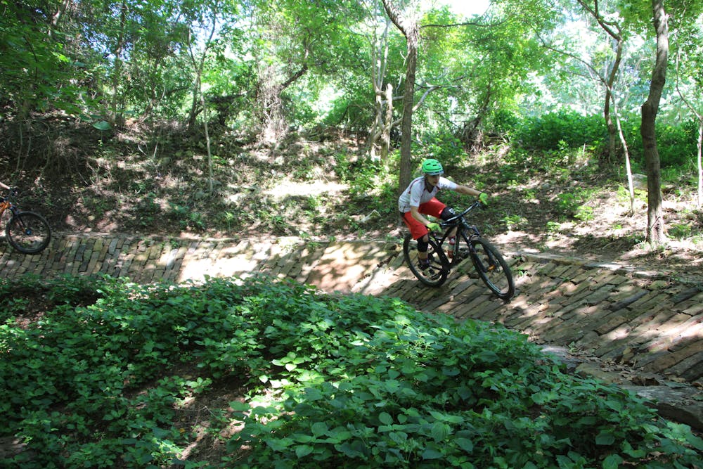
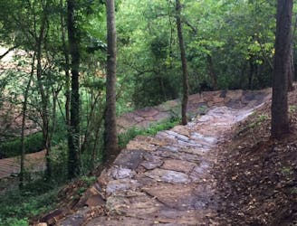
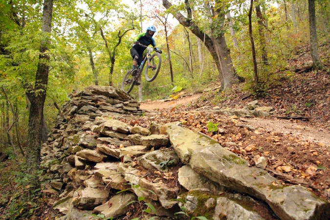
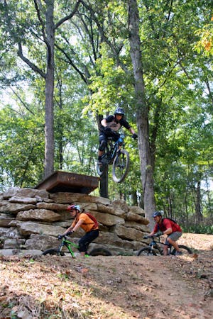
Just after entering Park Springs, riding counterclockwise, you ride over one of the highlights of this area, Phil Penny of Rogue Trails’ signature rock. In the middle of a sweeping rock-laden banked turn is a large rock in the shape of the state of Arkansas. The trails here also route cyclists through a scenic water garden area.
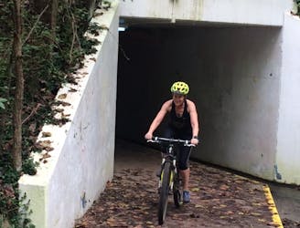
After wringing all the fun to be had from the Park Springs trails, don’t bother returning to the street where you entered. Just drop down the hillside to reach the remaining section of trails via a tunnel. How cool is that?
Difficult
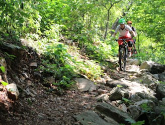
Mostly stable trail tread with some variability featuring larger and more unavoidable obstacles that may include, but not be limited to: bigger stones, roots, steps, and narrow curves. Compared to lower intermediate, technical difficulty is more advanced and grades of slopes are steeper. Ideal for upper intermediate riders.

The trail contains some obstacles such as outcroppings and rock which could cause injury.

Close to help in case of emergency.
114 m away
I recommend riding counterclockwise, making sure you take the high ground when given an option to catch a couple of fun features.
Difficult Mountain Biking
164 m away
Techy, rocky run on hillside overlooking Black Apple Creek Trail
Severe Mountain Biking
739 m away

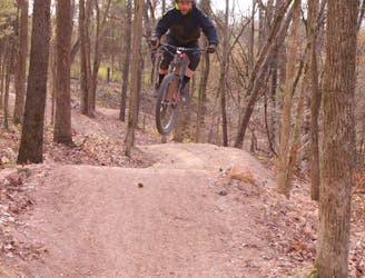
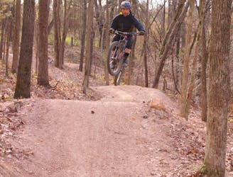
A fresh jump line with big tabletops.
Severe Mountain Biking
1.3 km away
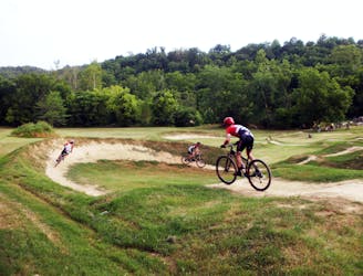
Slaughter Pen Phase III includes a collection of short, fun trails within densely-wooded green space preserves that include abrupt climbs and fast descents.
Difficult Mountain Biking
1.4 km away
Slaughter Pen Phase II East is a set of narrow rocky trails that will challenge your handling skills and provide a feeling of accomplishment after riding them.
Severe Mountain Biking
2 km away
Slaughter Pen Trails Phase I crisscrosses the hillside with several old-school trails packed with short climbs, wooden bridges, sharp banked turns, and a short downhill run packed with many fun features.
Severe Mountain Biking
2.1 km away
Tatamagouche Trails and Armadillo’s Last Stand are both twisting, turning, undulating trails within the Outer Loop trail of Phase I.
Severe Mountain Biking
2.4 km away

A rock slab-filled black diamond descent.
Severe Mountain Biking
2.4 km away
More old school single track that flows along the hillside then switches back up the hillside for short climbs and descent.
Difficult Mountain Biking
2.4 km away
The OG jump line at Slaughter Pen
Extreme Mountain Biking
13 routes · Mountain Biking
10 routes · Mountain Biking