209 m away
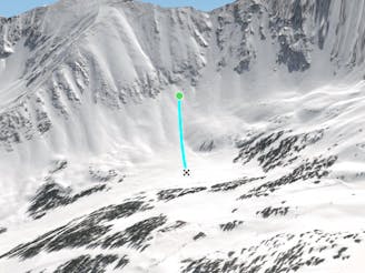
Land of the Giants

Fun low angled rocky terrain
Moderate Freeride Skiing
- Distance
- 719 m
- Ascent
- 0 m
- Descent
- 197 m
Access to hikeable and out of bounds terrain
Freeride Skiing Moderate

This is a popular freeride skiing route which is generally considered to be moderate. It's remote, it features unknown exposure and is typically done between January and May. From a low point of 3.5 km to the maximum altitude of 3.7 km, the route covers 1.5 km, 22 vertical metres of ascent and 191 vertical metres of descent.
A long traverse out of the gate from Humbug will deliver you to Wide Willys Staircase and the Land of the Giants. This area offers plenty of unique terrain features to jump off including some cliffs lower down.
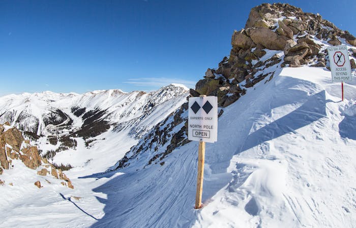
Moderate
Slopes become slightly steeper at around 25-30 degrees.

Away from help but easily accessed.
209 m away
Fun low angled rocky terrain
Moderate Freeride Skiing
478 m away

Fun and challenging line down to the east wall
Difficult Freeride Skiing
545 m away

Bowl skiing tree run
Difficult Freeride Skiing
570 m away

Bowl skiing into a tree run
Difficult Freeride Skiing
586 m away

Mellow bowl skiing into mellow tree skiing
Moderate Freeride Skiing
601 m away

Flat bowl to steep tree skiing
Difficult Freeride Skiing
633 m away

Steep bootpack up from inbounds
Difficult Freeride Skiing
716 m away

Nice steep less skied option on East Wall
Severe Freeride Skiing
798 m away
Nice open bowl on the Lower East Wall.
Moderate Freeride Skiing
936 m away

Steep tight trees
Difficult Freeride Skiing
8 routes · Freeride Skiing