87 m away
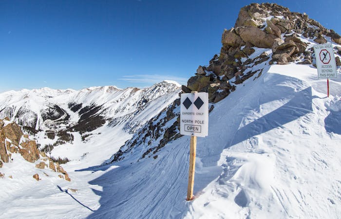
Willy's Wide Staircase

Steep bootpack up from inbounds
Difficult Freeride Skiing
- Distance
- 240 m
- Ascent
- 0 m
- Descent
- 164 m
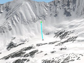
Nice steep less skied option on East Wall
Freeride Skiing Severe

To access this line, you start by hiking Willy's Staircase. Once you summit Willy's, you will then see the rest of the hike that goes uphill to the left. Follow this very steep hike over the rock formations, and favor your uphill left. The bootpack will eventually end, and you will have to traverse to get over the line. Enjoy nice steep and long turns to the bottom with cliff options on either side depending on coverage. This line is a great choice because it is not as popular as the other lines on the East Wall. Make sure to check for openings when skiing this line.
Severe
Steep skiing at 38-45 degrees. This requires very good technique and the risk of falling has serious consequences.

In case of a fall, death is highly likely.

Close to help in case of emergency.
87 m away
Steep bootpack up from inbounds
Difficult Freeride Skiing
340 m away

Fun and challenging line down to the east wall
Difficult Freeride Skiing
497 m away
Nice open bowl on the Lower East Wall.
Moderate Freeride Skiing
507 m away

Fun low angled rocky terrain
Moderate Freeride Skiing
716 m away

Access to hikeable and out of bounds terrain
Moderate Freeride Skiing
1 km away

Nice steep short line off of East Wall
Difficult Freeride Skiing
1.3 km away

Bowl skiing tree run
Difficult Freeride Skiing
1.3 km away

Bowl skiing into a tree run
Difficult Freeride Skiing
1.3 km away

Mellow bowl skiing into mellow tree skiing
Moderate Freeride Skiing
1.3 km away

Flat bowl to steep tree skiing
Difficult Freeride Skiing
8 routes · Freeride Skiing