520 m away
Lower East Wall
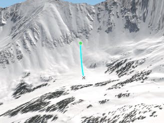
Nice open bowl on the Lower East Wall.
Moderate Freeride Skiing
- Distance
- 412 m
- Ascent
- 0 m
- Descent
- 130 m
Nice steep short line off of East Wall
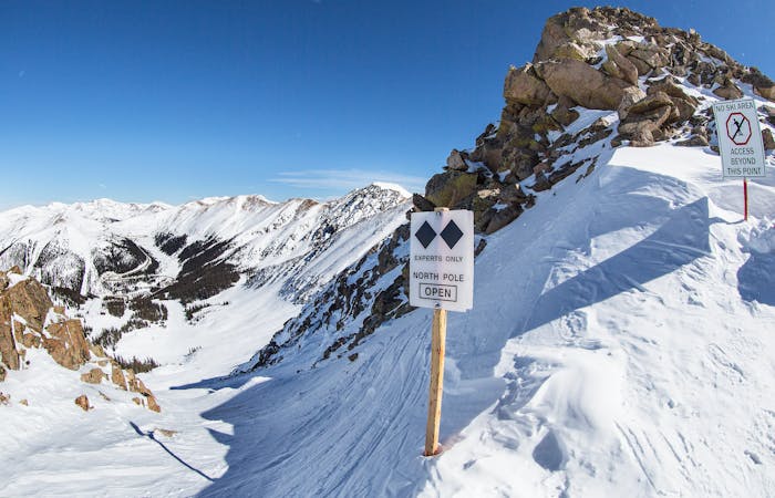
Freeride Skiing Difficult

Take the East Wall Traverse out as far as you can go, keep going, and look for a sign marked "Tree Chutes." From here, you can usually spot a boot pack to hike these chutes to the top of the ridgeline. Take the short, but steep hike up to the ridge, enjoy the view, and then pick your line. Enjoy a nice run out to the bottom and through the trees back to the piste.
Difficult
Serious gradient of 30-38 degrees where a real risk of slipping exists.

As well as the slope itself, there are some obstacles (such as rock outcrops) which could aggravate injury.

Close to help in case of emergency.
520 m away
Nice open bowl on the Lower East Wall.
Moderate Freeride Skiing
982 m away

Steep bootpack up from inbounds
Difficult Freeride Skiing
1 km away

Nice steep less skied option on East Wall
Severe Freeride Skiing
1.1 km away

Nice exposed rock chute hidden off Turbo
Severe Freeride Skiing
1.1 km away

nice steep chute off the main Piste Trail Turbo
Severe Freeride Skiing
1.1 km away

Fun low angled rocky terrain
Moderate Freeride Skiing
1.1 km away

Access to hikeable and out of bounds terrain
Moderate Freeride Skiing
1.2 km away

Fun and challenging line down to the east wall
Difficult Freeride Skiing
1.3 km away

Steep tight trees
Difficult Freeride Skiing
1.4 km away

Frequently accessed gladed run out of the resort gate
Moderate Freeride Skiing
8 routes · Freeride Skiing
4 routes · Freeride Skiing · Resort Ski Touring