294 m away
Willy's Wide Staircase

Steep bootpack up from inbounds
Difficult Freeride Skiing
- Distance
- 240 m
- Ascent
- 0 m
- Descent
- 164 m
Fun and challenging line down to the east wall
Freeride Skiing Difficult

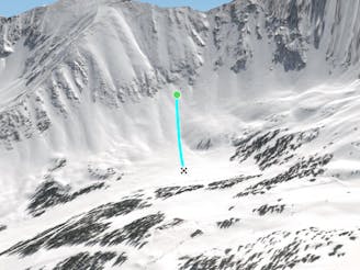
This is a popular freeride skiing route which is generally considered to be difficult. It's remote, it features unknown exposure and is typically done between January and April. From a low point of 3.7 km to the maximum altitude of 3.9 km, the route covers 266 m, 0 vertical metres of ascent and 181 vertical metres of descent.
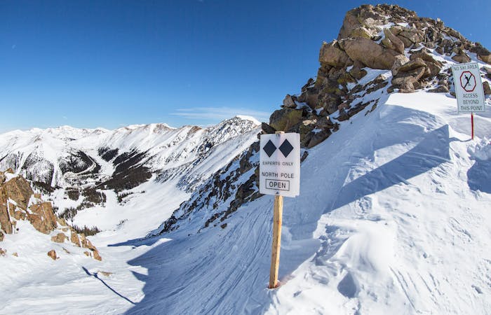
North Pole is a short and sweet zone that can possibly start off rocky, but it is consistently steep. It will provide skiers/riders with that big mountain feel, although only for a short while.
Difficult
Serious gradient of 30-38 degrees where a real risk of slipping exists.

Away from help but easily accessed.
294 m away
Steep bootpack up from inbounds
Difficult Freeride Skiing
294 m away

Fun low angled rocky terrain
Moderate Freeride Skiing
340 m away

Nice steep less skied option on East Wall
Severe Freeride Skiing
478 m away

Access to hikeable and out of bounds terrain
Moderate Freeride Skiing
710 m away
Nice open bowl on the Lower East Wall.
Moderate Freeride Skiing
1 km away

Mellow bowl skiing into mellow tree skiing
Moderate Freeride Skiing
1 km away

Bowl skiing tree run
Difficult Freeride Skiing
1 km away

Bowl skiing into a tree run
Difficult Freeride Skiing
1.1 km away

Flat bowl to steep tree skiing
Difficult Freeride Skiing
1.2 km away

Nice steep short line off of East Wall
Difficult Freeride Skiing
8 routes · Freeride Skiing