33 m away
Abes
A classic big air descent
Severe Freeride Skiing
- Distance
- 1.3 km
- Ascent
- 3 m
- Descent
- 484 m
Great introduction to East Vail Chutes
Freeride Skiing Difficult

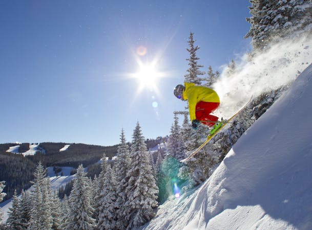
Tele Line is the furthest drop in off Benchmark/Mill Creek road before the road starts to bend to the northwest. Tele Line is east facing, so the snow quality isn't always great. The entrance is a cliff band/boulder garden with fun air options, or it is easily navigated around. The rest of the run is wide open undulating terrain with multiple convexities. The entire run is very straight forward and offers excellent views of the rest of the East Vail Chutes. To exit this area back to the bus to Vail, follow the drainage to a trail that parallels the highway. Take it easy on the run out.
Difficult
Serious gradient of 30-38 degrees where a real risk of slipping exists.

As well as the slope itself, there are some obstacles (such as rock outcrops) which could aggravate injury.
Away from help but easily accessed.
33 m away
A classic big air descent
Severe Freeride Skiing
160 m away

A locals favorite
Difficult Freeride Skiing
299 m away

A large, steep open cliffed zone to be respected
Severe Freeride Skiing
392 m away

Fun big, exposed line
Severe Freeride Skiing
1 km away

A fun couloir with multiple options
Difficult Freeride Skiing
2.2 km away

China Bowl's worst kept secret.
Moderate Freeride Skiing
2.4 km away

Hidden gem in China Bowl.
Moderate Freeride Skiing
3.7 km away

Solid treeline that holds snow for weeks after a storm.
Moderate Freeride Skiing
3.8 km away

Some incredible tree skiing in Sun Up Bowl.
Moderate Freeride Skiing
4 km away

Long gully, epic on powder days.
Moderate Freeride Skiing
16 routes · Freeride Skiing
6 routes · Freeride Skiing