1 km away
Tele Line

Great introduction to East Vail Chutes
Difficult Freeride Skiing
- Distance
- 2.6 km
- Ascent
- 0 m
- Descent
- 790 m
A fun couloir with multiple options
Freeride Skiing Difficult

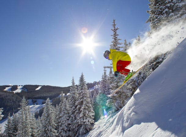
Water Tank is a classic descent. The Water Tank drop in can be found at the "end" (northern most point) of the Benchmark ridge. There are some options to enter and ski Water Tank, many which require long exposure to avalanche terrain. Although there are multiple options to ride WT, the basic line can be very straight forward by staying in the meat of the couloir. There are some fun easy cliff bands on skier's left and good tree skiing can be found even further left. A good map of the area is essential if you plan on navigating the trees to skier left due to the nature of larger unrideable cliffs that become more frequent as the ridge extends NNW. As the couloir terminates, it becomes narrower and more difficult to navigate. Keep to the main drainage and work whatever snow remains down to the bottom. Water Tank ends at an actual water tank in the East Vail neighborhood. It's very easy to reach the bus stop from the bottom of the drainage.
Difficult
Serious gradient of 30-38 degrees where a real risk of slipping exists.

As well as the slope itself, there are some obstacles (such as rock outcrops) which could aggravate injury.
Away from help but easily accessed.
1 km away
Great introduction to East Vail Chutes
Difficult Freeride Skiing
1 km away
A classic big air descent
Severe Freeride Skiing
1.1 km away

A locals favorite
Difficult Freeride Skiing
1.2 km away

A large, steep open cliffed zone to be respected
Severe Freeride Skiing
1.2 km away

Fun big, exposed line
Severe Freeride Skiing
3 km away

China Bowl's worst kept secret.
Moderate Freeride Skiing
3.2 km away

Hidden gem in China Bowl.
Moderate Freeride Skiing
3.9 km away

Long gully, epic on powder days.
Moderate Freeride Skiing
4 km away

Solid treeline that holds snow for weeks after a storm.
Moderate Freeride Skiing
4.3 km away

Some incredible tree skiing in Sun Up Bowl.
Moderate Freeride Skiing
16 routes · Freeride Skiing
6 routes · Freeride Skiing