816 m away
Hartman Rocks: Top of the World Loop
Hike along the elevated ridgeline with stunning views of the Gunnison Valley.
Difficult Hiking
- Distance
- 13 km
- Ascent
- 383 m
- Descent
- 383 m
An easily-accessible loop at Hartman Rocks touring some of the best trails.
Hiking Difficult

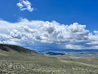
While Hartman Rocks is known primarily as a trail system for mountain biking, the multi-use trail system also offers great hiking opportunities. With a rich history carved initially by moto riders, the trails have evolved into a labyrinth of possibilities for hikers. Hartman Rocks offers a wide spectrum of terrain—from sandy paths to rocky challenges that will test your mettle, sprawling across an immense area.
The hike shown here connects some of the most beautiful, best-known, and most easily-accessible trails in the trail system that are accessible directly from the main trailhead off of Gold Basin Road.
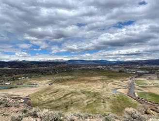
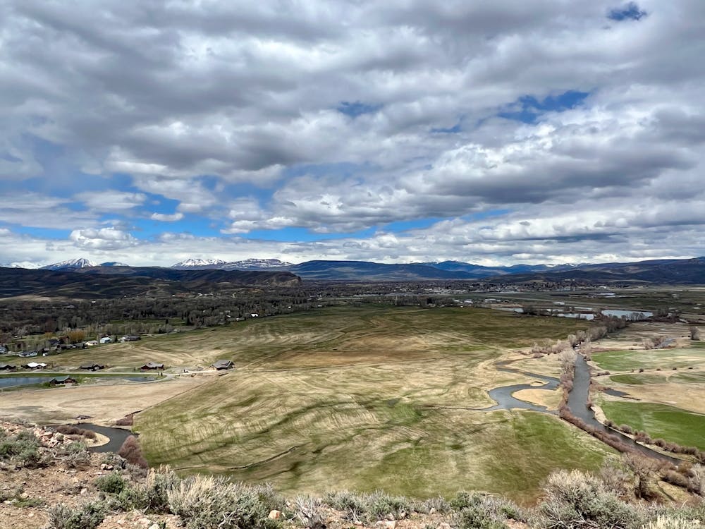
The hike begins by climbing quickly from the base area up the Jack's Trail to access Tail Pipe and The Ridge. These trails wind up and down through beautiful rock formations on the edge of the ridge, which provides expansive views over the Gunnison Valley, the town of Gunnison, and the Elk Range beyond. The singletrack through this section is quite rocky and chunky, but all obstacles are easy to overcome.
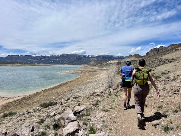
The loop heads through a dispersed camping area and then up the Becks Tech trail to reach Rocky Ridge, which provides a beautiful lookout over the entire elevated plateau that's home to this incredible trail system.
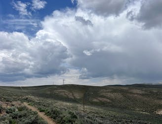
After an easy walk up the Sea of Sage trail, the rocks return as you descend a series of extensive granite slabs on the Rattlesnake Trail. After some doubletrack road walking on Main Street, you'll finish the descent on the rocky trails of "Notch" and "Backbone" to return to the trailhead.
Difficult
Hiking trails where obstacles such as rocks or roots are prevalent. Some obstacles can require care to step over or around. At times, the trail can be worn and eroded. The grade of the trail is generally quite steep, and can often lead to strenuous hiking.

The trail contains some obstacles such as outcroppings and rock which could cause injury.
Away from help but easily accessed.
816 m away
Hike along the elevated ridgeline with stunning views of the Gunnison Valley.
Difficult Hiking
4.6 km away

A short but scenic hike in the far reaches of Hartman Rocks.
Difficult Hiking
5.3 km away
A beautiful loop hike accessible directly from the outskirts of Gunnison.
Easy Hiking
5.9 km away
A beautiful gravel path through one of the most easily-accessible greenspaces adjacent to the town of Gunnison.
Easy Hiking
5.9 km away
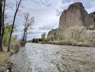
A short, direct hike to the beautiful banks of the Gunnison River.
Easy Hiking
8 km away
A scenic loop deep in the Signal Peak trail system.
Moderate Hiking
11 routes · Hiking