5 m away
Telegraph -> Skull Rock -> Big Canyon Loop

A longer loop hike accessible directly from downtown Durango.
Moderate Hiking
- Distance
- 17 km
- Ascent
- 430 m
- Descent
- 431 m
Hike to a spectacular 360-degree view from Pautskey Point.
Hiking Difficult

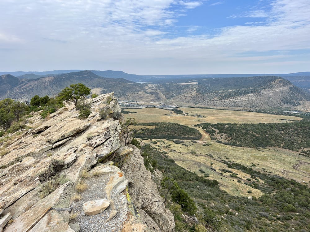
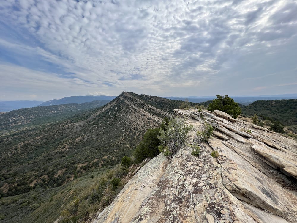
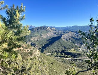
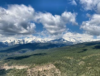
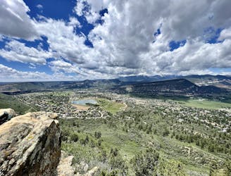
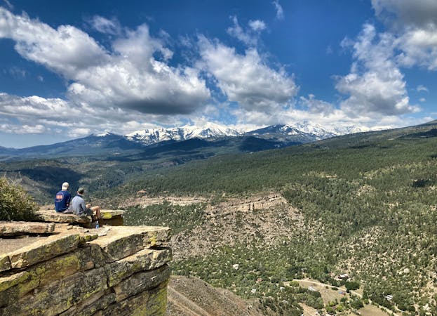
Pautskey Point is an easily identifiable ridge forming part of the skyline above the southern end of Durango. While it's tough to discern from downtown Durango due to Raider's Ridge sitting in between, this 7,698-foot upthrust spine of jagged rock offers panoramic 360-degree views of the region.
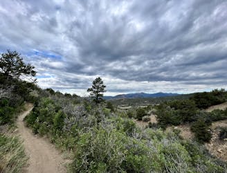
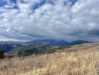
To get there, begin hiking from the Horse Gulch trailhead, and then take a right onto the Telegraph Trail. Telegraph can be a bit of a grind at times, but as you get higher and higher up the trail, beautiful views slowly begin to open up, giving an indication of what you'll find at the top. While you'll gain elevation consistently, this section has nothing technical.
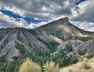
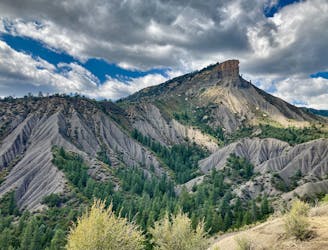
The final grunt to the summit is fairly steep and is almost guaranteed to get you breathing hard. Most of this pitch consists of a rock slab chute that runs straight up the ridge. This unique rock formation is quite entertaining to hike up, but it's not so steep to require you to use your hands. You should be able to walk up it just fine.
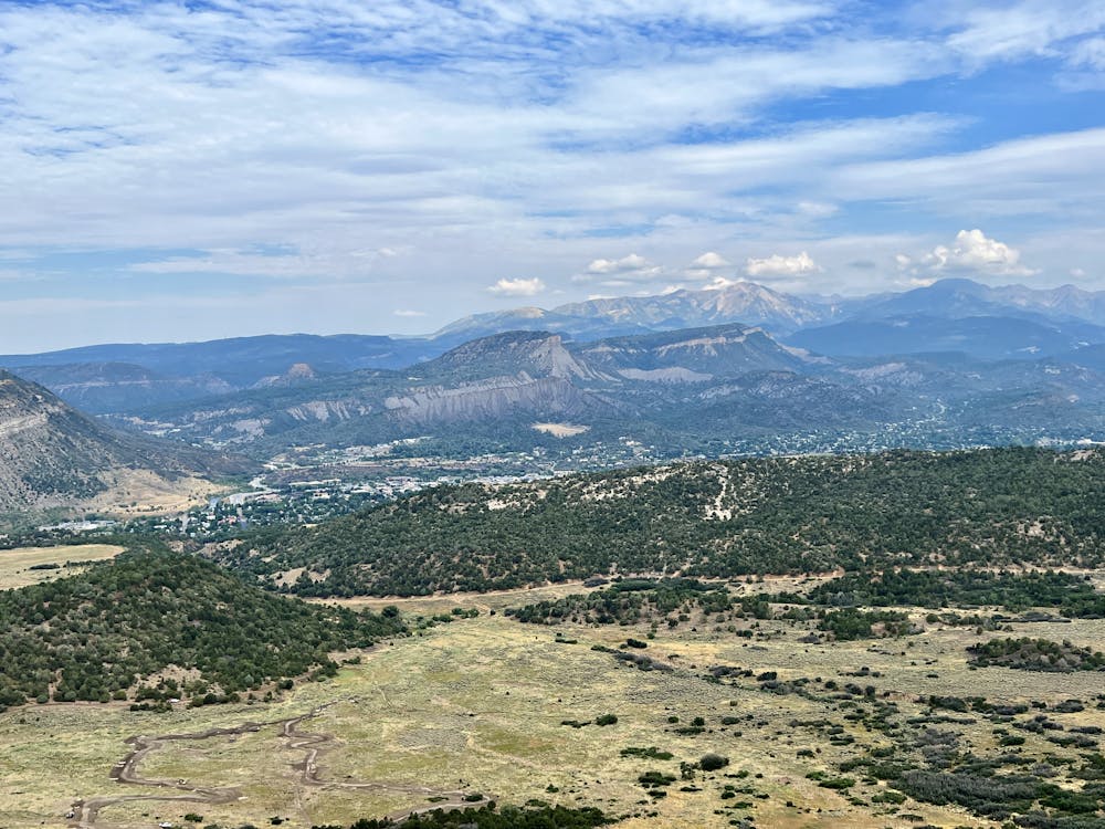
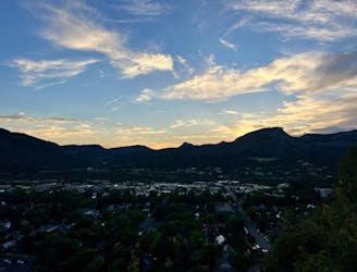
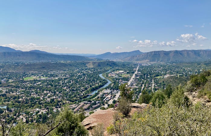
The final few feet of the climb follow a rocky ridge reminiscent of Raider's Ridge far below but with much more spectacular views! Hike as far as you'd like along this ridge, then stop to take in the stupendous views. You'll be able to glimpse downtown Durango peeking out from behind Raider's, but Perins Peak and the La Platas form an absolutely gorgeous skyline in the distance! Directly across the river, Smelter Mountain looms in front of you, with Nighthorse Reservoir visible beyond.
Once done enjoying the views, retrace your steps back to the trailhead. Or if you're looking for additional miles, consider following the Grandview Loop or the Skull Rock and Big Canyon trails.
Difficult
Hiking trails where obstacles such as rocks or roots are prevalent. Some obstacles can require care to step over or around. At times, the trail can be worn and eroded. The grade of the trail is generally quite steep, and can often lead to strenuous hiking.

The trail contains some obstacles such as outcroppings and rock which could cause injury.
Away from help but easily accessed.
5 m away
A longer loop hike accessible directly from downtown Durango.
Moderate Hiking
9 m away
A beautiful loop up and around Grandview Ridge.
Moderate Hiking
986 m away
A quick hike to a beautiful vista over Durango.
Moderate Hiking
1.4 km away
While Smelter Mountain is known as one of Durango's classic in-town hikes, the ascent is far from easy.
Severe Hiking
2.6 km away
Climb the dramatic Hogsback Ridge.
Difficult Hiking
3.8 km away
Hike to one of the most visually-distinctive peaks above Durango.
Moderate Hiking
4.3 km away
Possibly Durango's most popular hike.
Difficult Hiking
4.3 km away
Quick hike to a great view of Durango.
Difficult Hiking
5.2 km away
The most popular route to the top of Perins Peak, beginning in Rockridge.
Difficult Hiking
5.7 km away
An easily-accessible hike near the Three Springs neighborhood.
Easy Hiking
10 routes · Alpine Climbing · Hiking
6 routes · Hiking