2.2 km away
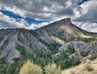
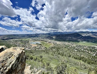
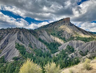
Perins Peak
The most popular route to the top of Perins Peak, beginning in Rockridge.
Difficult Hiking
- Distance
- 9 km
- Ascent
- 474 m
- Descent
- 474 m
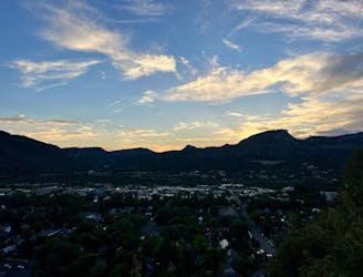
Possibly Durango's most popular hike.
Hiking Difficult
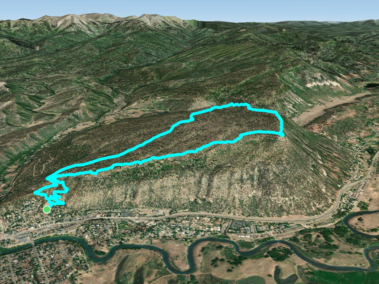
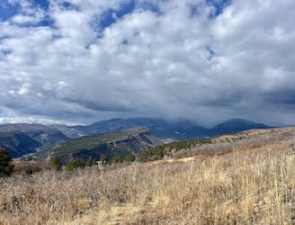
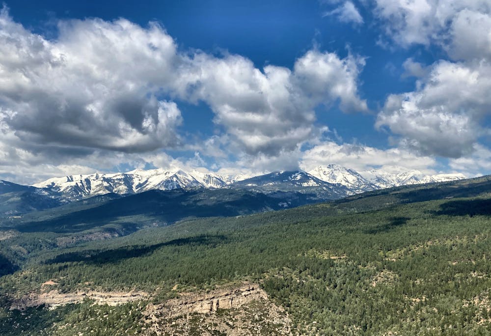
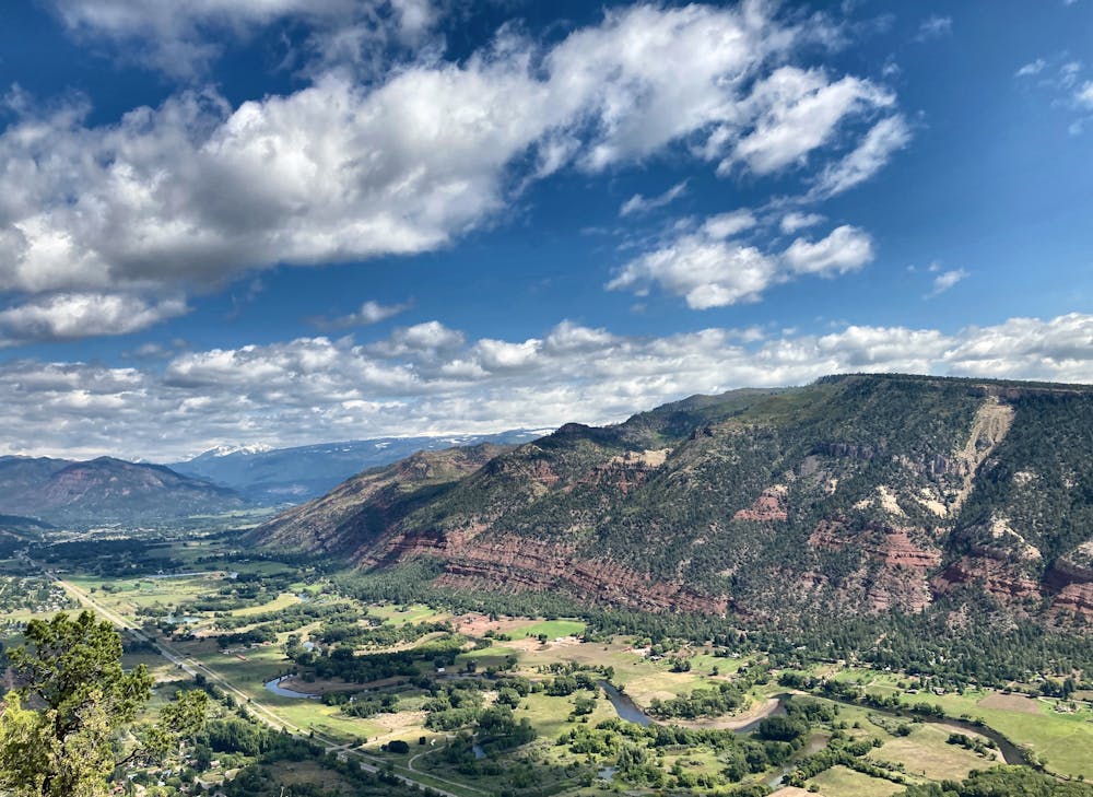
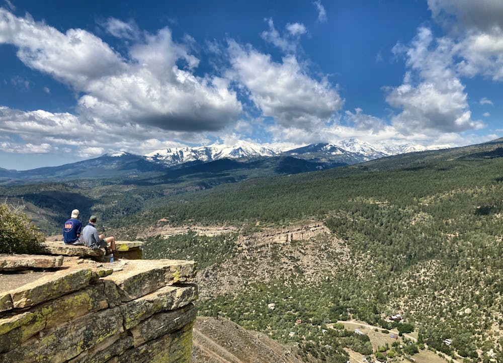
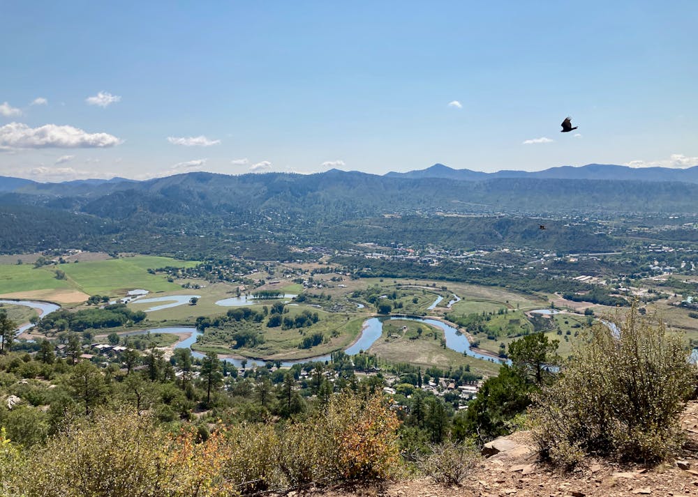
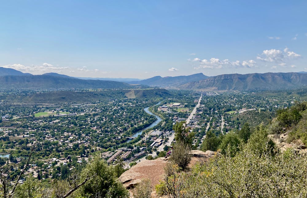
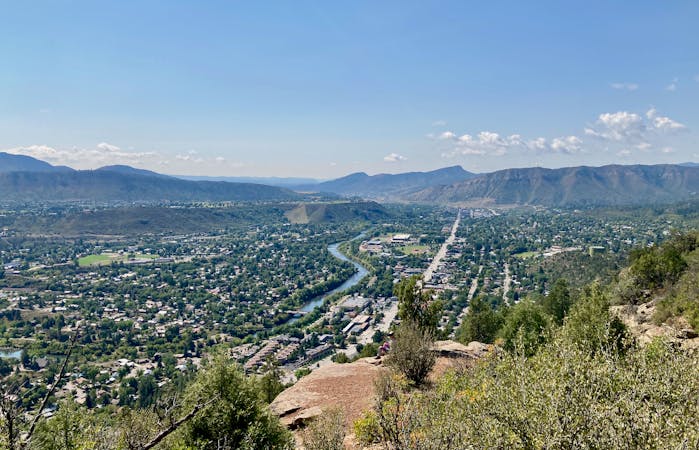
Animas Mountain is one of the most popular hikes in Durango, and for good reason. This short (but steep) loop offers up some of the most stupendous views in the region! With vistas over Durango, a front-and-center perspective of the red rock cliffs nearby, and long-range views of the San Juans off in the distance, you'll find yourself constantly pulling out your phone to snap photos of the incredible scenery!
The hike begins right in town Durango, gaining elevation quickly up the flanks of Animas. The climb is steep and consistent, gaining elevation via a narrow, rocky, switchbacked trail. While the trail is rocky and crisscrossed with roots in places, there are no major obstacles or scrambling required on the standard route. If you veer off onto other connector trails, you may encounter more substantial obstacles.
After a few miles of climbing, the trail traverses over to the rim of the mountain, and you start enjoying incredible views as you climb! Be sure to look behind you and take in the views over downtown Durango.
When you reach the top of the mountain, you'll realize that the opposite side of Animas ends in a sheer cliff. The exposed rock faces provide the perfect spot to take in the incredible views of the San Juans! Stop and enjoy a snack—there are few places with scenery this incredible.
Once you've had your fill of the views, continue following this loop to descend Animas Mountain via a different trail than you climbed. This unique loop-style route to the top of a mountain makes for original scenery both up and down, providing a delightful change of pace from the standard out-and-back route.
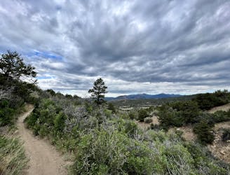
Difficult
Hiking trails where obstacles such as rocks or roots are prevalent. Some obstacles can require care to step over or around. At times, the trail can be worn and eroded. The grade of the trail is generally quite steep, and can often lead to strenuous hiking.

Some trail sections have exposed ledges or steep ascents/descents where falling could cause serious injury.

Away from help but easily accessed.
2.2 km away
The most popular route to the top of Perins Peak, beginning in Rockridge.
Difficult Hiking
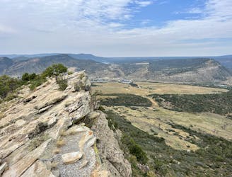
2.5 km away
Climb the dramatic Hogsback Ridge.
Difficult Hiking
3.1 km away
Quick hike to a great view of Durango.
Difficult Hiking
3.3 km away
A quick hike to a beautiful vista over Durango.
Moderate Hiking
4.3 km away
A beautiful loop up and around Grandview Ridge.
Moderate Hiking
4.3 km away

A longer loop hike accessible directly from downtown Durango.
Moderate Hiking
4.3 km away
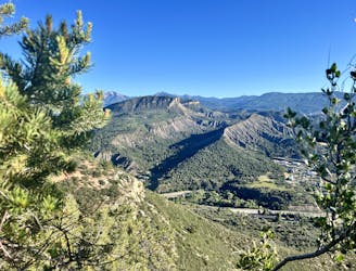
Hike to a spectacular 360-degree view from Pautskey Point.
Difficult Hiking
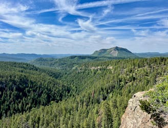
5.2 km away
Hike to one of the most visually-distinctive peaks above Durango.
Moderate Hiking
5.5 km away
While Smelter Mountain is known as one of Durango's classic in-town hikes, the ascent is far from easy.
Severe Hiking
5.6 km away
A popular Durango hike to a gorgeous viewpoint.
Moderate Hiking

10 routes · Alpine Climbing · Hiking
6 routes · Hiking