3.1 km away
Animas Mountain Loop
Possibly Durango's most popular hike.
Difficult Hiking
- Distance
- 9.3 km
- Ascent
- 466 m
- Descent
- 466 m
Quick hike to a great view of Durango.
Hiking Difficult

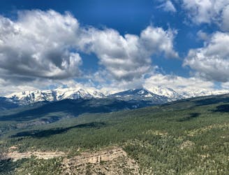
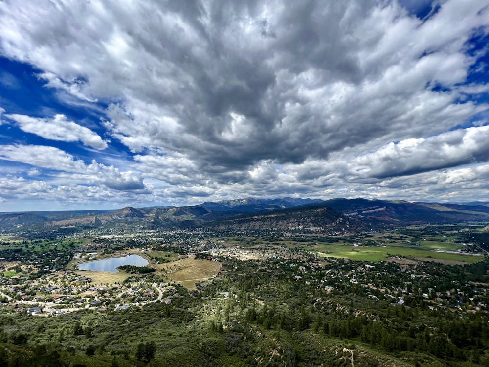
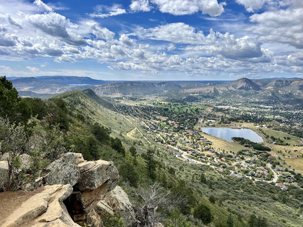
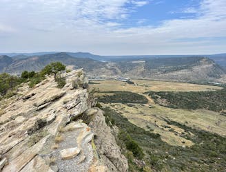
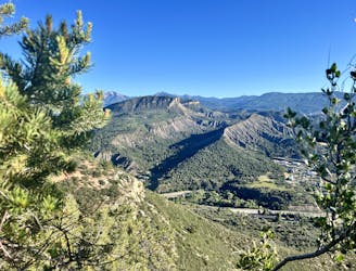
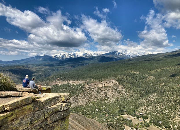
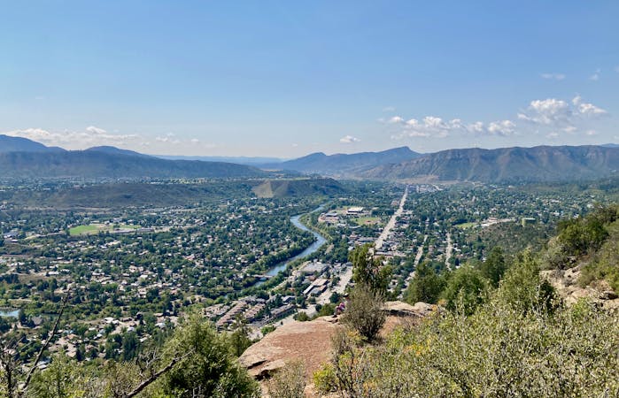
The Skyline Trail quickly ascends the northern side of Raider's Ridge via a switchbacked singletrack. The hike gains a fast 950 feet, but the reward for your effort is a stunning 360-degree view above Durango!
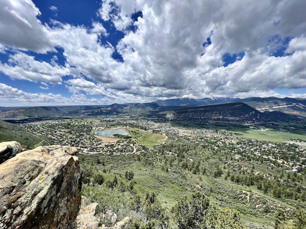
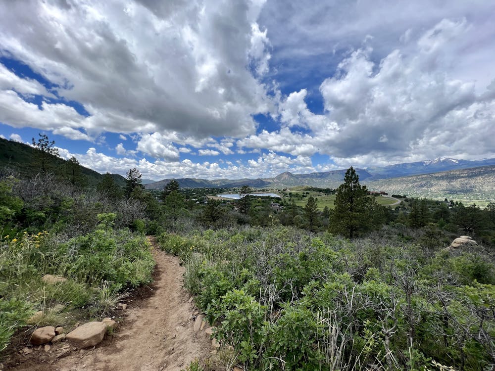
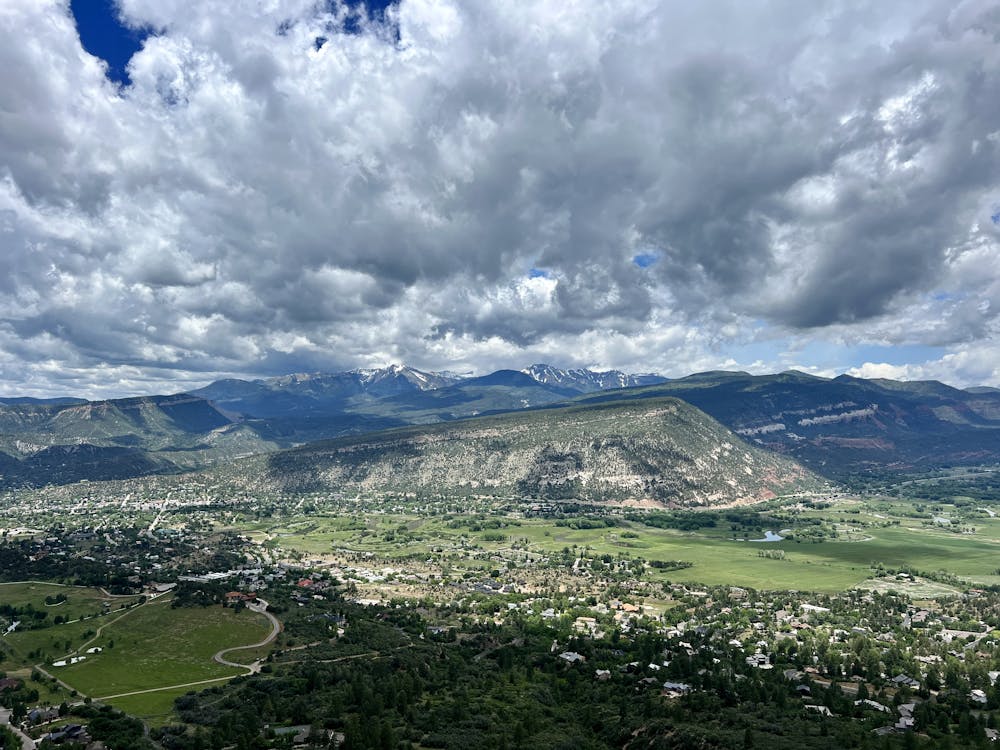
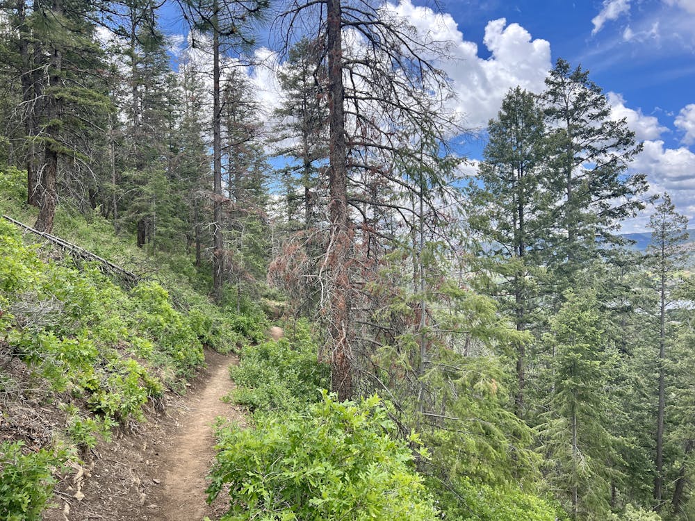
The climb to the top of the ridge follows a relatively non-technical switchbacked trail. "The first 1.7 miles is almost predominantly comprised of switchbacks, affording some amazing views of the mesa and reservoir below," according to RootsRated.com. "This first section of trail is fairly even underfoot and offers quite a bit of shade before you hit the top of the ridge."
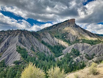
From the very top of the Skyline Trail, you'll enjoy stunning views of the region, but you could continue along Raider's Ridge for a short way, as mapped here, to continue enjoying the views for a little while longer. This upper section is more technical, so if you want an easier hike with more secure footing, simply turn around at the top of the ridge. Turning around at the top of the ridge and heading back down would reduce the difficulty rating from "difficult" to "moderate."
Difficult
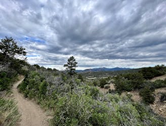
Hiking trails where obstacles such as rocks or roots are prevalent. Some obstacles can require care to step over or around. At times, the trail can be worn and eroded. The grade of the trail is generally quite steep, and can often lead to strenuous hiking.

The trail contains some obstacles such as outcroppings and rock which could cause injury.
Away from help but easily accessed.
3.1 km away
Possibly Durango's most popular hike.
Difficult Hiking
3.8 km away
A quick hike to a beautiful vista over Durango.
Moderate Hiking
4.3 km away
Hike to a spectacular 360-degree view from Pautskey Point.
Difficult Hiking
4.3 km away
A beautiful loop up and around Grandview Ridge.
Moderate Hiking
4.3 km away

A longer loop hike accessible directly from downtown Durango.
Moderate Hiking
4.4 km away
Climb the dramatic Hogsback Ridge.
Difficult Hiking
5.3 km away
The most popular route to the top of Perins Peak, beginning in Rockridge.
Difficult Hiking
5.6 km away
While Smelter Mountain is known as one of Durango's classic in-town hikes, the ascent is far from easy.
Severe Hiking
6.3 km away
An easily-accessible hike near the Three Springs neighborhood.
Easy Hiking
7.1 km away
Hike to one of the most visually-distinctive peaks above Durango.
Moderate Hiking
10 routes · Alpine Climbing · Hiking
6 routes · Hiking