4 m away
Grandview Ridge Loop
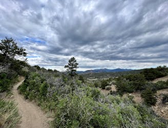
A beautiful loop up and around Grandview Ridge.
Moderate Hiking
- Distance
- 14 km
- Ascent
- 374 m
- Descent
- 374 m
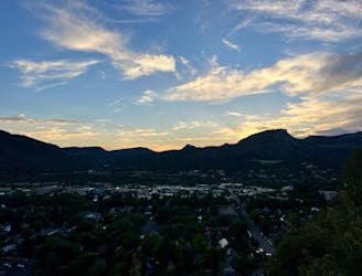
A longer loop hike accessible directly from downtown Durango.
Hiking Moderate

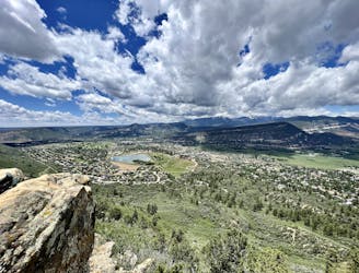
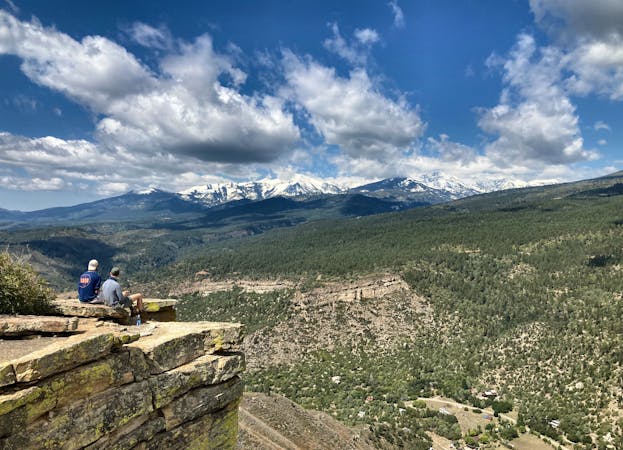
The Telegraph Trails provide beautiful all-day hikes directly from downtown Durango! While the route options are myriad, this loop is one of the best on offer.
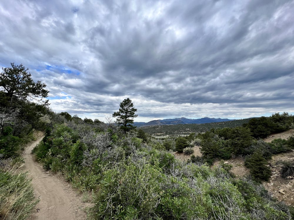
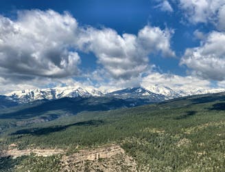
Begin hiking from the Horse Gulch trailhead, and then take a right onto the Telegraph Trail. Telegraph can be a bit of a grind at times, but as you get higher and higher up the trail, beautiful views slowly begin to open up, giving an indication of what you'll find at the top. While you'll gain elevation consistently, this section has nothing exceedingly technical. The climb does finish with a short, steep pitch to reach the saddle, but after that, the grade mellows out substantially.
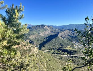
From the pass, you'll enjoy some fantastic sidehilling before dropping swiftly down Yellow Brick Road into the Sidewinder trail. Upper Telegraph, Yellow Brick Road, and Sidewinder all provide smooth buffed-out singletrack. The manicured trail tread provides quick hiking, but the difficulty will kick up a notch when you drop into Skull Rock.
The initial steep descent into Skull Rock provides a taste of what's to come. There are a few steep sections and big blocky rocks to negotiate, but the change in character provides welcome diversity to this hike.
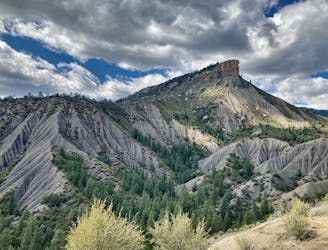
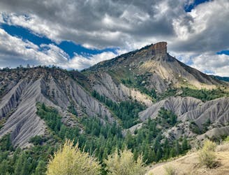
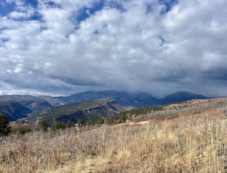
The final stretch of the descent on Big Canyon is aptly named, with the trail rolling through the bottom of a steep-sided canyon. At times, you're hiking directly down the stream bed. The eons of water action have carved entertaining features, such as a rock wall in a corner of the canyon. This final section of trail is one of the true highlights of the route, but like all good things, it soon comes to an end.
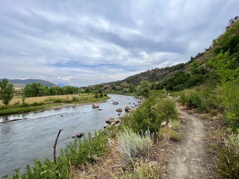
The hike connects along some pavement to reach the Railroad Trail, providing a beautiful pedal along the river to return. You'll have to walk along more pavement on Sawmill Road to reach the next section of singletrack, but ultimately you'll complete the loop on trail.
Moderate
Hiking along trails with some uneven terrain and small hills. Small rocks and roots may be present.

The path is on completely flat land and potential injury is limited to falling over.

Away from help but easily accessed.
4 m away
A beautiful loop up and around Grandview Ridge.
Moderate Hiking
5 m away
Hike to a spectacular 360-degree view from Pautskey Point.
Difficult Hiking
984 m away
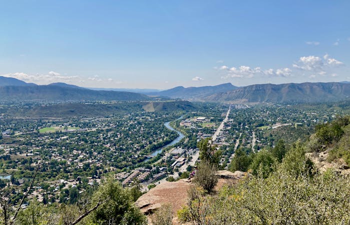
A quick hike to a beautiful vista over Durango.
Moderate Hiking
1.4 km away
While Smelter Mountain is known as one of Durango's classic in-town hikes, the ascent is far from easy.
Severe Hiking
2.6 km away
Climb the dramatic Hogsback Ridge.
Difficult Hiking
3.8 km away
Hike to one of the most visually-distinctive peaks above Durango.
Moderate Hiking
4.3 km away
Possibly Durango's most popular hike.
Difficult Hiking
4.3 km away
Quick hike to a great view of Durango.
Difficult Hiking
5.2 km away
The most popular route to the top of Perins Peak, beginning in Rockridge.
Difficult Hiking
5.7 km away
An easily-accessible hike near the Three Springs neighborhood.
Easy Hiking
10 routes · Alpine Climbing · Hiking
6 routes · Hiking