1.4 km away
Telegraph -> Skull Rock -> Big Canyon Loop

A longer loop hike accessible directly from downtown Durango.
Moderate Hiking
- Distance
- 17 km
- Ascent
- 430 m
- Descent
- 431 m
While Smelter Mountain is known as one of Durango's classic in-town hikes, the ascent is far from easy.
Hiking Severe

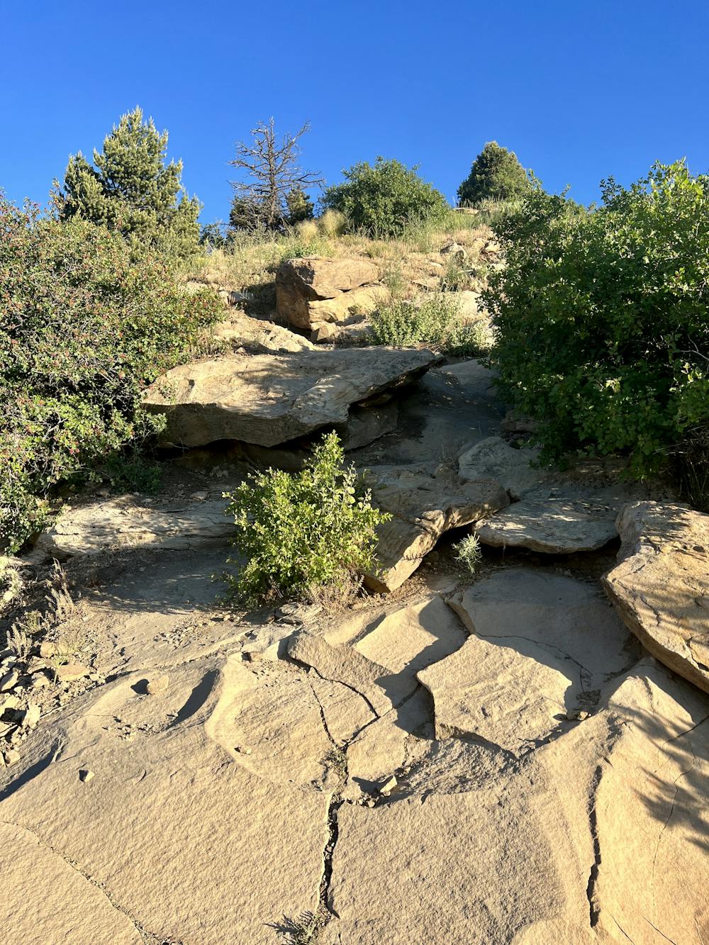
The hike up Smelter Mountain begins just off the highway at an easily-accessible trailhead... but it doesn't stay easy for long. Right out of the gate, the trail begins ascending the steep flanks of Smelter Mountain, climbing a rocky face that will require using your hands for a few scrambly bits. You'll be faced with a series of rock slabs, boulders, rock gardens, and steep singletrack. These steep, rock-scrambly bits earn this hike its FATMAP "Severe" rating... but thankfully, after the initial ascent, the hike mellows out substantially.
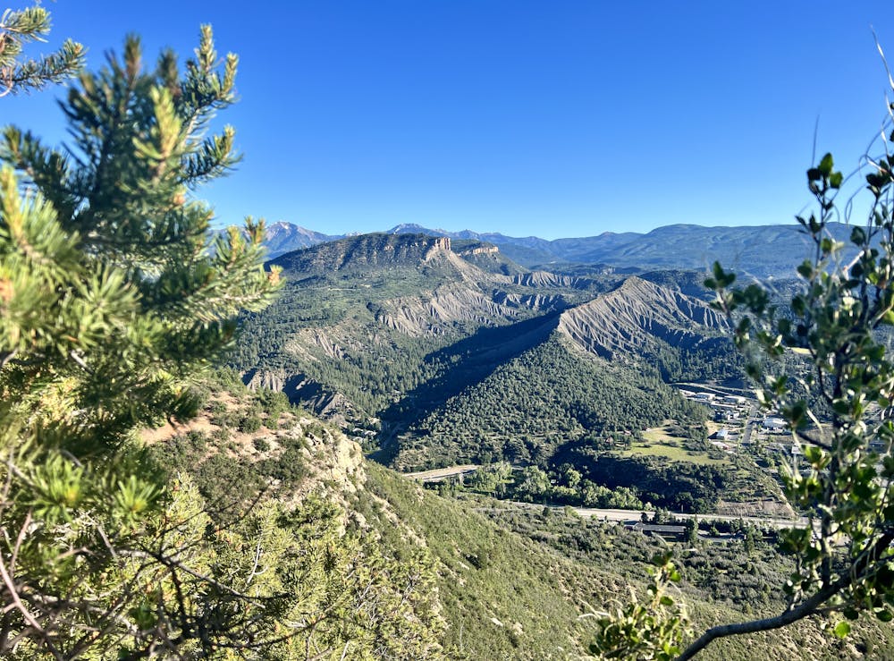
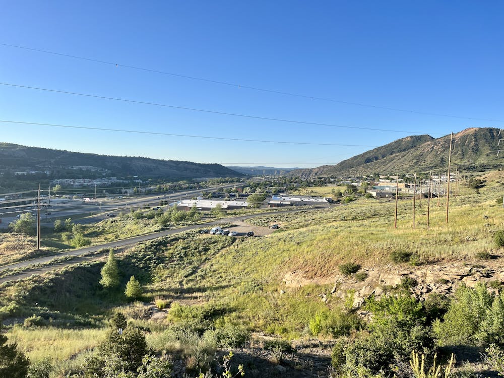
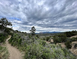
After passing an overlook on the shoulder of the ridge, the grade flattens out dramatically into a pleasant ridgeline walk. In fact, you'll exchange the narrow trail for a wide dirt path and then spend some time walking along a dirt access road that runs along the ridge.
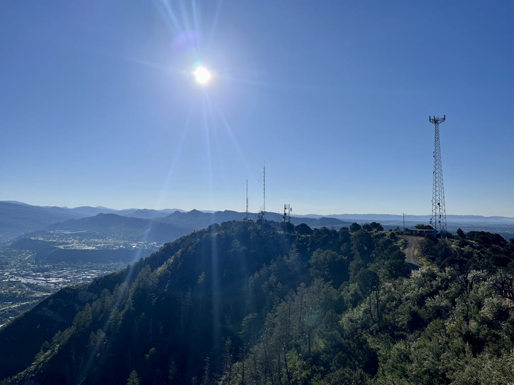
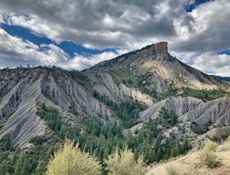
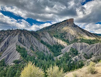
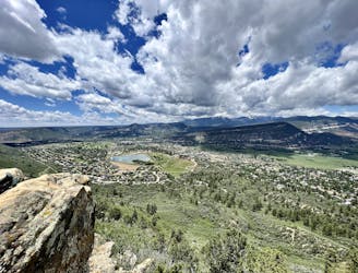
The dirt (and sometimes broken-down blacktop) road is in place to serve a series of cell phone towers, radio towers, and other communication arrays that serve the city of Durango and the surrounding area. While not the most natural of settings, these towers need to go somewhere, so apparently, this is the place. In a few spots, you'll see narrow social trails that cut straight along the ridge, but sometimes it's actually easier to take a slightly longer mileage walk on the road to avoid some of the steep up-and-down climbs.
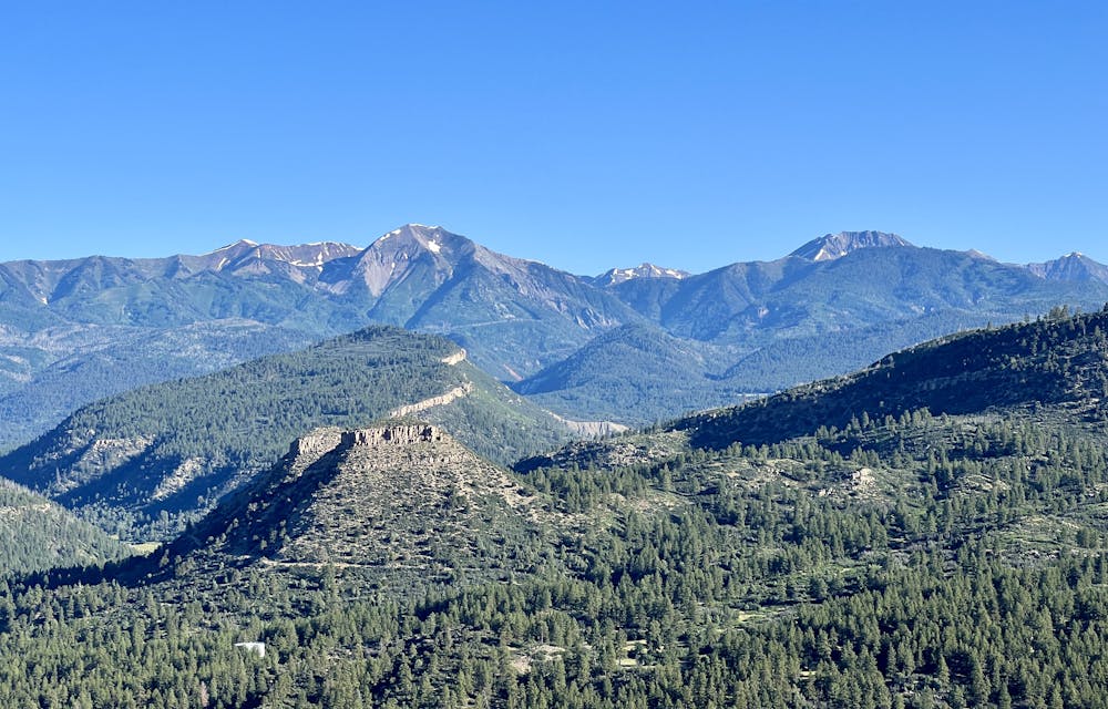
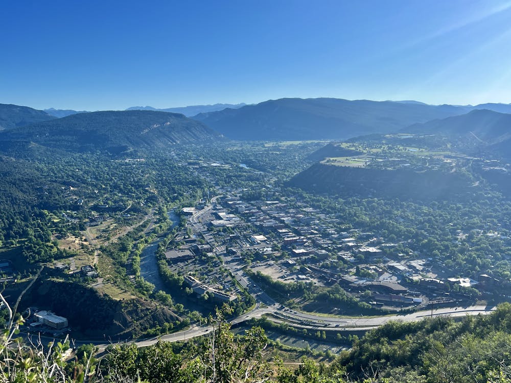
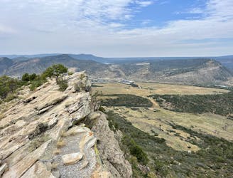
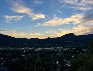
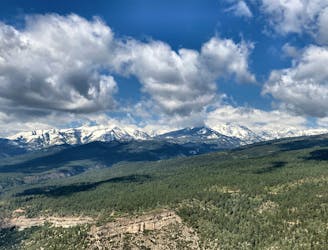
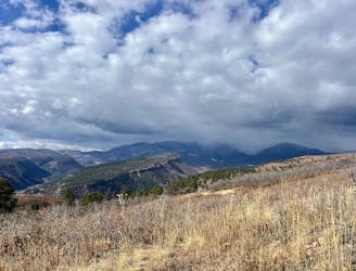
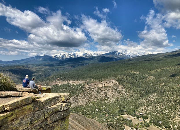
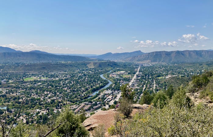
You'll need to walk along the ridge for over a mile to reach the designated top of Smelter Mountain, at 7,725ft. While the top isn't very marvelous, you'll enjoy spectacular views over Durango, Perins Peak, the Hogback area directly below you, and the La Platas forming a scenic skyline in the distance.
Once done enjoying the view, turn around and retrace your steps back down the mountain.
Severe
Hiking challenging trails where simple scrambling, with the occasional use of the hands, is a distinct possibility. The trails are often filled with all manner of obstacles both small and large, and the hills are very steep. Obstacles and challenges are often unexpected and can be unpredictable.

The trail contains some obstacles such as outcroppings and rock which could cause injury.
Away from help but easily accessed.
1.4 km away
A longer loop hike accessible directly from downtown Durango.
Moderate Hiking
1.4 km away
Hike to a spectacular 360-degree view from Pautskey Point.
Difficult Hiking
1.4 km away
A beautiful loop up and around Grandview Ridge.
Moderate Hiking
2.2 km away
A quick hike to a beautiful vista over Durango.
Moderate Hiking
3.5 km away
Climb the dramatic Hogsback Ridge.
Difficult Hiking
3.6 km away
Hike to one of the most visually-distinctive peaks above Durango.
Moderate Hiking
5.5 km away
Possibly Durango's most popular hike.
Difficult Hiking
5.6 km away
Quick hike to a great view of Durango.
Difficult Hiking
5.8 km away
An easily-accessible hike near the Three Springs neighborhood.
Easy Hiking
6.1 km away
The most popular route to the top of Perins Peak, beginning in Rockridge.
Difficult Hiking
10 routes · Alpine Climbing · Hiking
6 routes · Hiking