4 km away
Perins Peak
The most popular route to the top of Perins Peak, beginning in Rockridge.
Difficult Hiking
- Distance
- 9 km
- Ascent
- 474 m
- Descent
- 474 m
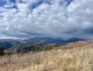
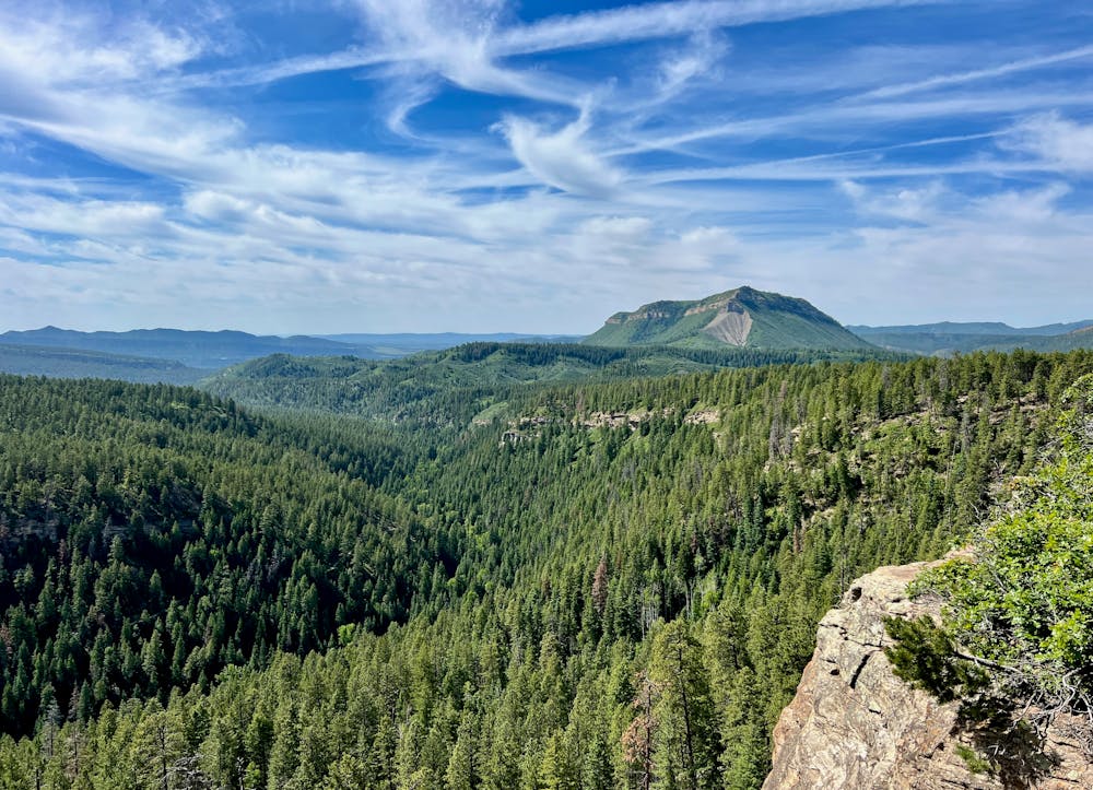
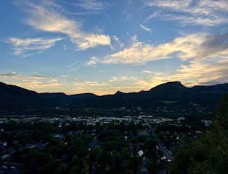
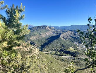
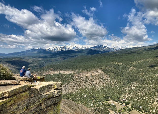
A popular Durango hike to a gorgeous viewpoint.
Hiking Moderate

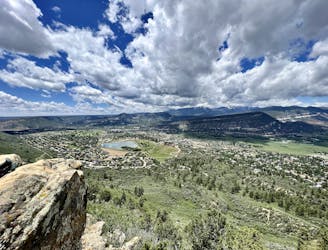
The out-and-back route to Gudy's Rest is an exceedingly popular Durango-area hike, especially early and late in the season when the higher-elevation trails are covered in snow.
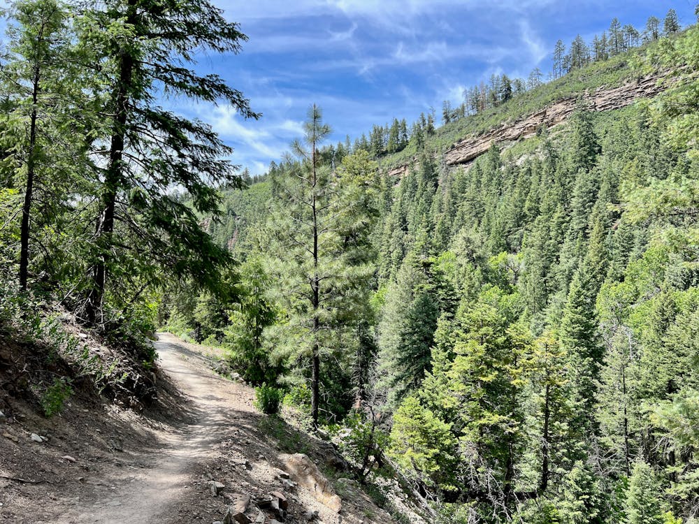
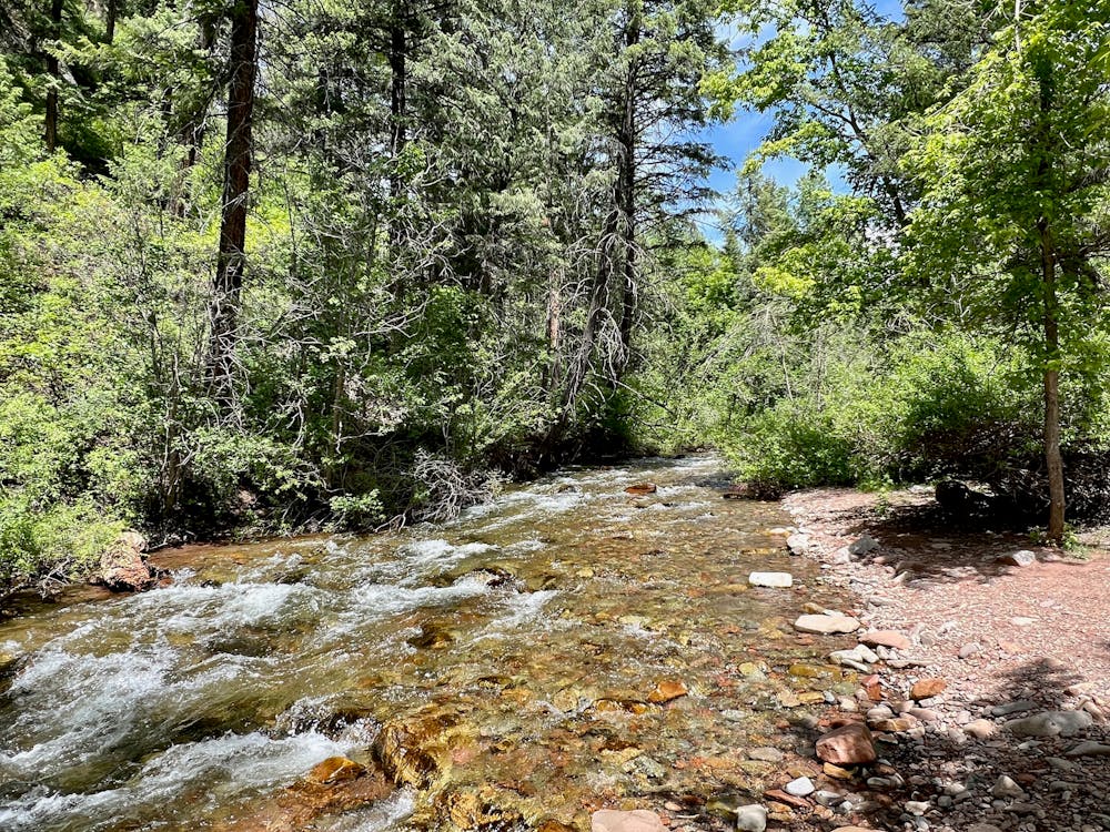
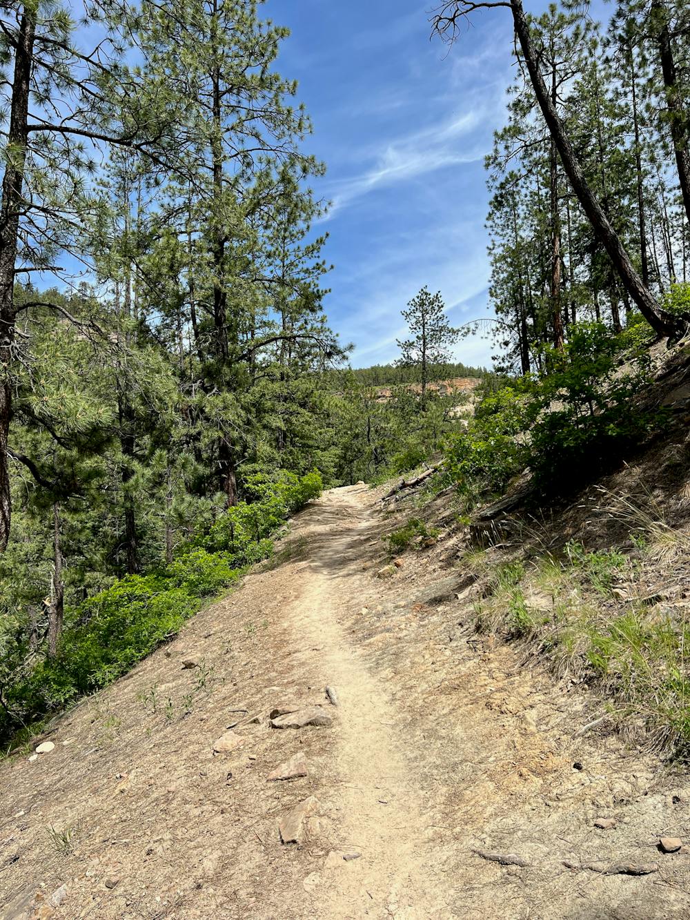
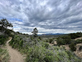
The hike begins from a trailhead near the Junction Creek Campground by following the Colorado Trail along a bench above Junction Creek itself. This section of the hike is fairly mellow, despite some rocks and roots to step over. You'll enjoy gorgeous views of rock outcroppings, the creek below, and the mountains peeking through the trees above you.
After crossing the creek on a well-built bridge, it's time to get your climbing legs on! The hike gains most of its elevation quickly via a series of switchbacks that climb steadily up the mountainside. While you'll gain a stiff 584 vertical feet in about 1.2 miles, the trail is well-built and well-graded. Even though the climb is aerobic, the trail is never exceedingly steep or eroded, thus keeping this hike to a "Moderate" FATMAP rating.
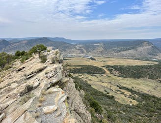
You'll know when you reach Gudy's Rest thanks to the wooden sign on the tree and the wooden bench on top of a stupendous overlook! The view from this cliff edge is sublime, with the mountains spreading out around you and Durango not quite visible in the distance. This is the perfect spot to take a break, enjoy a snack, and soak in the tremendous view—you earned it!
To get back to your car, simply turn around and retrace your steps.
Moderate
Hiking along trails with some uneven terrain and small hills. Small rocks and roots may be present.

The trail contains some obstacles such as outcroppings and rock which could cause injury.
Away from help but easily accessed.
4 km away
The most popular route to the top of Perins Peak, beginning in Rockridge.
Difficult Hiking
5.6 km away
Possibly Durango's most popular hike.
Difficult Hiking
6.5 km away
Climb the dramatic Hogsback Ridge.
Difficult Hiking
7.6 km away
Hike to one of the most visually-distinctive peaks above Durango.
Moderate Hiking
8.2 km away
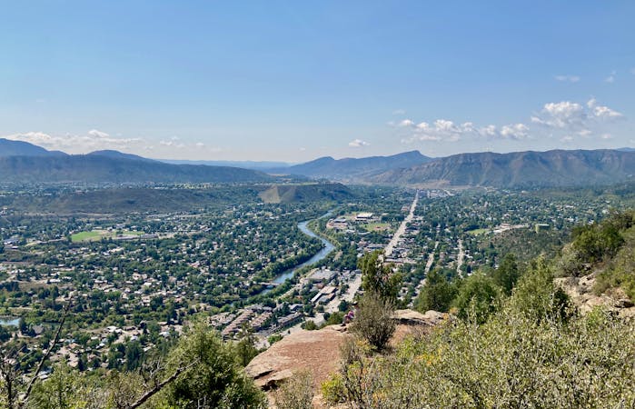
A quick hike to a beautiful vista over Durango.
Moderate Hiking
8.6 km away
Quick hike to a great view of Durango.
Difficult Hiking
9.1 km away
A beautiful loop up and around Grandview Ridge.
Moderate Hiking
9.1 km away

A longer loop hike accessible directly from downtown Durango.
Moderate Hiking
9.1 km away
Hike to a spectacular 360-degree view from Pautskey Point.
Difficult Hiking
10 km away
While Smelter Mountain is known as one of Durango's classic in-town hikes, the ascent is far from easy.
Severe Hiking
10 routes · Alpine Climbing · Hiking
6 routes · Hiking