1.3 km away
Pass Creek -> Engine Creek Shuttle
A point-to-point shuttle on one of Durango's best high-country trails.
Severe Mountain Biking
- Distance
- 21 km
- Ascent
- 462 m
- Descent
- 1 km
A short but high-value alpine ride easily accessible from the Million Dollar Highway.
Mountain Biking Difficult

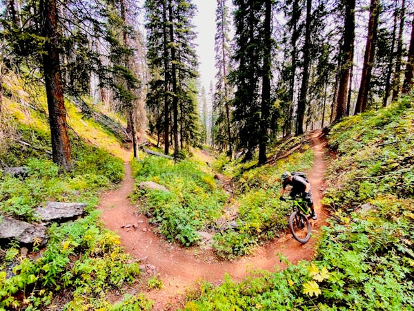
The Coal Creek Loop, as it is mapped here, begins at the bottom of the Coal Creek trail with a short grind up the highway. While it's technically possible to shuttle this section, it's short and really not too bad. Before you know it, you'll be turning right onto the Pass Creek Trail.
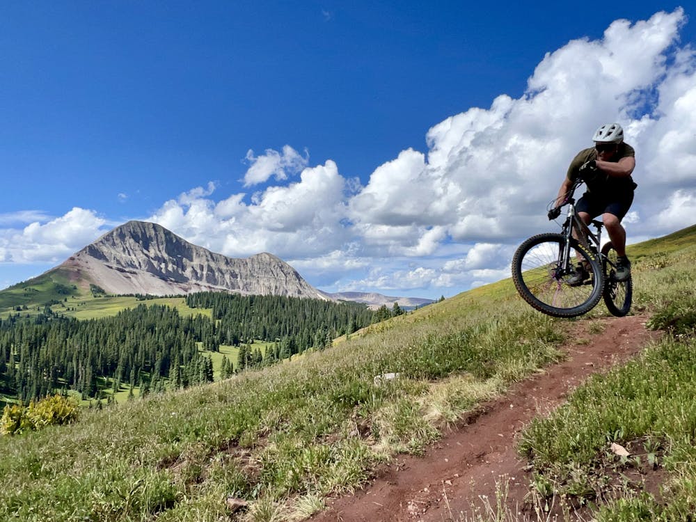
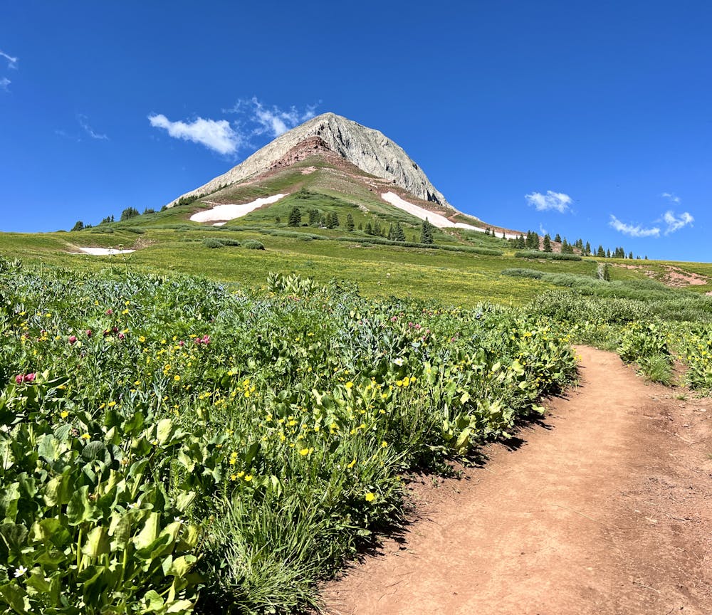
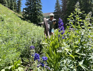
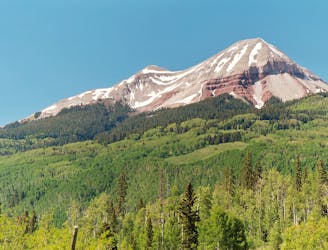
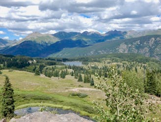
Pass Creek is a popular conduit into the high alpine, beginning from Coal Bank Pass on the Million Dollar Highway. Easily accessible from nearby Durango, on every day of the week, Pass Creek is filled with hikers, mountain bikers, trail runners, and equestrians climbing into the beautiful alpine meadows high above treeline at the top of the trail.
The climb to get above treeline is fairly reasonable, but it still isn't an easy ride: you'll have to gain over 1,000 feet of elevation just to reach the junction with the Engineer Mountain Trail. The climb up Pass Creek alternates back and forth from riding to hiking through steep, rocky pitches. True badasses may be able to clean all of the rocks, but most riders will have to push through a few sections. But even so, Pass Creek is at least 95% rideable on the way up, making it the easiest alpine climb in the area—hence the popularity.
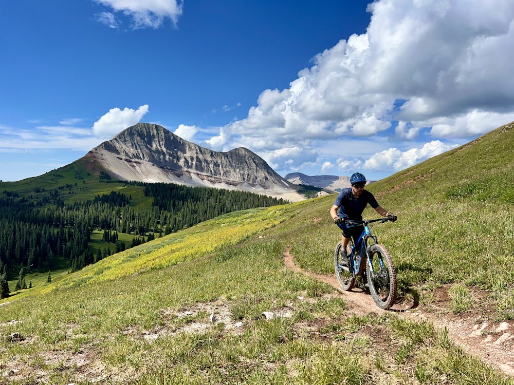
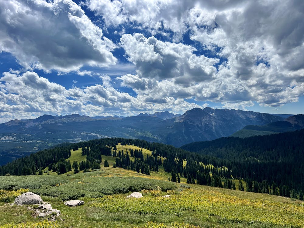
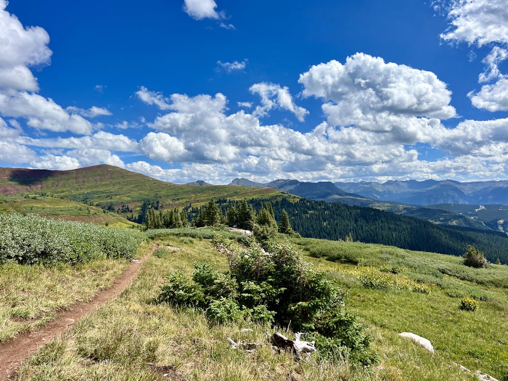
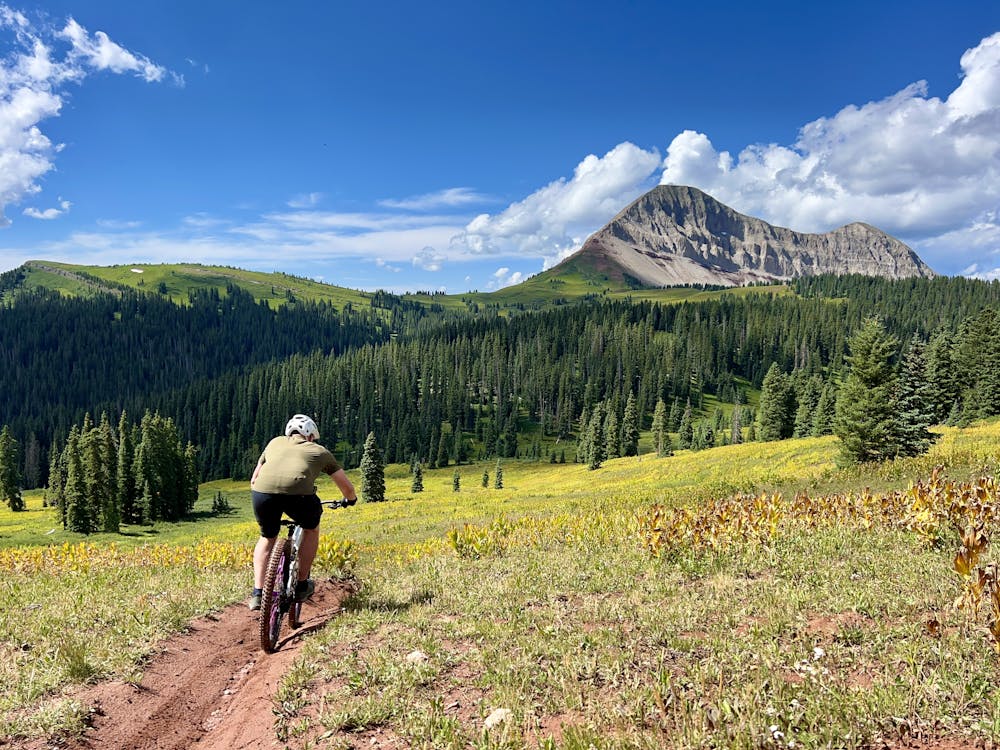
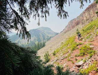
Once at the junction with the Engineer Mountain Trail, take a right to pedal through some more meadows and then another right onto the Coal Creek Trail. From here, you'll still need to do some more climbing before you reach the ride's high point on a beautiful alpine ridge. Be sure to savor this view before you begin descending because once you start going down, you'll go down in a hurry!
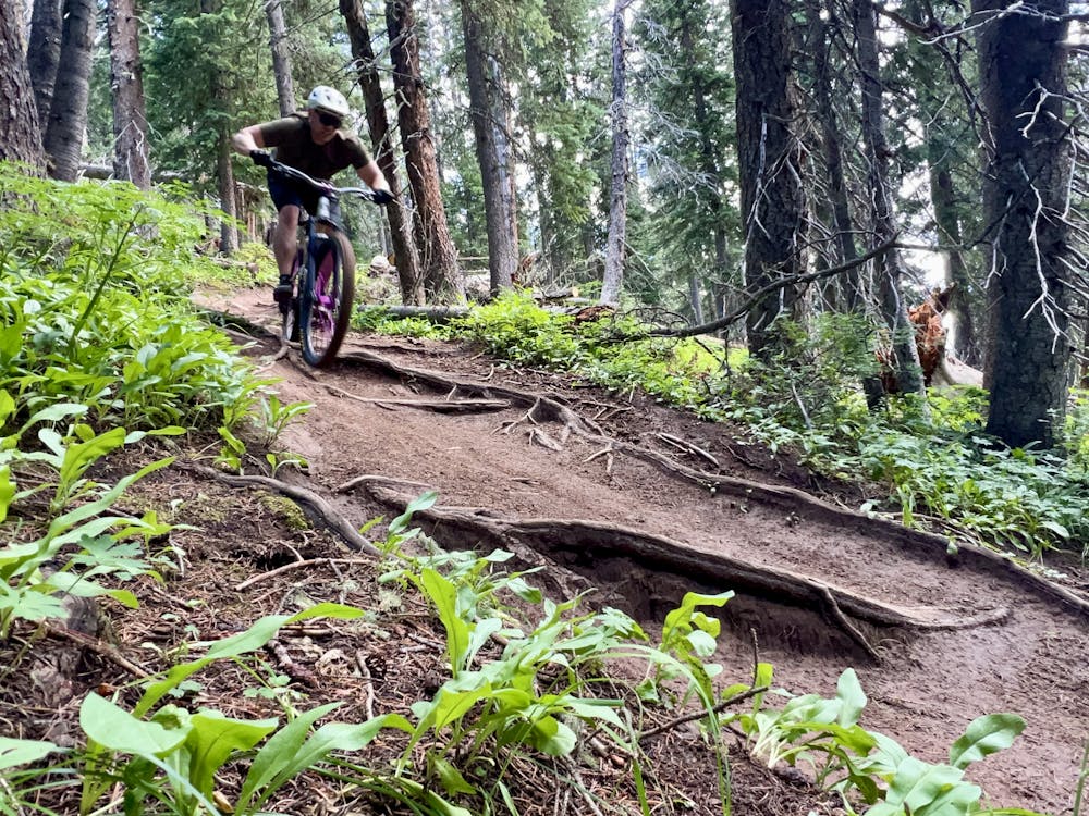
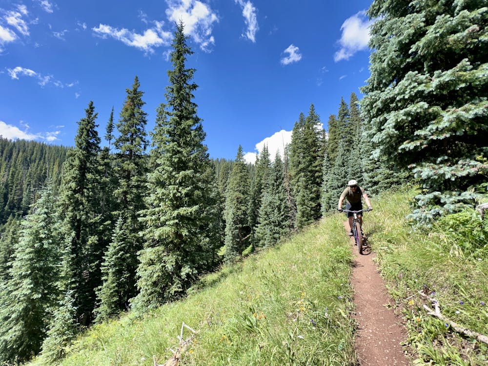
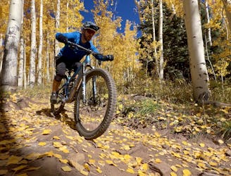
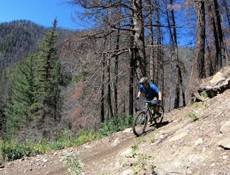
The Coal Creek descent begins in the alpine, whipping through meadows thick with corn lilies as you rocket toward the trees below. After the trail hits the timber, the dirt gets dark and loamy, providing a steep, ripping descent reminiscent of the PNW or the deep pine forests of Montana or Idaho. Dark, loamy dirt, root webs, small drops, and high-speed shredding are on tap, and it's tough to want to stop to soak in the beauty of the forest when the riding is this good! A few small rocky stretches interrupt the loam and will keep you on your toes, but this descent is a real brake-burner that more than pays off for the steep 1,800 feet of climbing that you just did to reach it.
All good things must come to an end, and soon, you'll pop out above the highway, dropping back down to the pavement. But one thing's for sure: this won't be your last time riding Coal Creek!
Difficult
Mostly stable trail tread with some variability featuring larger and more unavoidable obstacles that may include, but not be limited to: bigger stones, roots, steps, and narrow curves. Compared to lower intermediate, technical difficulty is more advanced and grades of slopes are steeper. Ideal for upper intermediate riders.

The trail contains some obstacles such as outcroppings and rock which could cause injury.

Little chance of being seen or helped in case of an accident.
1.3 km away
A point-to-point shuttle on one of Durango's best high-country trails.
Severe Mountain Biking
1.3 km away
The most popular high-country descent near Durango.
Difficult Mountain Biking
7.2 km away
World-class alpine scenery capped with a 4,000-foot descent!
Severe Mountain Biking
7.2 km away
The IMBA Epic portion of the Colorado Trail from Silverton to Durango.
Severe Mountain Biking
7.2 km away
The inaugural segment of the famous Silverton to Durango stretch of the Colorado Trail.
Severe Mountain Biking
9.4 km away
A classic mountain bike ride through a gorgeous mountain valley.
Difficult Mountain Biking
9.6 km away
This trip celebrates the two iconic mountain bike towns of Durango and Moab, and the remote riding in between.
Severe Mountain Biking

26 routes · Mountain Biking
4 routes · Mountain Biking
8 routes · Mountain Biking