1 m away
Engineer Mountain Shuttle
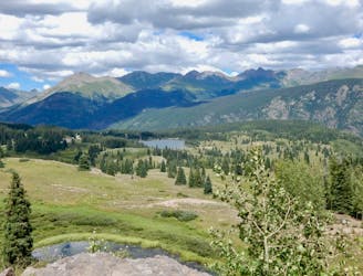
The most popular high-country descent near Durango.
Difficult Mountain Biking
- Distance
- 14 km
- Ascent
- 353 m
- Descent
- 924 m
A point-to-point shuttle on one of Durango's best high-country trails.
Mountain Biking Severe

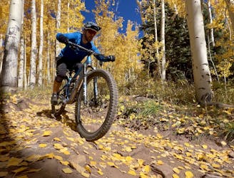
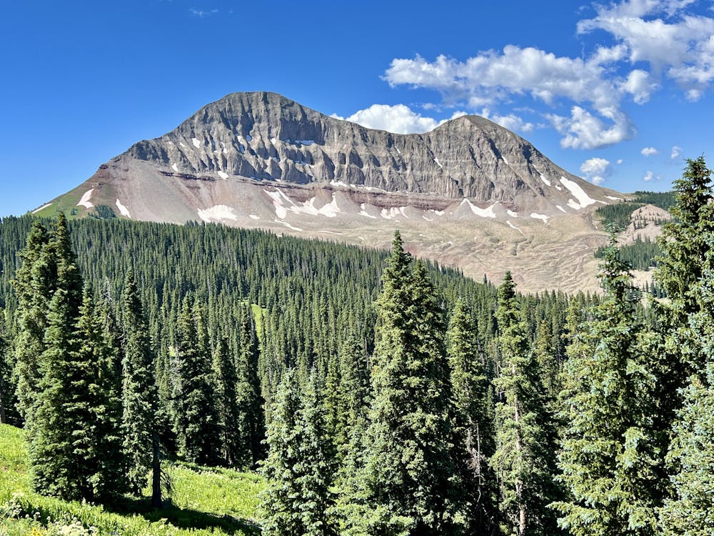
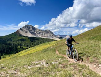
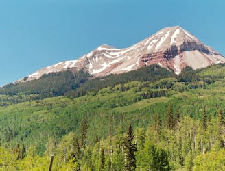
Engine Creek is renowned as one of the best trails in the network of trails surrounding Engineer Mountain. To get there, you'll begin by climbing the Pass Creek Trail. Pass Creek is a popular conduit into the high alpine, beginning from Coal Bank Pass on the Million Dollar Highway. Easily accessible from nearby Durango, on every day of the week, Pass Creek is filled with hikers, mountain bikers, trail runners, and equestrians climbing into the beautiful alpine meadows high above treeline at the top of the trail.
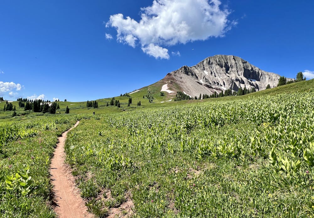
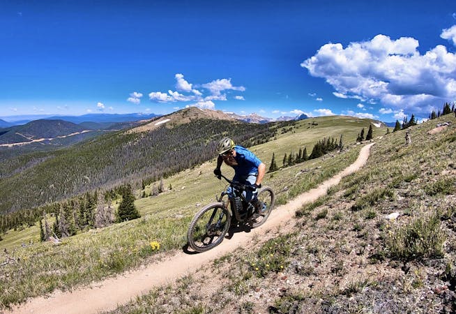
The climb to get above treeline is fairly reasonable, but it still isn't an easy ride: you'll have to gain over 1,000 feet of elevation just to reach the junction with the Engineer Mountain Trail. The climb up Pass Creek alternates back and forth from riding to hiking through steep, rocky pitches. True badasses may be able to clean all of the rocks, but most riders will have to push through a few sections. But even so, Pass Creek is at least 95% rideable on the way up, making it the easiest alpine climb in the area—hence the popularity.
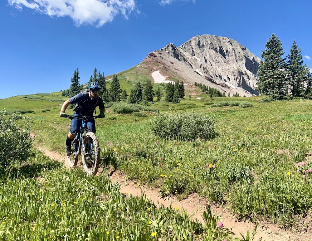
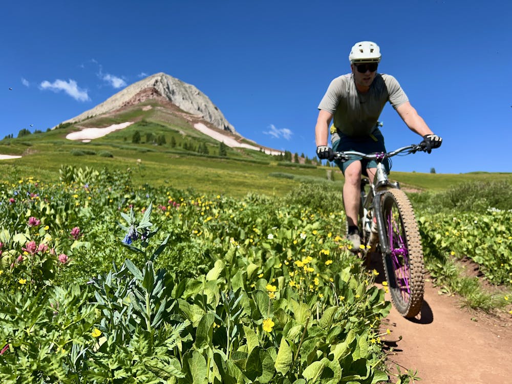
Once at the Engineer Mountain Trail junction, take a right to pedal through some more meadows, then drop down a short but fast descent to reach the left turn onto Engine Creek.
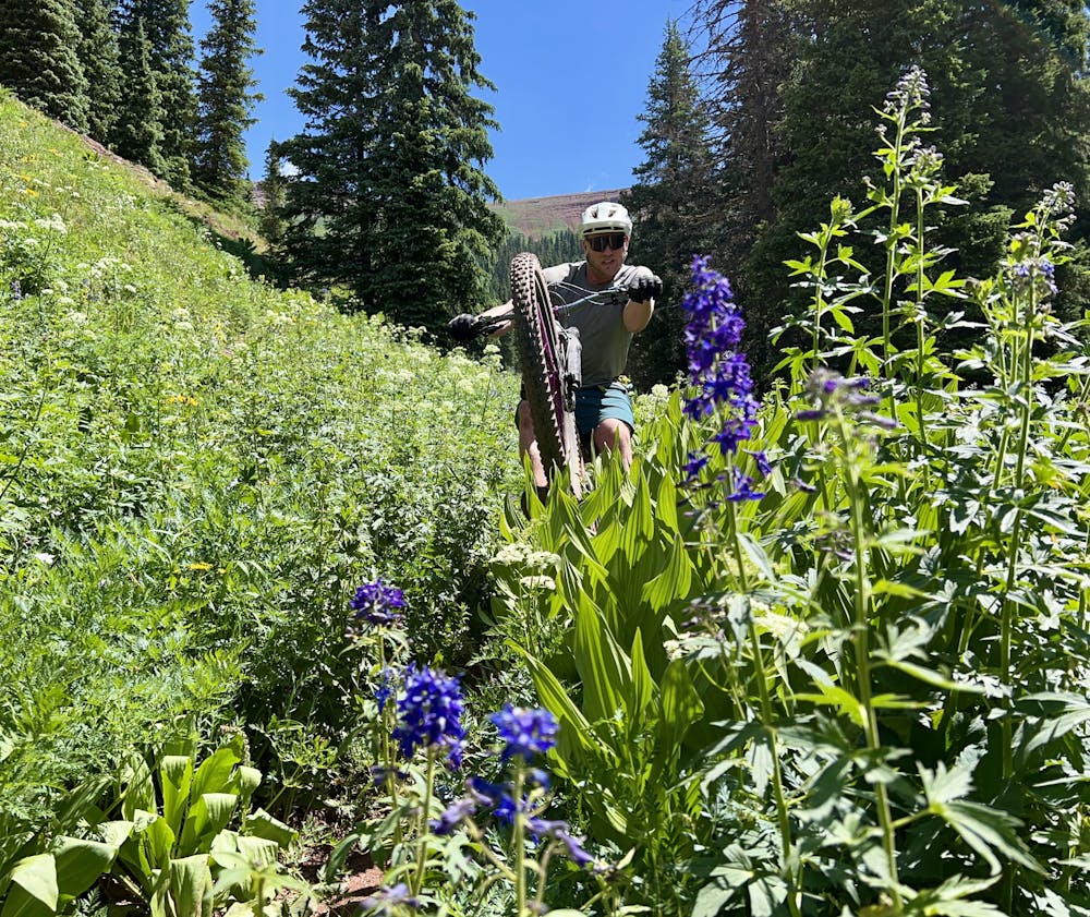
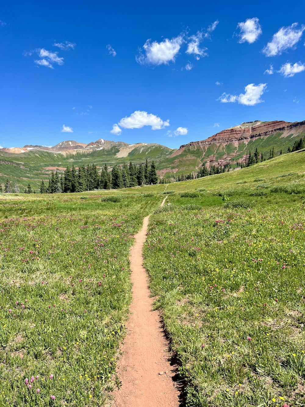
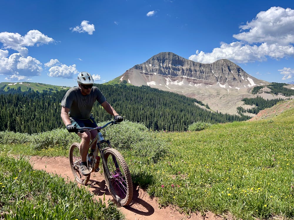
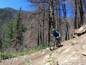
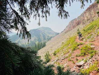
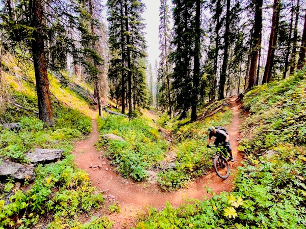
Engine Creek receives much less traffic than the Engineer Mountain Trail, and as such, it is beautifully narrow and natural. The singletrack drops quickly down the mountainside into a narrow valley thick with wildflowers in the meadows and towering pines when you enter the timber. While the descent is fast, be sure to pause and appreciate the stunning environment you're riding through. As you look around, you won't be able to find a single indication of humanity's impact on this area aside from the trail you're riding. This isolation is a blessing, providing a true backcountry mountain biking experience.
The narrow, twisty trail tread leads to short sightlines in places. At times, you'll roll up onto difficult features blind and be forced to improvise on the fly. Sometimes this is due to sharp switchbacks with drops in the middle, and other times, the density of the undergrowth is to blame. While many sections of the trail are smooth and fast, others offer up rock gardens, roots, and even a few blocky boulders. This is classic backcountry riding with a true mixed bag of challenges.
At the bottom where the trail hits the Cascade Creek Trail, for the best-quality riding, it's recommended to ford the stream and pedal the trail on the opposite bank. The section of trail on the south side is reportedly much more rideable than the trail on the north side, although you'll still need to negotiate some short but steep climbs and descents that are choked with rocks. But before you know it, you'll pop out onto the dirt road and coast down to your waiting car!
Severe
Widely variable, narrow trail tread with steeper grades and unavoidable obstacles of 15in/38cm tall or less. Obstacles may include unavoidable bridges 24in/61cm wide or less, large rocks, gravel, difficult root sections, and more. Ideal for advanced-level riders.

The trail contains some obstacles such as outcroppings and rock which could cause injury.

Little chance of being seen or helped in case of an accident.
1 m away
The most popular high-country descent near Durango.
Difficult Mountain Biking
1.3 km away
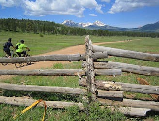
A short but high-value alpine ride easily accessible from the Million Dollar Highway.
Difficult Mountain Biking
8.1 km away
A classic mountain bike ride through a gorgeous mountain valley.
Difficult Mountain Biking
8.3 km away
World-class alpine scenery capped with a 4,000-foot descent!
Severe Mountain Biking
8.3 km away
The IMBA Epic portion of the Colorado Trail from Silverton to Durango.
Severe Mountain Biking
8.3 km away
The inaugural segment of the famous Silverton to Durango stretch of the Colorado Trail.
Severe Mountain Biking
8.4 km away
This trip celebrates the two iconic mountain bike towns of Durango and Moab, and the remote riding in between.
Severe Mountain Biking

26 routes · Mountain Biking
4 routes · Mountain Biking
8 routes · Mountain Biking